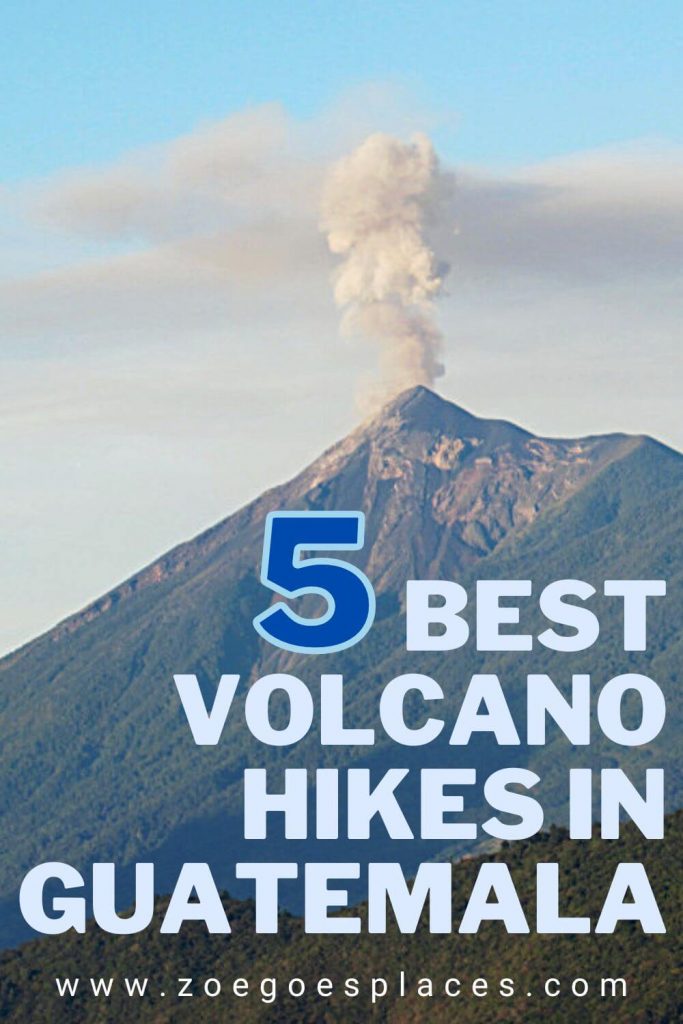
If you’re wanting to go on a Guatemala volcano hike, then look no further than this complete guide to the 5 best.
And, who wouldn’t? With a chance to see lava eruptions, roast marshmallows on volcanic rock and experience the best sunrises with incredible backdrops.
So, whether you’ve never hiked before or a 4000-metre plus (13,000 feet) volcano sounds like a walk in the park, there’s a hike here for everyone. Whatever your budget, fitness level or trip length.
If you’re ready to go hiking volcanoes in Guatemala, read on…
Some of the links below are affiliate links, meaning, at no additional cost to you, I may earn a small commission if you click through and make a qualifying purchase.
Can you hike in Guatemala?
Absolutely you can!
As a country located on the Pacific Ring of Fire, there is no shortage of impressive hills, mountains and volcanoes to go hiking in Guatemala. Additionally, the country has huge amounts of stunning jungle, countryside and national parks to enjoy the great outdoors.
Despite this, Guatemala is not known as a hiking destination. As such, some of the best hikes in Guatemala can be enjoyed surrounded by nature’s best creations, without crowds and for low prices.
What volcano can you hike in Guatemala?
Actually, you can do many different Guatemala volcano hikes. Acatenango is the most well-known and popular choice, but it’s not the only volcano hike in Guatemala.
In fact, the country has 37 volcanoes and almost all are accessible. These are all handily located across the south of Guatemala. So you won’t have to travel far to reach different volcanoes and enjoy some of the best hikes in Guatemala.
This guide focuses on the 5 best volcano hikes in Guatemala: Acatenango, Fuego, Pacaya, Santa María and Tajumulco. Chosen for their epic views, unique twists, ease of access and safety.
Most notably, the two volcanoes around Lake Atitlán – San Pedro and Atitlán – haven’t made the list. This is due to recent crime, including armed robbery against tourists.
Similarly, the recommendation that tourists travel with an armed guard and guide to climb Agua Volcano means it isn’t really an option for your average traveller.
FAQs
Well, that depends on the volcano. Some of them require you to have a guide with you at all times and others do not.
But, even for those where a guide is optional, often it is cheaper, easier and safer to visit with one. Not only that, but you’ll also be supporting locals to earn a living.
Whether you need a guide or not is detailed in the respective sections below for each volcano.
Again, this is going to depend on the volcano. But, the price to go on a volcano hike in Guatemala will vary from completely free to the price you’re willing to pay.
The national park entrance fees, equipment rental prices, transport costs and guide charges vary from place to place.
However, Guatemala is not an expensive country. The price to go volcano hiking in Guatemala is much less than those in more developed or touristic countries. You’ll get the best price by booking with local tour operators or agencies.
Generally yes, but some volcanos aren’t safe for tourists to climb. However, if you’re with a guide then you should avoid running into any issues. Of course, there’s still a risk of injury and altitude sickness, particularly once you get past 2500 metres (8200 feet). And you should make sure your travel insurance covers activity at this altitude.
This varies depending on the altitude and length of time you’ll be on the volcano, but I’d recommend starting with: walking shoes or trainers, comfortable clothing with layers, a waterproof jacket, hat and gloves, sunglasses, sun cream, water, snacks and a camera.
Guatemala Volcano Hike: The 5 Best Options
When you’re in Guatemala, climbing one of the many volcanoes is a fun activity for even the least outdoorsy people. Perhaps it might surprise you to learn that not all of these require long treks, camping in tents and legs of steel.
These 5 Guatemala volcano hikes suit a range of abilities, ages and travel preferences. But, they’re all (almost) guaranteed to give you incredible views and a great sense of achievement.
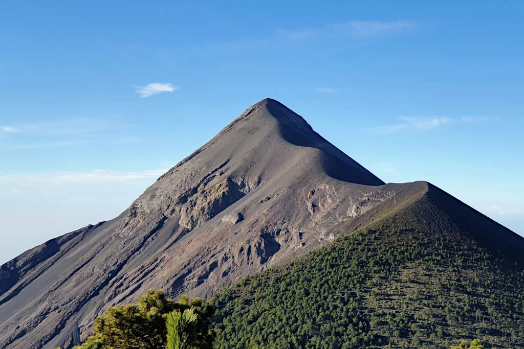
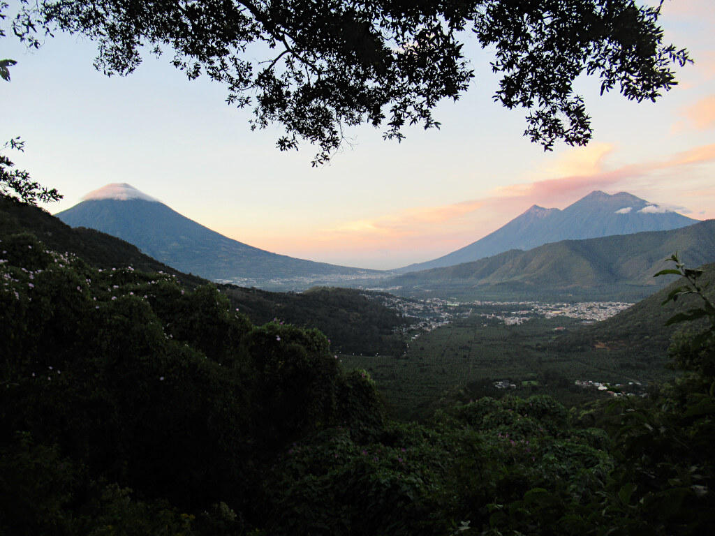
Acatenango Volcano Overnight Hike
The most well-known and popular volcano hike in Guatemala is Acatenango.
And it’s first on the list for a reason. Hiking this volcano will probably be one of the best experiences of your life!
It is possible to reach the summit on a day hike or climb through the night for sunrise. But, the two-day, one-night Acatenango hike is by far the best option.
This way, you’ll have plenty of time to enjoy the lava eruptions of neighbouring Fuego through the night and the incredible sunrise over Guatemala. For most, it’s a once-in-a-lifetime experience…
Hike Overview
As most people hike Acatanengo overnight, almost everyone goes with a tour company. As they provide tents or cabins on the mountain and essential equipment like sleeping bags.
Your hike will start on Day 1 with a pick-up in Antigua before a drive to the trailhead, which sits at 2200 metres elevation (7200 feet). Then it’s a long, 5-hour climb to base camp at around 3700 metres (12,100 feet).
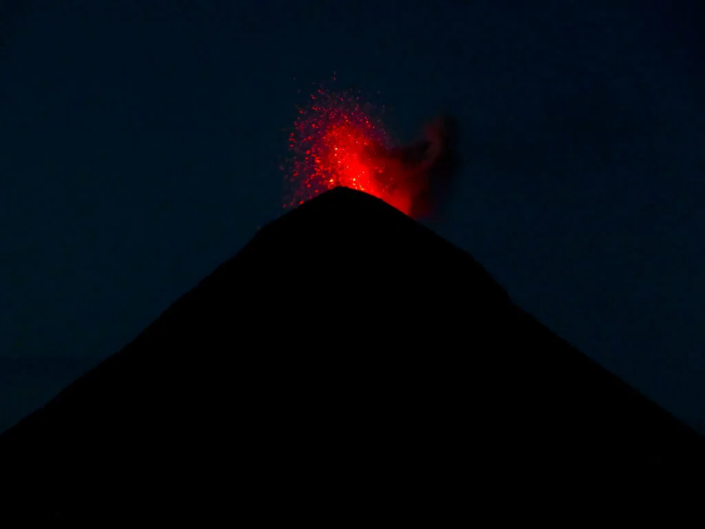
The temperature quickly drops as the sun starts to set, so pack layers and settle in for a night of lava eruptions.
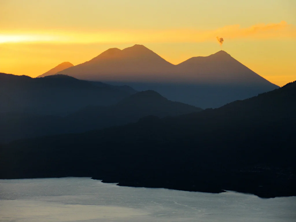
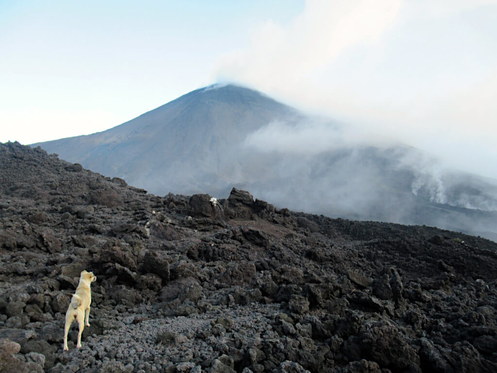
As the colour drains from the sky, the eruptions of Fuego change from ash clouds to the bright orange lava being clearly visible. You’ll feel the earth shake during particularly large eruptions.
And the loud booms take a while to carry, so make sure you’re looking out as much as possible! At its most active, Fuego erupts up to every 15 minutes!
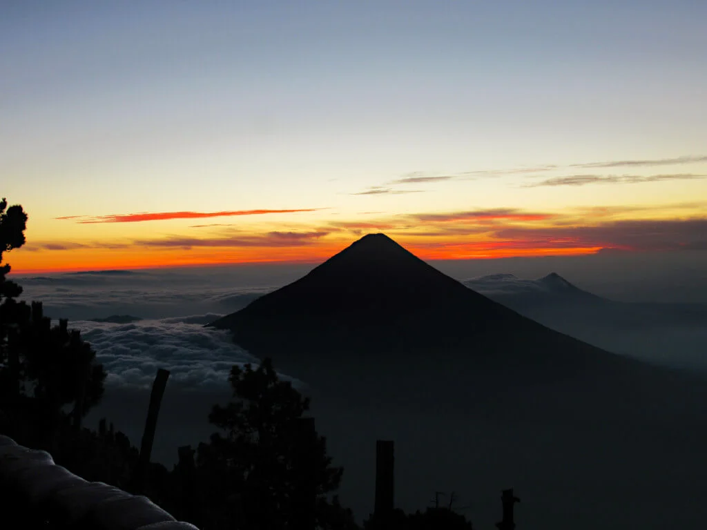
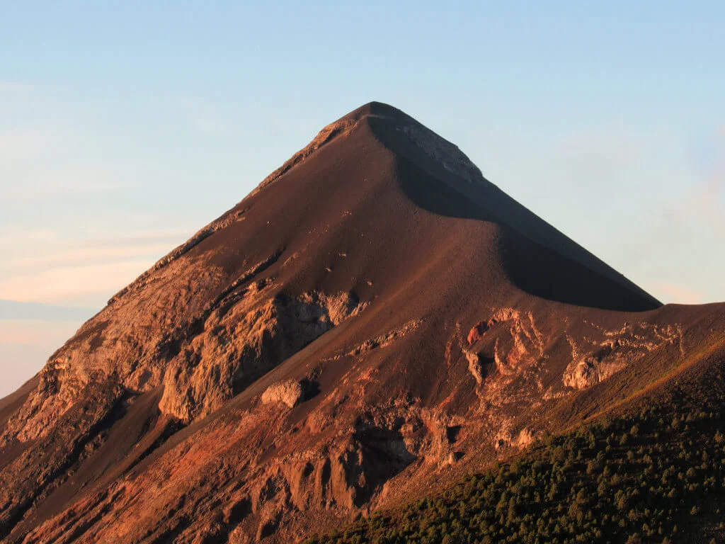
Day 2 starts early – at around 4 am – with the (optional) hike to the 3967-metre summit of Acatenango. It’s cold, dark and hard work to climb the last 300 metres or so of elevation on slippery ground.
But, at the top, you’ll be treated to the most spectacular and well-earned sunrise of your life. The sight of the sun rising behind Volcan Agua and the slopes of Fuego illuminated with the golden glow really is quite magical…
But of course, what goes up, must come down. And soon you’ll be quickly descending the slopes of Acatenango.
It takes just 3 hours to return to the trailhead before returning to Antigua Guatemala to rest your tired legs. Honestly, wait until you wake up the next day and try to walk… 1000% worth it though!
Tours
Going with a small tour is best for Acatenango, for several reasons.
Firstly, all the camping and cooking gear comes ready set up for you at base camp.
Secondly, all the necessary equipment and meals are provided.
And, thirdly, most tour companies only hire guides and porters from the local communities, paying them a fair wage and keeping the trails and camps well-maintained.
Tours can be booked through one of the many agencies in Antigua. Popular options include CA Travelers and Soy Tours. And booking at least 4 days in advance is usually enough to secure your date – but perhaps allow more time in peak travel seasons.
Expect to pay around 500 to 600 Quetzales, including the park entrance fee and overnight camping fee.
Or if you’d prefer to firm up your date more in advance, you can book online.
This popular, 4.8-star rated overnight Acatenango tour includes all your essentials including food, transport, tent, mattress and guide for 90 USD per person. I couldn’t recommend this experience more!
Find out more about this truly special hike in this complete guide to hiking Acatenango, including tour company recommendations, packing lists and other top tips!
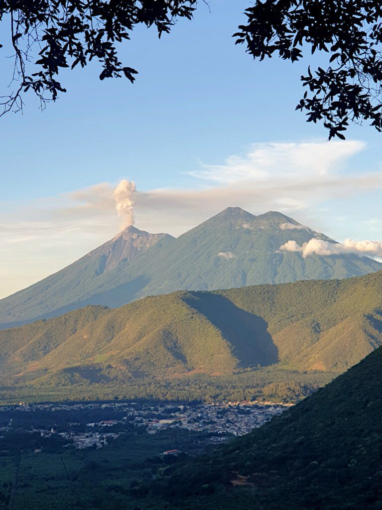
Fuego Night Hike
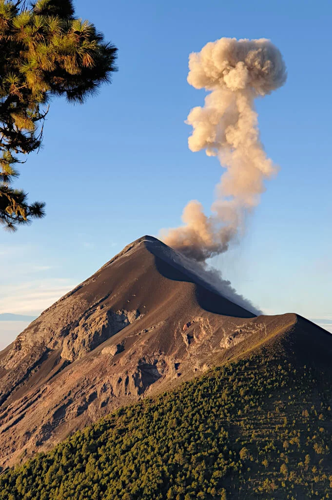
Volcan Fuego is perhaps one of the most pictured places in all of Guatemala. Its near-constant eruptions, with lava being thrown skyward and huge ash clouds spewing from the crater, certainly make for a dramatic image.
And, while the best view of Fuego might be from the base camp or summit of Acatenango, it is possible to get even closer…
Can you climb Volcan Fuego?
Yes – but not all the way to the top, of course!
The best way to climb Fuego Volcano is as an add-on to the Acatenango overnight hike. Although, there are a couple of agencies that run Fuego-only tours.
Either way, you’ll need to be prepared for some serious climbing and long hikes.
Fuego Hike Overview
The Fuego hike is usually done as part of the Acatenango overnight hike. With this, you don’t have to decide about hiking Fuego until you reach base camp.
This means you can see how tired or energised you are for it at the time, without having to commit in advance to a tough Guatemala volcano trek. And you’ll have the chance to rest at base camp and enjoy the view before deciding.
The guides get to decide if the conditions are good enough to hike Fuego. Cloud, fog, rain or strong winds may mean you don’t get the go-ahead. But remember, at this altitude, you’re often above the clouds.
Hiking Fuego is perhaps the toughest Guatemala volcano hike.
You’ll have already hiked for 5 hours gaining almost 1500 metres (4900 feet) in elevation. Then you have to hike the V-shaped route – descending from Acatenango base camp before climbing steeply up to the ridge where the treeline ends on Fuego.
After some time seeing the eruptions up close and feeling the earth shake beneath your feet, you’ll retrace your steps back up to Acatenango base camp.
The Fuego hike takes 4 to 5 hours and when done as part of the Acatenango overnight hike, most agencies charge a flat additional price of 200 Quetzales.
Pacaya Volcano Day Hike
Acatenango and Fuego are two of the toughest volcano hikes in Guatemala. But luckily, hiking Pacaya is a relatively easy half-day activity to one of the country’s most active volcanoes.
The volcano is currently in a quiet phase with no ash or lava eruptions in the last 12 months. But, a visit to Pacaya is still a unique and worthwhile day trip suitable for even the most inexperienced hiker.
A guide is mandatory for those wishing to visit Pacaya. And, the cheapest option is to take a tour from Antigua that includes transport and a guide.
Typically, these tours cost 150 to 200 Quetzales per person plus a 100 Quetzales national park entrance fee as well.
You can book through one of the many agencies in Antigua once you’re there. Or this 23 USD Pacaya Volcano tour including hotel pick-up, transport and a local guide is great value for money. And it allows you to confirm your trip itinerary in advance.
From the drop-off spot, you’ll hike for around 90 minutes to the lava fields.
Not so long ago a 2 km long lava river flowed through here. Now, you’ll just find scorched rock and steam outlets.
But, it is this that allows you to roast marshmallows on the hot volcanic rock under the shadow of Pacaya.
Overall, the hike is moderately difficult taking around 3 to 4 hours in total. While the hike is a great stand-alone activity, it’s also a perfect acclimatisation trek for climbing Acatenango.
For more information on one of the most unique Guatemala volcano hikes, check out this complete guide to climbing Pacaya Volcano – full of useful information and top tips.
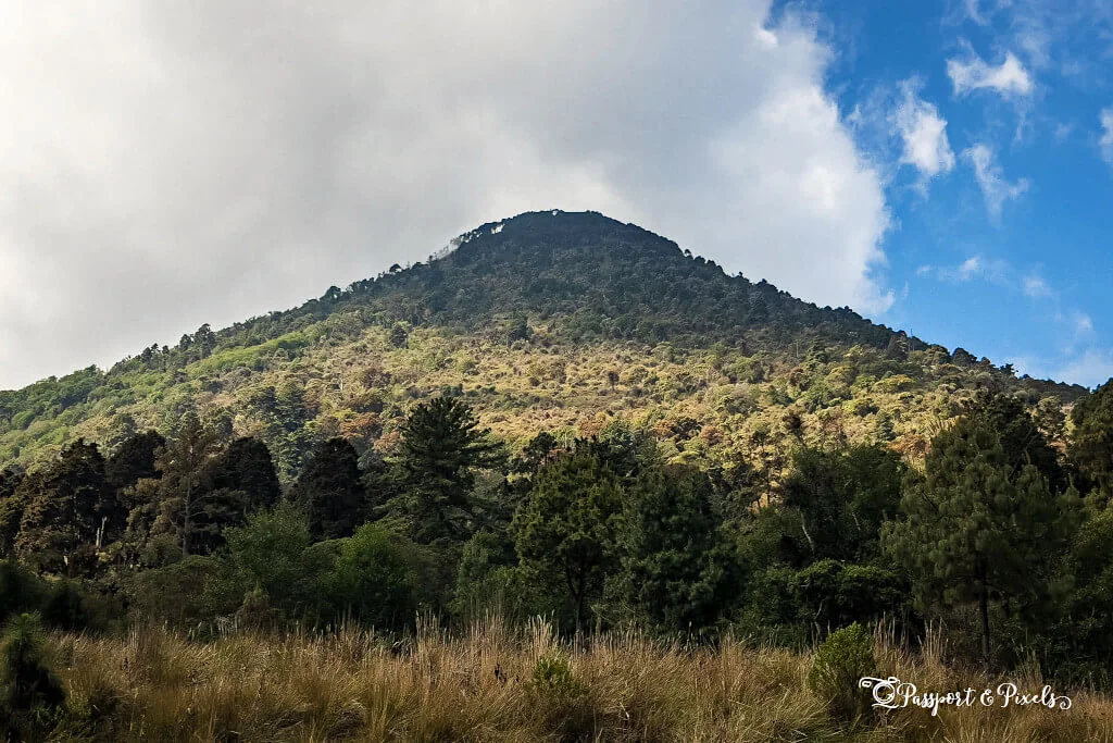
Santa María Volcano Hike
Towering over the town of Quetzaltenango (Xela to the locals), Santa María Volcano is easy to hike without a guide or tour. In fact, most visitors climb Santa María by themselves as a day hike, especially since it’s very safe to do so.
Additionally, it’s entirely free to hike Santa María Volcano. The only cost will be taking a bus or taxi to the trailhead in Llano del Pinal.
Once there, it’s a 13 km round trip route to the summit at 3772 metres (12375 feet) elevation. The route is fairly easy to follow with the trail available on sites such as All Trails and Maps.Me.
Spray-painted arrows along the trail help keep you on track too. The second half of the trail is more difficult as you can expect muddier conditions underfoot.
At the top, panoramic views over Xela and the Guatemalan countryside will greet you. That is assuming you aren’t completely surrounded by clouds, which is a real possibility on this hike.
For the best chance of clear conditions, set off before sunrise to summit early. This will also make the descent slightly easier as the tracks become more slippery once the sun is up.
Bella from Passport and Pixels talks about her experience of hiking through the night to the summit for sunrise in her guide to hiking Santa María Volcano.
In total, the hike takes around 6 hours to complete from Llano del Pinal. As such, you should be back in Xela by early afternoon to rest your weary legs and replenish those lost calories.
Tajumulco Volcano Hike
If you’re looking to go hiking volcanoes in Guatemala, it doesn’t get better than climbing the highest peak in the country. In fact, Tajumulco Volcano is the highest point in all of Central America.
Standing at an impressive 4203 metres (13,789 feet) according to official sources. Although, a height of 4220 metres (13,845 feet) is also given in less reliable reports.
Perhaps surprisingly, it’s possible to hike to the summit of Tajumulco and back in one day. This is because the trailhead sits at a lofty 3000 metres (9850 feet) of elevation.
Meaning, that the total elevation gain is 1200 metres (3900 feet) – far less than the climb to Acatenango. However, a one-night, two-day hike allows for a more leisurely pace and you’ll get to see the sunrise from the summit.
For a one-day hike, you don’t need to take a guide and there are also no entrance fees. However, consider staying the night before in San Marcos to avoid taking a very early bus from Xela (and you’ll get more sleep).
Alternatively, for a two-day hike, it is often easier and cheaper to travel with a guide and/or group. As typically, you’ll also be able to rent any camping or cooking equipment from them. Additionally, the guides will know the best camping spots and when to make the summit push for sunrise.
In total, the climb to the summit and back to the trailhead takes around 6 hours covering 14 km.
The journey from Xela to the trailhead takes over 2 hours when driving, longer by bus – and you’ll need more than one to go the whole way. While from San Marcos, the bus still takes an hour to the trailhead and is 90 minutes from Xela.
Bonus Extras…
It’s great fun hiking volcanoes in Guatemala, but if you’re looking for more then here are a couple more ideas for you.
First up, is the Indian Nose hike on the shores of Lake Atitlán. While not a volcano itself, it does offer splendid views of 5 volcanoes: Agua, Acatenango, Fuego, Atitlán and San Pedro!
Next up, is the Santa Ana volcano hike. Located just across the border in El Salvador, this volcano is a pretty easy hike and has a stunning turquoise-coloured lake in its crater!
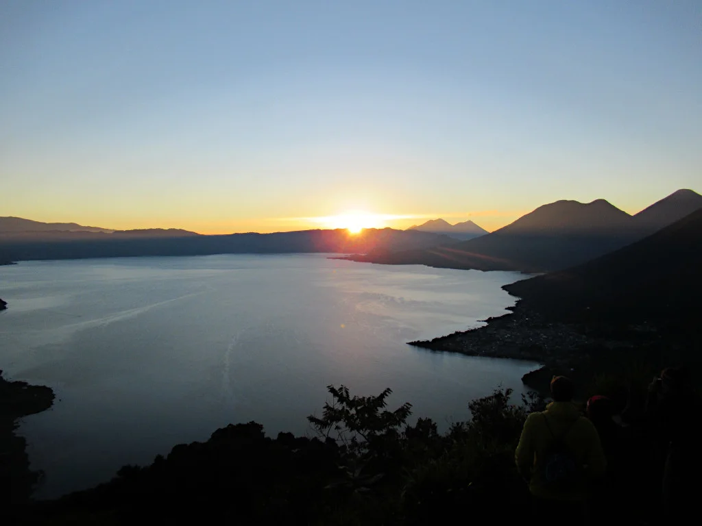
Indian Nose Sunrise Hike at Lake Atitlán
On the western shores of Lake Atitlán, sits the Indian Nose peak. Known in Spanish as Rostro Maya, this hillside viewpoint is perhaps the best sunrise spot in Guatemala.
Although you can hike here during the day, sunrise is absolutely the best time to be here. Tours are cheap and plentiful from the towns on this side of the lake such as San Pedro and San Juan, picking you up around 4am.
The hike itself is relatively short, taking just 30 to 45 minutes to reach the viewpoint. Then, sit back, relax and get ready for a panoramic showing from Mother Nature herself. You’ll even see the glow of lava or spewing ash clouds from Volcan Fuego in the distance.
An absolute must-do if you’re at Lake Atitlán and one of the best hikes in Guatemala. Suitable for hikers of all ages and abilities. Plus, you’ll be back in town in time for breakfast!
Check out this complete guide to the Indian Nose sunrise hike, including prices, how to book tours and other top tips!
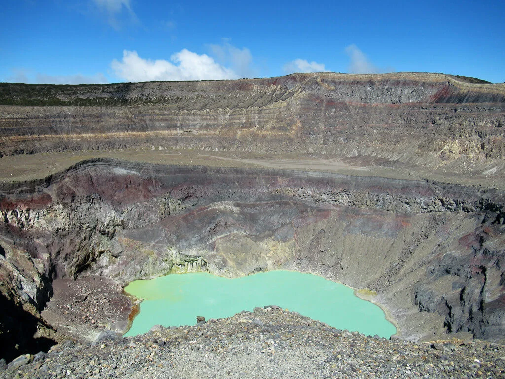
Santa Ana Volcano Hike in El Salvador
Located 53 miles driving distance from the Guatemala-El Salvador border is Santa Ana Volcano. The most iconic feature is the vividly coloured sulphur lake in the volcano’s crater.
Low clouds can sometimes leave hikers disappointed that they didn’t even get a glimpse of the turquoise pool. So, for the best chance of good conditions, visit during the dry season months of November to April.
It’s simple to cross the border for a trip to the volcano. If you have your own transport, you could manage the trip in a day.
Alternatively, consider staying for a couple of nights in nearby Santa Ana and taking the bus to the trailhead.
You’ll have to be accompanied by a guide for this hike.
Luckily, the volcano is staffed by volunteer guides who will take you from the park entrance booth to the crater and back. Although, the voluntary tip does seem somewhat mandatory and is payable before you start the Santa Ana Volcano hike…
Including rest breaks and photo stops, the hike takes around 2 hours to reach the top and around 1 hour to descend again. Expect hot conditions, although an entrepreneurial Salvadorian was selling ice lollies at the crater when I visited. Which most people were happy to pay for!
Read this complete guide to the Santa Ana Volcano hike to have a great day out, including how to avoid common scams, pay the right prices and travel there without a tour.
Do you have any questions or want any more information? If so, drop a comment below and I’ll get back to you!
Information and prices are correct as of August 2023 but are subject to change in future.
More Central America Travel Guides…
GUATEMALA: El Paredon Guatemala: Ultimate Travel Guide
GUATEMALA: Hobbitenango: Worth Every Penny! [Complete Guide]
EL SALVADOR: Salto de Malacatiupan (Hot Spring Waterfalls & River in El Salvador)
EL SALVADOR: El Tunco El Salvador: Ultimate Visitor’s Guide
NICARAGUA: San Ramón Waterfall, Ometepe: Complete Guide (100% Worth The Hike)
HONDURAS: Pulhapanzak Waterfalls, Honduras: Complete Guide To Visiting
BELIZE: Caye Caulker Snorkeling: An Underwater Paradise (Need to Know)
PIN IT FOR LATER!