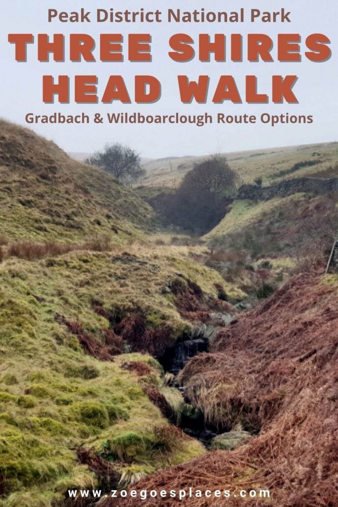
On the western edges of the Peak District is a point where three counties (shires) meet. Unsurprising called Three Shires Head.
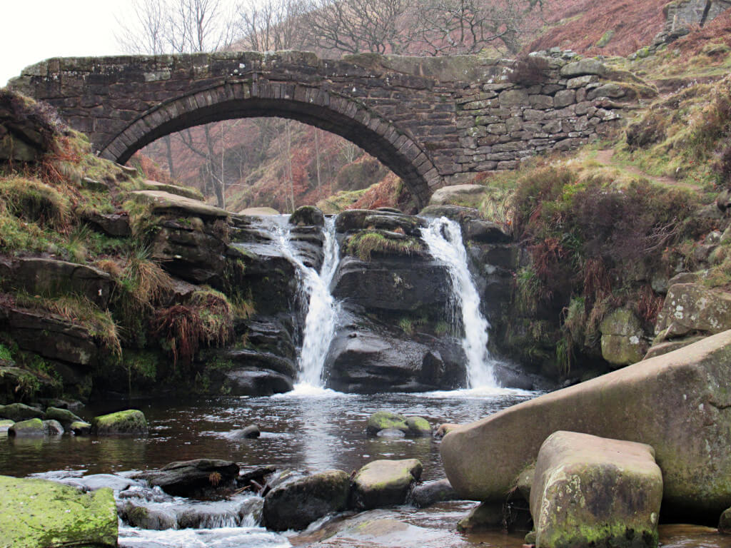
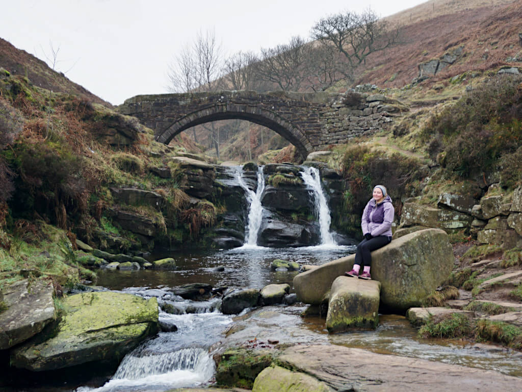
With the county boundaries following the rivers, the point is marked by a series of waterfalls and a small packhorse bridge that is picture-perfect. Inaccessible by road, you’ll need to take a walk to reach this Peak District gem.
There’s few roads nearby and even fewer parking options. Not to mention no public transport options.
So most people start their walk from either Gradbach or Wildboarclough. Although the closest Three Shires Head parking is just a 1-mile, 20-minute, short walk away.
Routes from all these places are detailed in this guide along with maps, directions, downloadable GPX files and lots of helpful information. Whichever route you choose will make for a perfect easy Peak District walk in the countryside…
| Where What Getting There Walks From Gradbach | Walks from Wildboarclough | Shortest Walk | Parking Other Information |
Where is Three Shires Head?
It is located in the western part of the Peak District National Park, an easy driving distance from Buxton, Leek and Macclesfield. The nearest villages are Gradbach, Wildboarclough and Allgreave.
What is The Three Shires Head?
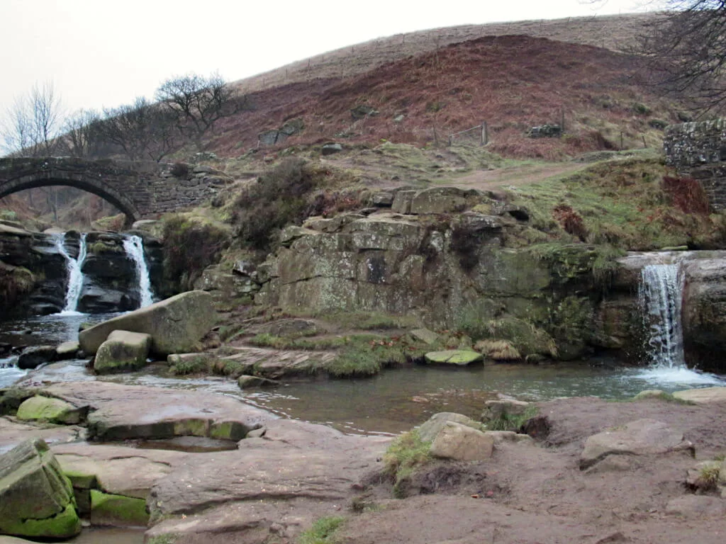
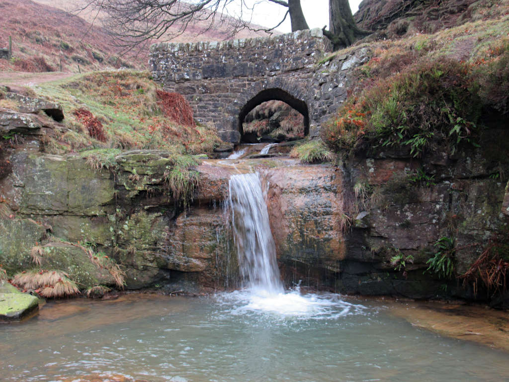
The popularity of this point has come from it being where Cheshire, Staffordshire and Derbyshire (the three shires) meet. There is little marking this tripoint and instead, you’ll find a stone bridge over the River Dane and a series of small waterfalls.
Most people visit to admire the Three Shires waterfalls. Or in passing on one of the many Peak District trails.
The spot is also growing in popularity as a wild swimming location. Although, it’s more suitable for a dip than a swim due to the lack of space and depth in most parts.
How To get to Three Shires Head
It’s not possible to access this tri-point directly in a vehicle. Instead, you’ll need to walk from Gradbach, Wildboarclough or the A54 layby parking areas.
Unfortunately, public transport does not service any of these places, so you’ll need your own car (or friends with one willing to let you tag along).
Each walking route comes with a downloadable GPX file – previewed in the Ordnance Survey maps below.
To open these you’ll need to download a GPX viewer app on your phone, there are plenty available on the App Store and Google Play Store. Simply download the file to your phone, open it in the app and have your GPS turned on.
Then, you’ll be able to follow the route using GPS even when you have no signal. Make sure your phone has battery though and familiarise yourself with the area beforehand to avoid getting lost.
Three Shires Head Walk From Gradbach
If you want to do the Three Shires walk from Gradbach, you have two route options. One is a there-and-back walking route, getting there and then retracing your steps back or a Three Shires circular walk.
Both routes are roughly the same length and have similar amounts of uphill walking, so the choice is all yours!
Straight, There-and-Back Route from Gradbach
Distance: 3.9 miles/6.3 kilometres
Elevation gain: 178 metres
Difficulty: Easy
Walking time: 2 hours
Start and endpoint: Gradbach Car Park
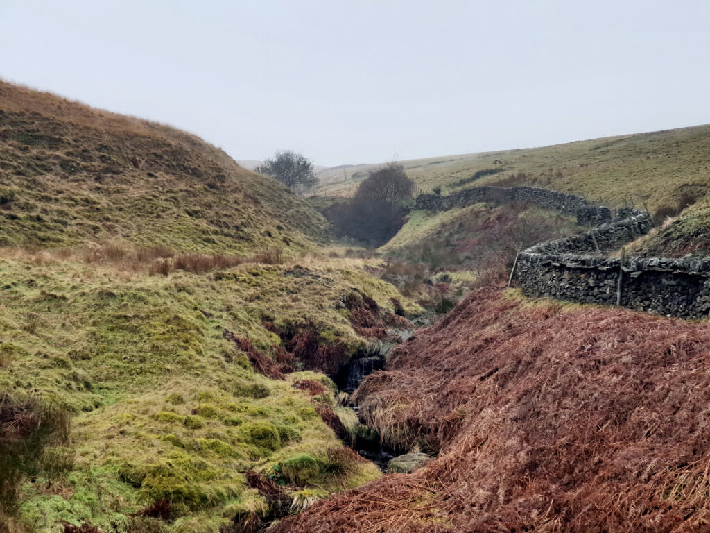
- Head out of Gradbach Car Park on the narrow path running parallel to the road. Then, cross the small bridge over the stream and cross the field towards the metal gate.
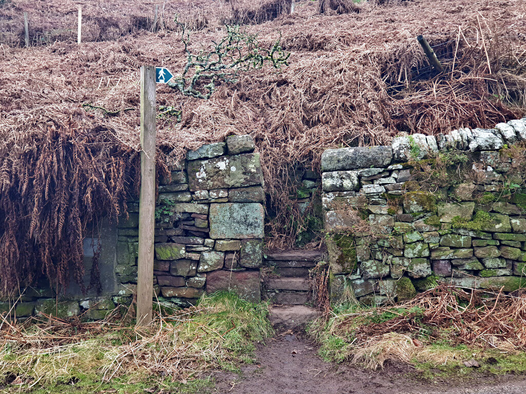
- Turn left onto the road and follow it until the corner. Here, join the path through the narrow gap in the dry stone wall just after the house that will be on your right-hand side.
- Follow the path as it heads uphill. When you reach the road, turn right and continue following this for about 1.3 km.
- Once you reach the farm that almost straddles the road, with outbuildings on your left and the main farmhouse on your right, the road forks in two. At the junction, enter the field and head diagonally across towards the gap in the dry stone wall.
- After the wall, head diagonally to your right again passing through another two dry stone walls before you come to a clear, well-trodden path. Turn left and follow this all the way until you can hear the Three Shires Head waterfall. You’ll know you’re there when you get to the small stone bridge with the river passing below.
- When you’re ready to head back, simply retrace your steps, along the path, across the field, follow the road and down the path back towards Gradbach.
Circular Route from Gradbach
Distance: 3.9 miles/6.3 kilometres
Elevation gain: 149 metres
Difficulty: Easy
Walking time: 2 hours
Start and endpoint: Gradbach Car Park
The circular route from Gradbach follows the same path as the there-and-back route until you reach the Three Shires Head Peak District. The directions are described in more detail above, but I’ll summarise them here.
- Take the narrow path out of the Three Shires Head car park at Gradbach, cross the stream and walk across the field to the road. Then, take the path just after the house on the right until you reach the road.
- At the road, turn right and follow this until you reach a farmhouse where the road splits in two. Enter the field and cross diagonally through three dry stone walls. Once you reach the path, turn right and keep going all the way to the three shires.
- Assuming you’ve crossed the old stone bridge to enjoy 3 Shires Head, this route continues on that side of the river. Head back in the direction you came from, with the river on your right-hand side.
- Shortly, the path splits in two – keep left and continue for another 800 metres. When you see a small farm building on your right-hand side, take the path across the field and follow it until it meets the road.
- Turn left and follow the road along until it bends round to the left. At this point, take the path on the right side that starts to run parallel to the road. Pass through the gap in the dry stone wall and then head towards the next gap in the wall on your right-hand side.
- Walk straight, through the trees and alongside the dry stone wall until you reach a more established path through another gap in the wall. Follow the path to the left and then the right until it reaches Love Lane. Cross over and continue down Gradbach Mill Lane until you reach the car park.
GRAB MY LIST OF MY FAVOURITE PEAK DISTRICT WALKS…
➡️ Is your New Year’s resolution to spend more time outdoors or exercise more?
➡️ Looking for more ideas for Peak District walks?
➡️ Want to explore more of this beautiful national park?
Save yourself the hours of research finding hidden gems and local favourites…
with this digital list of 52 beautiful Peak District walks full of my favourites from years of exploring.
Discover new places and spend more time in the great outdoors!
And – as a bonus – it includes 3 free trackers and challenge templates!
> > > BUY NOW FOR £2.99
> OR READ MORE
Three Shires Head Walk from Wildboarclough
If coming from Wildboarclough, again there are 2 Three Shires walking route options. A there-and-back walking route and a circular route, both with similar lengths and elevation gains.
Straight, There-and-Back Route from Wildboarclough
Distance: 4.2 miles/6.8 kilometres
Elevation gain: 249 metres
Difficulty: Easy
Walking time: 2 to 2.5 hours
Start and endpoint: Clough House Car Park
- From the Three Shires Head car park at Clough House, walk down the road in the direction of the house. Then, when you meet the road, cross over and continue onto the path beyond the wooden gate – Cumberland Brook stream should be on your left-hand side.
- Follow the path as it passes through the trees and makes a 180-degree turn almost back on itself. Keep walking until you reach the A54 road. Here, cross over and continue on the grassy path through the field.
- Once you’ve passed through the first dry stone wall, head diagonally left to the gap in the next wall. Then, keep to the left of the fields walking alongside the walls until you reach a well-trodden and visible path running parallel to the River Dane (river on your left-hand side).
- Follow the path for a couple of hundred metres until you reach the Three Shires Head waterfall, passing over the small stone, packhorse bridge to get the best view.
- Once you’re ready to return, simply follow the instructions above in reverse to complete this 3 Shires Head walk.
Circular Route from Wildboarclough
Distance: 4.4 miles/7.1 kilometres
Elevation gain: 212 metres
Difficulty: Easy
Walking time: 2 to 2.5 hours
Start and endpoint: Clough House Car Park
The Wildboarclough circular route follows the same path as the there-and-back route until you reach the Three Shires Head Peak District. But you return with a different route.
The directions for the first part of the walking route are described in more detail above but are also summarised below.
- From Clough House Car Park, follow the road until you reach the junction with the small grassy patch in the middle. Cross over the road and follow the path running alongside the stream and through the trees. Continue following the path all the way until it meets the road.
- At the road, cross straight over and continue through the field. Pass through two gaps in the dry stone wall and then walk around the left side of the field until you come to a clear path. After a couple of hundred metres on the path running alongside the river, you’ll reach the three shires.
- For the second part of the route back to the car park, make sure you’re on the western side of the river. I.e. the opposite side to the smaller stone bridge and smaller waterfall. Follow the path as it heads south and loops around until it reaches the road.
- Follow the road along for just a few metres past the house and then take the path beyond the wooden fence on the left-hand side. Continue on the grassy path that is fairly well-trodden until you reach the next road (A54).
- At the road, cross over and continue on the path. Head past the outbuilding and lone tree, keeping them on your left-hand side before walking parallel to the dry stone wall in the direction of the trees.
- The path emerges onto a single-track road, turn right and follow this all the way back to Clough House Car Park. The first junction you come to, take the road on the right signposted towards Macc Forest, then when you get to the junction with the tree in the circular stone ring, turn left and the car park is at the end of the road.
Shortest Walk to Three Shires Head
There are two places to park that are within a mile of the Three Shires Pass. These are both laybys on the A54.
Walking from here is the shortest distance you need to walk to get to the waterfall. And it’s even all downhill on the way there.
Both laybys have limited parking, so really it’s just a case of parking where you can find a spot.
Distance: 1.7 miles/2.8 kilometres or 2.1 miles/3.3 kilometres
Elevation gain: 108 metres or 78 metres
Difficulty: Easy
Walking time: 30 to 60 minutes
Start and endpoint: A54 layby
The shortest walk to Three Shires Head Peak District starts from the layby on the A54 that’s northwest of the waterfall (red route above). You can see the exact location on Google Maps here (red marker above).
- Head north along the road back in the direction of Buxton. After 200 metres walk down the steps on the right-hand side and then through the gap in the wall.
- Pass through and then head left following alongside the wall. There’s a clearer, trodden path on the other side – don’t head towards the farm building but in the other direction to the south.
- Keep following the trodden path until it becomes an even clearer path running alongside the River Dane. When you reach the bridge, you’ve made it to 3 Shires Head!
Similarly, the second shortest walk starts from a layby a quarter-mile along the road, closer to Allgreave. See the precise pin for this on Google Maps (green marker above). I’d say this route (green route above) is the easier of the two to follow.
- Head down the single-track road next to the layby.
- After 600 metres, take the dirt path on the left and pass through the fence.
- Follow the clear path for 1 km until you reach Three Shires Pass.
Where Do You Park For The Three Shires Head Walk?
Your three options for Three Shires Head parking are:
- Gradbach Car Park
- Clough House Car Park near Wildboarclough
- A54 layby parking
The isolated location away from public roads means that there are limited other Three Shires Head parking options. Arrive early or visit on a weekday if possible to avoid disappointment.
There isn’t a Three Shires Head postcode as it covers much of the large, rural area around. Instead, you’ll find links to Google Maps pins, GPS coordinates and what3words below.
Gradbach Car Park
If you’re doing the Three Shires walk from Gradbach, then use Gradbach Car Park. It’s free to park here and there is space for around 20 cars.
However, the car park is also used as a start point for walks to Lud’s Church and The Roaches. As such, it does get full quickly on weekends, bank holidays and during school holidays.
Google Maps Link | what3words ///develop.entitles.bonus
Clough House Car Park
If you’re coming from Wildboarclough, free parking is available at Clough House Car Park just north of the village.
This is also a small car park with around 30 spaces. And it can fill up quickly at peak times too.
Google Maps Pin | what3words ///whiplash.unloaded.outs
A54 layby Car Park for 3 Shires Pass
There are 2 laybys within a mile of the waterfall and pools. Both offer free, unlimited parking – so long as you are not parked within the lines of the road.
Both are less than half a mile apart, so if one is full, you can easily and quickly drive to the other.
Option 1 (nearer Buxton): Google Maps Link | what3words ///host.tribal.dugouts
Option 2 (nearer Allgreave): Google Maps Pin | what3words ///tweed.position.shoppers
Other Information
Yes, this is a popular wild swimming location and 3 Shires Head is perfect for a cold water plunge.
Yes, but depending on your route you may pass through fields of sheep. In these parts, I’d recommend walking your dog on a lead.
- There are no public toilets at any of the car parks or at the Three Shires. There are also no shops, so make sure to bring enough drinks and snacks to last you for the whole walk.
- Unfortunately, the paths are not suitable for wheelchair users, pushchairs or cyclists (in places). If you want to cycle to 3 Shires Head, I’d recommend cycling on the road as far as the A54 in line with the Three Shires waterfall, then use the single-track road and then the more established path.
- Good trainers are suitable for walking this route even in wet conditions. If walking in colder weather, wrap up warm as the wind can be quite strong towards the tops of the hills and on open sections.
- Don’t be like me and think that this is an entirely flat walk! The Three Shires Head walk from Gradbach is very much uphill in certain sections!
If you have any questions or want any more information drop a comment below and I’ll get back to you!
Prices and offerings mentioned are correct as of August 2023 but are subject to change in future.
More Peak District Walks…
SHINING TOR: Straight and Circular Walking Route Guides
THOR’S CAVE: 4 Circular Route Options From Wetton
BAMFORD EDGE: 3 Easy-to-Follow Walking Routes (Short + Circular)
WINNATS PASS: Best Routes for Incredible Views
MAM TOR: 4 Routes with Stunning Views
LADYBOWER RESERVOIR: 6-Mile Circular Route including Derwent Dam Viewpoint
CHROME HILL: 3 Routes to the Spectacular Summit Views
PIN IT FOR LATER!