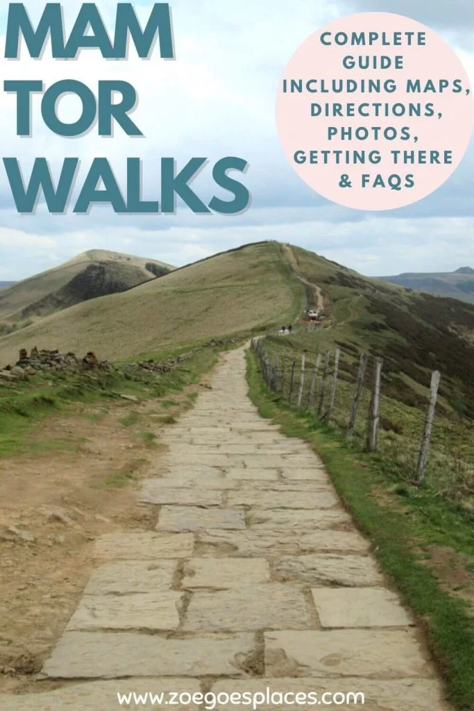
There are plenty of Mam Tor walks and finding the right one can be difficult. So, I’ve hand-picked my favourite 4 routes to share in this post.
Whether you’re looking for a Mam Tor short walk to stretch your legs or a long route to challenge yourself, this guide has you covered.
The routes here range from under 1 mile to just over 5.5 miles. And you’ll also find information on where to park, nearby facilities, how to get there and much more.
As well, these Mam Tor walking routes all come with downloadable GPS files so you can track the route on your smartphone without the internet too. Then, at the end of the post, there’s plenty of FAQs to make sure I’ve covered as much as possible to help you plan your day out!
If Mam Tor Peak District isn’t on your must-visit list, it will be after reading this post!
Where is Mam Tor?
Mam Tor is at the heart of the Peak District National Park.
It’s perfectly located around other spectacular natural attractions. To name but a few, these include Kinder Scout, Bamford Edge, Ladybower Reservoir, Winnats Pass and Win Hill.
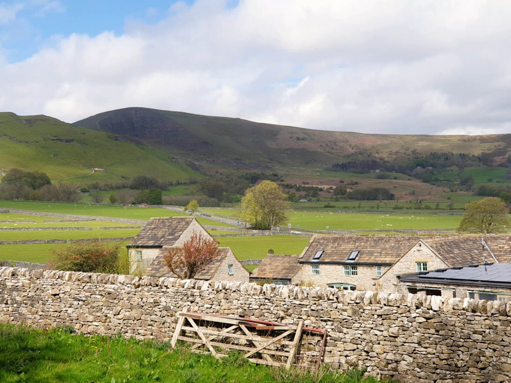
The nearest villages to the famous hill are Edale and Castleton – one of the most beautiful towns in the Peak District.
Although, it’s just a short drive from the nearby larger towns of Chapel-en-le-Frith, Buxton, Glossop and New Mills. As well as being within an hour of Sheffield, Stockport, Stoke-on-Trent and Manchester.
Mam Tor Walks: The 4 Routes
| Short Walk from Mam Nick Car Park 1.1 km | 30 minutes Circular Walk from Castleton via Back Tor 9.0 km | 3 hours Circular Route via the Broken Road 3.8 km | 1 to 1.5 hours Mam Tor and Winnats Pass Walk (Circular Route) 5.8 km | 1.5 to 2 hours |
Mam Tor Short Walk (From Mam Nick Car Park)
Distance: 0.7 miles/1.1 kilometres
Elevation Gain: 70 metres
Difficulty: Easy
Walking time: 30 minutes
Start and endpoint: Mam Nick Car Park
At less than one mile, this walk holds the record for the shortest walk time on this website! But, as a strong believer in not gatekeeping travel or the countryside, I think it’s important to highlight that this Mam Tor walking route exists!
Not everyone wants to or is physically capable of long walks over uneven terrain in uncertain weather. So, if you’re looking for a Mam Tor short walk – this is the one for you!
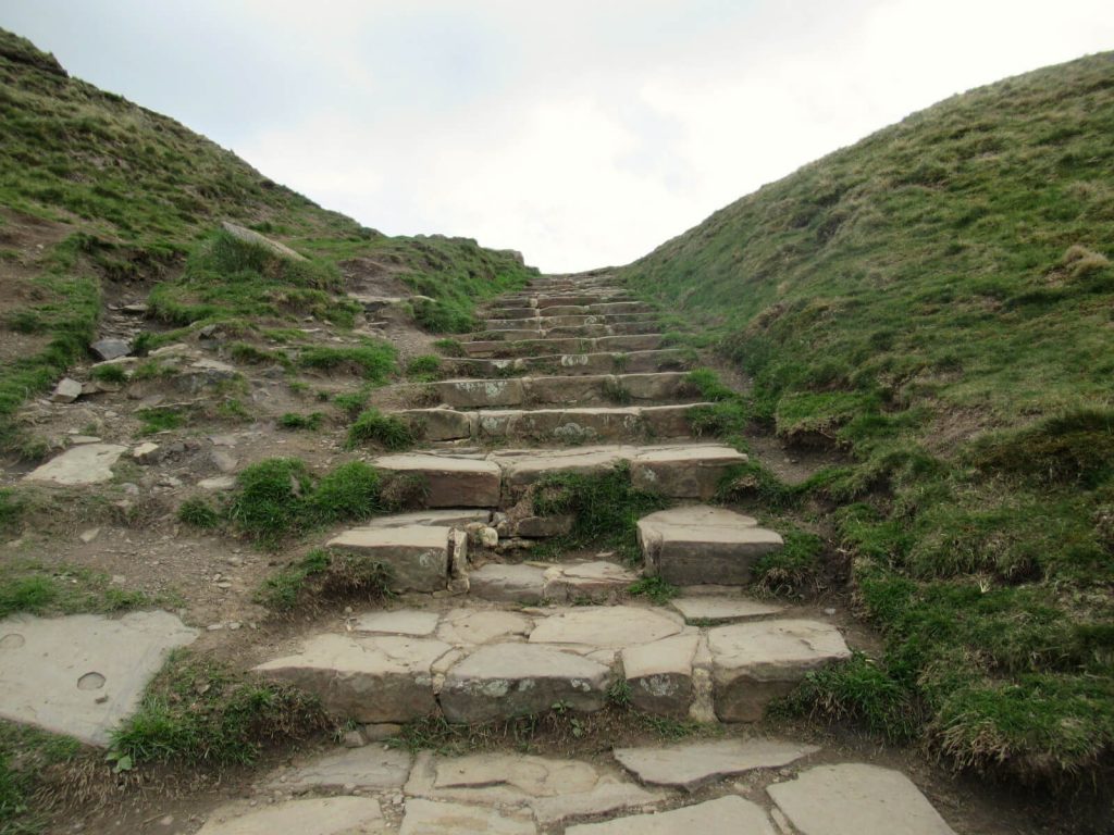
Although I warn you now, the steps to the Mam Tor summit aren’t the easiest…
Car Parking and Start Point
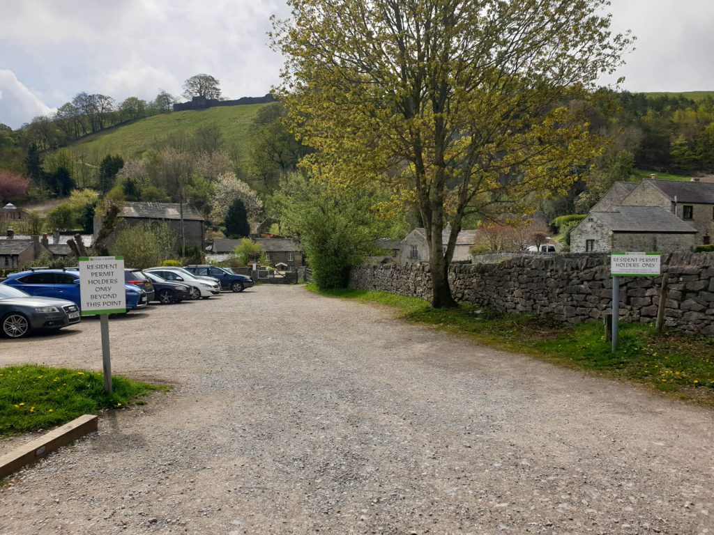
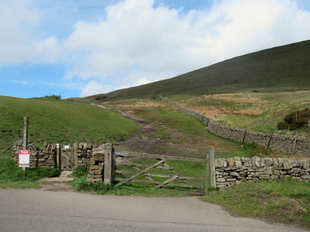
This short Mam Tor walk starts (and ends) at Mam Nick Car Park (GPS coordinates: 53.345530, -1.815729).
The car park is owned by the National Trust. As a result, parking is free for National Trust members or for those with blue badges.
For everyone else, Mam Tor parking costs £4.50 for up to 4 hours and £6 for over that. The only payment method is Pay by (Smart) Phone – no cash or card payments are accepted on site.
As with all car parks at beauty spots, spaces can fill up quickly on weekends, bank holidays and during school holidays. If travelling on those days, I’d recommend arriving early or late in the day as parking is particularly limited here.
Alternatively, parking is available on Old Mam Tor Road near Blue John Cavern.
Mam Tor Short Walk Directions
- The Mam Tor trail to the summit starts at the back of Mam Nick Car Park. Keep to the path as it runs parallel to the small country road.
- You’ll soon see the steps to the top ahead of you, behind a small fence. Just the small matter of climbing them separates you from the incredible views of the Peak area!
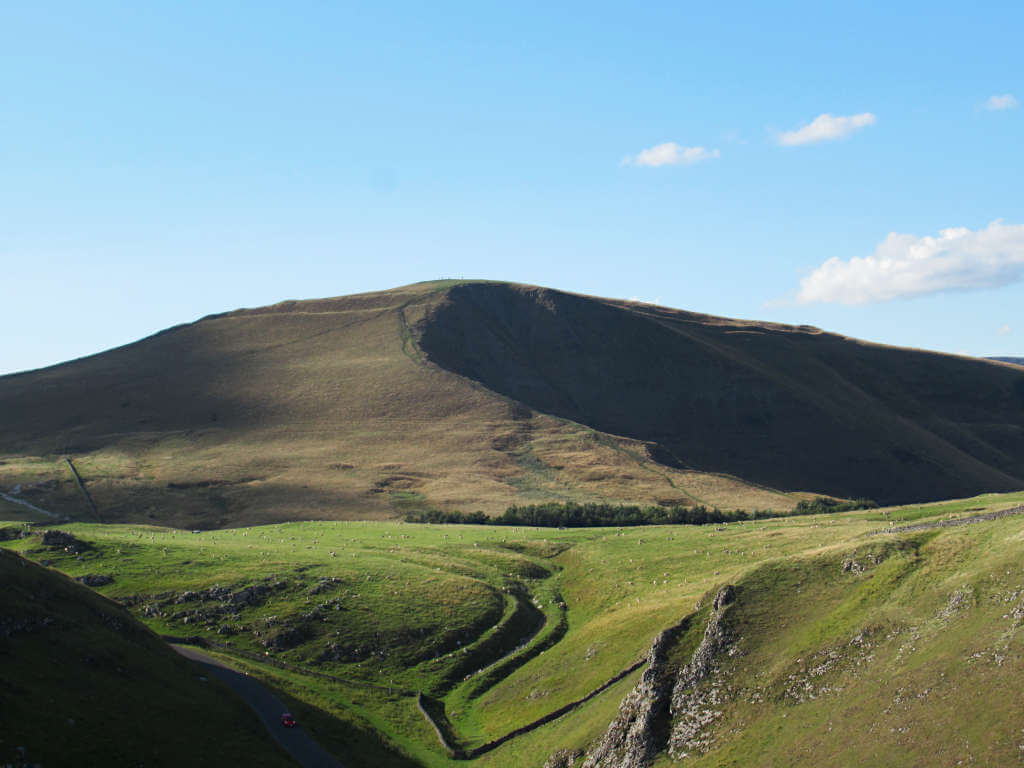
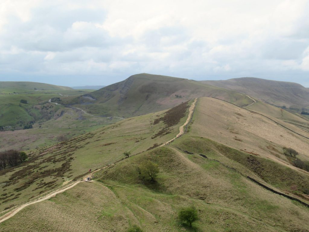
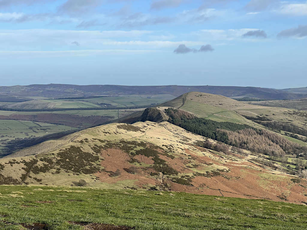
- Once you reach the Mam Tor summit and take in the views over Castleton and Hope, along the Great Ridge toward Back Tor and Lose Hill and back toward Chapel-en-le-Frith. The sparse Peak District countryside to the north is also scenic.
- If you want to extend your Mam Tor short walk, you can walk along the Great Ridge to Hollins Cross or Back Tor. Otherwise, simply head back down the steps and retrace your steps back to where you parked.
Mission Accomplished!
GRAB MY LIST OF MY FAVOURITE PEAK DISTRICT WALKS…
➡️ Is your New Year’s resolution to spend more time outdoors or exercise more?
➡️ Looking for more ideas for Peak District walks?
➡️ Want to explore more of this beautiful national park?
Save yourself the hours of research finding hidden gems and local favourites…
with this digital list of 52 beautiful Peak District walks full of my favourites from years of exploring.
Discover new places and spend more time in the great outdoors!
And – as a bonus – it includes 3 free trackers and challenge templates!
> > > BUY NOW FOR £2.99
> OR READ MORE

Mam Tor Circular Walk From Castleton (Via Back Tor)
Distance: 5.6 miles/9.0 kilometres
Elevation Gain: 396 metres
Difficulty: Moderate
Walking time: 3 hours
Start and endpoint: All Day Car Park next to Castleton Garage on Buxton Road, Castleton
This circular route is one of my favourite Peak District walks and my absolute favourite Mam Tor route!
You’ll be treated to the narrow streets of Castleton, views of the Hope Valley, the summit of Mam Tor, the Great Ridge and Back Tor! All of that in a Mam Tor walk time of less than 3 hours… So, I won’t keep you waiting anymore, here’s a great Mam Tor hike!
Car Parking and Start Point
For this Mam Tor circular walk, the route starts and ends at Peak Cavern Car Park, next to Castleton Garage on Buxton Road (in Castleton).
While the car park has a lot of spaces, it can still fill up quickly on bank holiday weekends and on particularly summery days. See its exact location with this Google pin, GPS coordinates (53.34273, -1.77908) and Ordnance Survey grid reference (SK 14773 82906).
Mam Tor Circular Walk Directions
Stage 1: Castleton to Mam Tor Peak District
- First, head to the back of the car park and turn right after the gate. Follow the road up until it narrows into a small path between a stone wall and some bushes (first picture below).
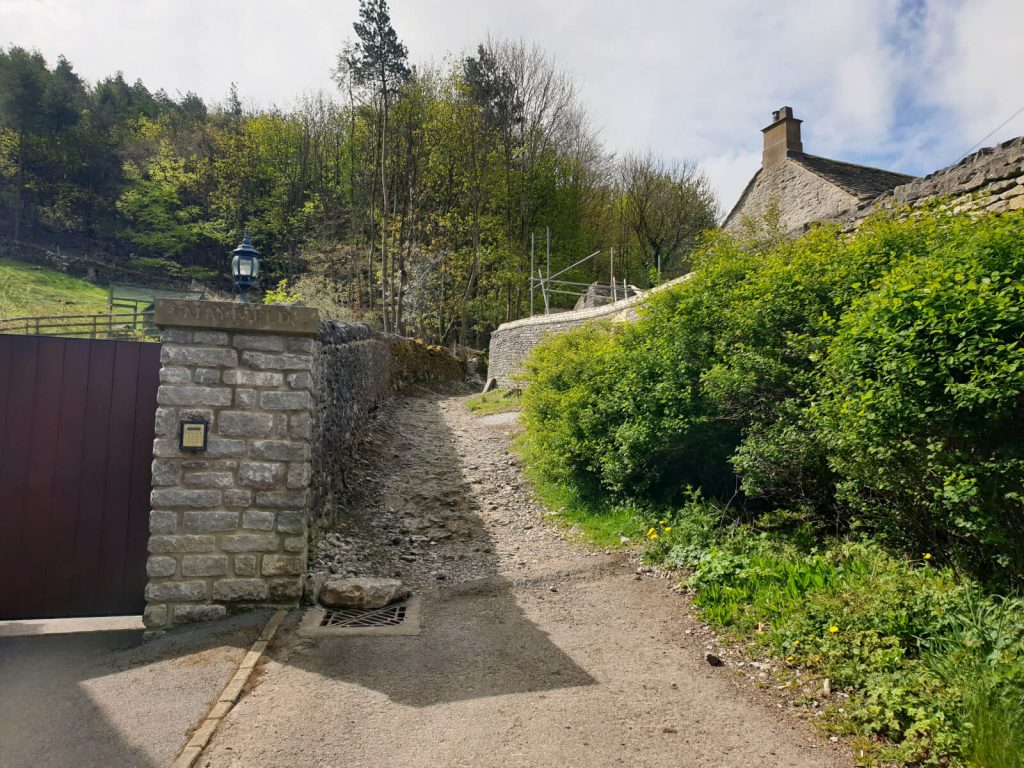
- Keep following the path (look right for the best views!) all the way until it meets the road (Arthurs Way), opposite Speedwell Cavern.

- Pass through the small entrance next to the Speedwell Cavern sign. Then follow the trodden path, heading first towards the gap in the drystone wall. The path is easy to follow and next joins a concrete path leading up to Treak Cliff Cavern.
- Next, the Mam Tor trail snakes around the back of the cavern (clearly signposted) and continues uphill, slowly turning to the left. Once you pass through the fence, head towards the road and building (Blue John Cavern) on the right-hand side
- Pass through the gate and join the small road at Blue John Cavern and then turn left onto Old Mam Tor Road. Follow the road around until you see a large wooden fence on the right, enter through this.
- Continue to follow the well-trodden path as it climbs uphill. Keep going until the path almost meets the road, turn right and you’ll see the steps to the summit in front of you!
- The stairs are a slog but even before you’re at the top the views are worth it! Don’t forget to look back behind too…
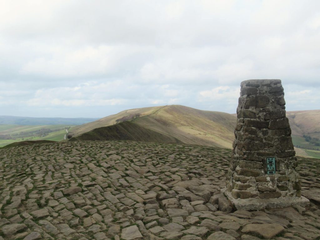
- A trig point marks the summit and you can breathe a sigh of relief that (most of) the hard uphill walking is complete! Enjoy the views over Castleton and towards Kinder Scout – you’ve deserved it!
Stage 2: The Great Ridge
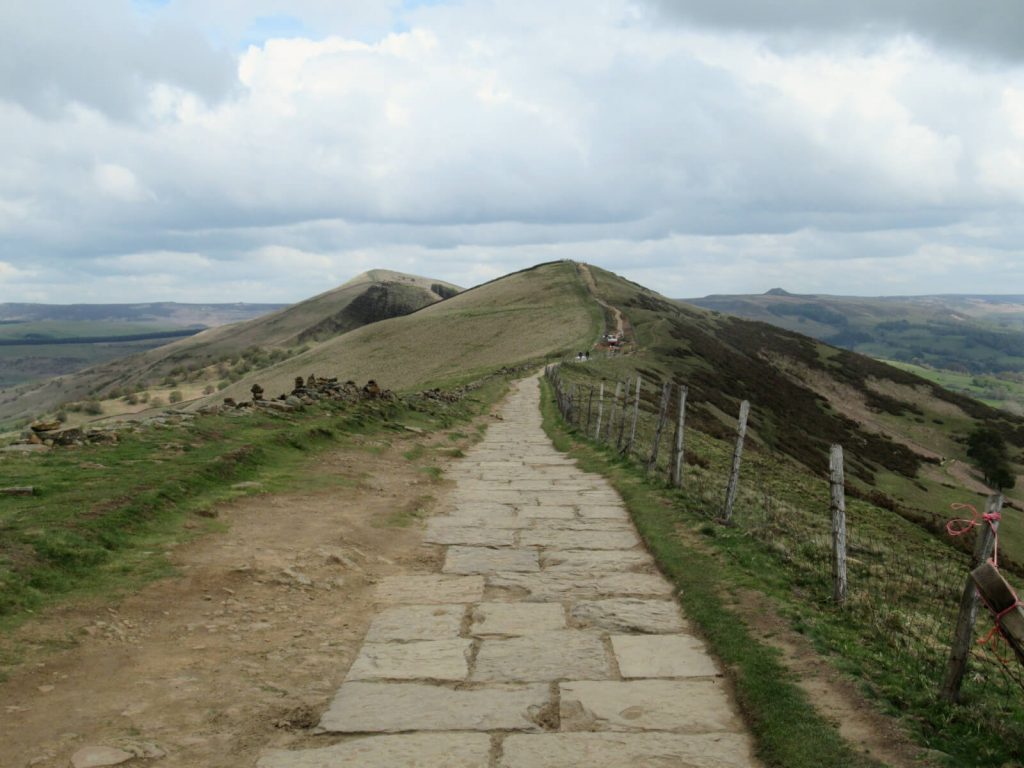
- From the peak, the Great Ridge is clearly visible along the hilltop – and, this is where you’re heading next. Follow the path along and you’ll be practically skipping on those downhill stretches feeling light as a feather!
- You’ll first pass Hollins Cross, marked only by a small stone cylinder in the middle of the path. Keep going as the path starts to climb uphill again and soon you’ll be at the base of the stairs to Back Tor.
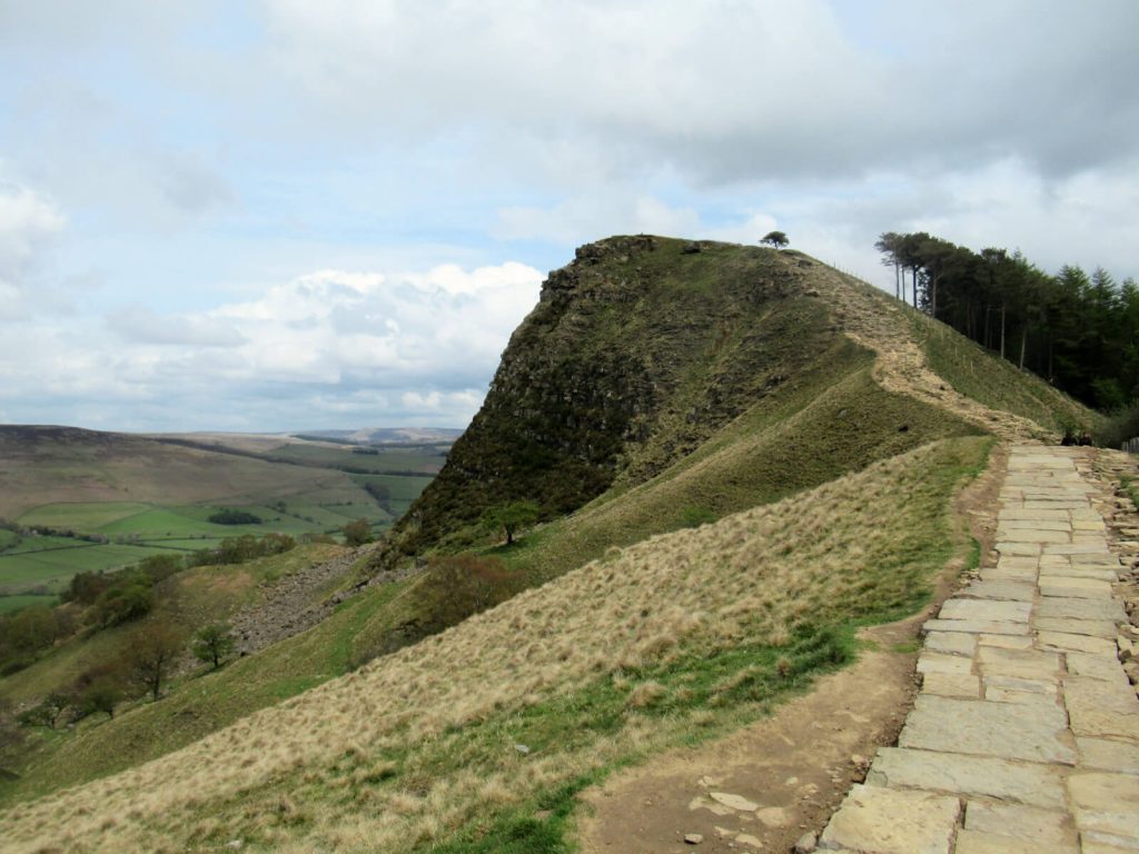
- Unfortunately, these steps are even tougher than the ones to the top of Mam Tor Peak District. They’re much more rugged and you need to find a good path for you across the rocks. However, the views will make it all worthwhile!
- At the top, you’ll be treated to unspoiled views of Edale and Kinder Scout in the background. If you’re lucky, you may even get to see a train pass through the valley on the Manchester to Sheffield line.
Stage 3: Back Tor to Castleton
- Walk back down the steps from Back Tor. And in front of you, there’s a sign with different paths. To the right is Edale, but you want the path to the left towards Castleton. Pass through the small gate and continue almost straight (the path bears right slightly first), heading downhill.
- Follow the path as it heads diagonally downhill, passing through a small section of trees. Next, the path runs parallel to a drystone wall before shortly converging with the path down from Hollins Cross.
- Where these paths meet, head into the narrow pathway between the two grassy embankments. Follow the path all the way until you meet the road.
- Although, do be warned this path can be very wet (almost a stream) if there has been wet weather recently. In this case, I recommend trying to walk along the embankments rather than the path itself. Although you will need to weave between the trees and bushes.
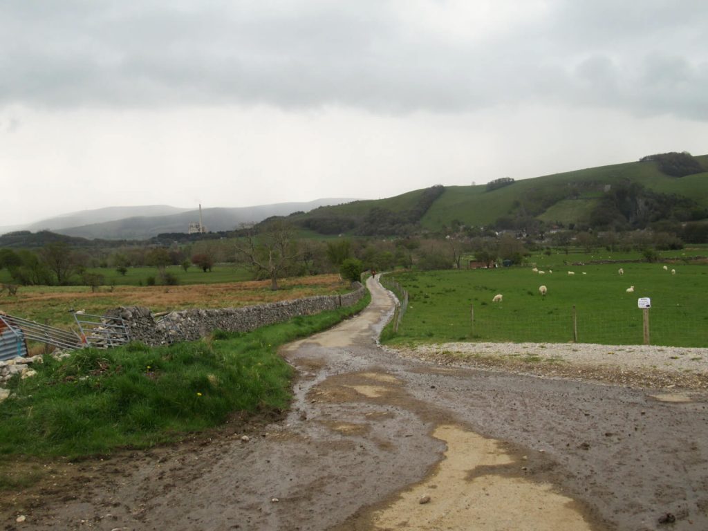
- Finally, keep walking straight along Hollowford Road (that becomes Millbridge and then Back Street) until you are in the centre of Castleton. Turn right onto Cross Street (with Ye Olde Nags Head on the corner).
- Once you cross the roundabout, you’re on the home straight. The car park will be on the left just after Castleton Garage – you’ve definitely deserved a rest!
Click the link above to download the file for use in a GPS viewer. This way you’ll be able to track where you are on the route using your phone’s GPS – avoiding accidental detours and providing reassurance for less experienced countryside walkers! Once you’ve downloaded the GPX file above, install a GPX viewer app (Google PlayStore or iPhone App Store) and load the GPX file.
Circular Mam Tor Route via the Broken Road
Distance: 2.4 miles/3.8 kilometres
Elevation Gain: 180 metres
Difficulty: Easy
Walking time: 1 to 1.5 hours
Start and endpoint: Roadside parking on Old Mam Tor Road
The next of these Mam Tor walks takes you to the top and back via a unique sight. As a result of the ever-sliding face of the peak, the road beneath has been twisted and destroyed.
And now, you can see how it’s been ruined by nature’s forces as the layers of tarmac contort around the earth.
Parking and Start Point Locations
Free parking is available along Old Mam Tor Road near Blue John Cavern. The entire road is free parking and there’s space for campers to pitch up.
This Mam Tor circular walk starts and ends here. As a result, you can follow the route in either direction although the directions below are for a clockwise loop.
Mam Tor Circular Walk Directions (Via the Broken Road)
- From where you’ve parked on Old Mam Tor Road, head back up the road and then turn right onto Rushup Edge/Sheffield Road.
- Stick to the grassy verge path on the right side of the road until you reach Mam Nick Car Park. Here, cut through to take the path at the back of the car park.
- Follow the path as it runs to the side of the road before taking the steps up to the top of Mam Tor Peak District. On a clear day, you can see for miles from here – it’s a photographer’s dream.
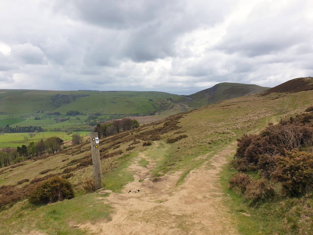
- Next, head along the Great Ridge – it’s easy to see from the summit as the Mam Tor trail runs along the top of the hill. Continue along this path until you reach a wooden fence and gate.
- Don’t pass through. Instead, take the downhill path on your right-hand side as it heads back in the direction of the face of Mam Tor.
- After 300 metres or so, the path splits in two – take the left-hand fork towards the road. Head downhill until you reach it.
- As you leave the grassy footpath, turn right and then right again through the gate as you come onto Old Mam Tor Road. After 400 metres you’ll reach the torn-up remains of the road, with the depth of tarmac layers perhaps most surprising. Although the landslide and subsiding are visible all along this stretch of road.
- Continue along the path and cross through the wooden fence to enter the other side of the road, where this Mam Tor walk started.
Mam Tor and Winnats Pass Walk (Circular Route)
Distance: 3.6 miles/5.8 kilometres
Elevation Gain: 265 metres
Difficulty: Easy to moderate
Walking time: 1.5 to 2 hours
Start and endpoint: Roadside parking on Old Mam Tor Road
Where to Park and Start the Walk
Parking for this Mam Tor walking route through Winnats Pass is on Old Mam Tor Road. Loads of spaces are available on the section of the road by Blue John Cavern. And it’s free.
This Mam Tor walking route starts by passing Blue John Cavern, so the closer you can park to there, the better.
Mam Tor & Winnats Pass Walk Directions
- From Old Mam Tor Road, take the small downhill road towards Blue John Cavern. However, before you reach the building turn left off the road and through the gate onto the grassy footpath.
- Head along the trodden path until you reach another wooden gate. Pass through and then continue straight in the direction of Castleton in the distance.
- Follow the path as it passes Treak Cliff Cavern and continues all the way to Speedwell Cavern at the road.
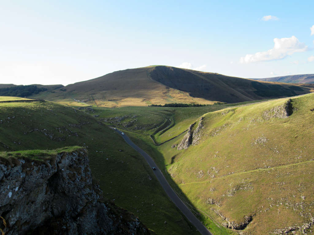
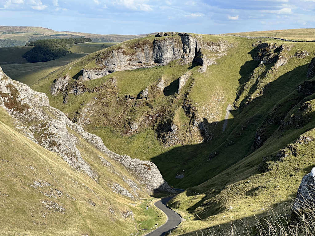
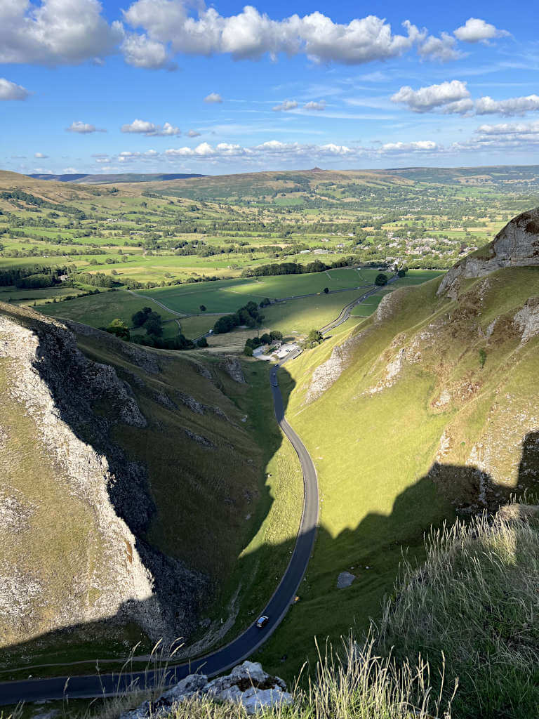
- Turn right at the road and begin the slow, ascending climb through Winnats Pass. Keep to the right-hand side as there’s a large grass verge you can walk on away from the passing cars.
- Walk through the wooden fence when you reach the drystone wall, then continue parallel to the road until you’re level with the cattle grid.
- At this point, follow the path as it heads right – pass the farmhouse and through two fences until you reach the next road. Cross straight over and continue straight in the direction of the trees.
- At the next road, cross straight over again and follow the path uphill. Climb the steps to the Mam Tor summit and take in those spectacular views!
- From the summit trig point, walk along the Great Ridge until you reach a fence crossing the path. Turn right, heading downhill back in the direction of Mam Tor.
- When the path splits, stay on the right-hand trail. Here, it levels out before heading downhill to bring you past the sinking face of Mam Tor and back to where you parked.
Mam Tor Parking
Parking in Castleton
On-street parking is exceptionally limited in Castleton. Instead, your best option is to get a spot in one of the car parks in the village if you want to enjoy a Mam Tor walk from Castleton.
Castleton Coach/Car Park is situated in the centre of the village, next to the visitor centre. Parking costs £1.60 for up to 1 hour, £2.50 for up to 2 hours, £4 for up to 4 hours, £6 for up to 10 hours and £7 for 24 hours.
Payment is made using either the ticket machine or PayByPhone app.
Alternatively, Peak Cavern Car Park (next to Castleton Garage) accepts cash and card and charges £7 for all day or £3 after 5 pm.
Both have a lot of spaces but do fill up quickly, particularly on bank holiday weekends and in school holidays (when the weather is nice). Public toilets are available next to Castleton Coach/Car Park.
Parking Near Mam Tor
A surprising amount of parking exists around Mam Tor with car parks and roadside parking.
That said, be sure to check the signs when you get there. Recently, the council have announced a review into the free roadside and layby parking and changes are likely.
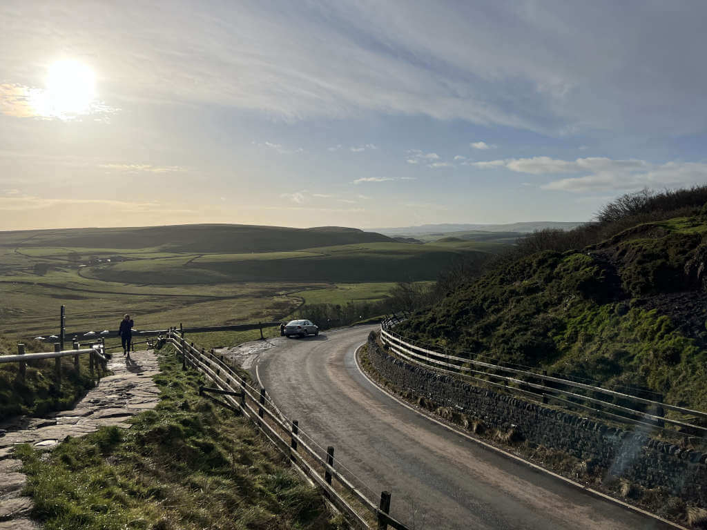
The main Mam Tor parking place near the top is at Mam Nick Car Park, approximately half a mile from the summit.
This National Trust car park is free for members and blue badge holders. Otherwise, it costs £6 (pay by phone only) for all-day parking. There are no facilities at this car park and it’s not within easy walking distance of Castleton.
The next best option is roadside parking along Old Mam Tor Road, by Blue John Cavern.
Spaces here are plentiful with room for campervans. The road is designed for parking spaces, so this is the less likely place to see restrictions introduced.
Alternatively, a good amount of layby parking exists on the roads between Winnats Pass and Mam Tor Peak District. These can be identified fairly easily using Google Maps satellite view.
The closest laybys to Mam Tor are along Rushop Edge (the road that Mam Nick Car Park is on). And right next to the steps leading up to the Mam Tor trig point – with space for about 4 cars.
Is Mam Tor Car Park Open?
All three car parks listed above (Mam Nick and the two in Castleton) are open 24 hours a day, 365 days a year.
So, whether you’re after a Mam Tor sunrise walk or a late-night stroll, these Mam Tor Car Park options are available.
How to get to Mam Tor
The easiest way to get to Mam Tor is by driving. A limited number of public transport options are available with the frequency varying throughout the week.
Nearest train station to Mam Tor
The nearest station is Edale, and it is possible to walk from Edale to Mam Tor and the Great Ridge. The closest station to Castleton is Hope.
Bus services to Castleton and Mam Tor
A handful of bus services run through Castleton. Travel time from Hope to Castleton is approximately 10 minutes.
The 272 (Hulleys of Baslow) runs Monday to Sunday from Sheffield to Castleton and from Castleton to Sheffield, via Bamford and Hope. The latest bus timetable is available online but you can also check out the Hulleys’ website for the latest information.
The 257 (Hulleys of Baslow) runs on Sundays and bank holiday Mondays from April to September between Castleton and Sheffield. There’s 5 departures each day in each direction – see the timetable online here.
In addition, the 173 between Bakewell and Castleton, via Tideswell and Wardlow runs Monday to Saturday. Check out the latest timetable online.
FAQs
517 metres. This makes it the 23rd-highest peak in the Peak District National Park.
The name translates to Mother Hill.
No, not to the top. The closest point you can drive to and park at is a small layby by the steps to the top – approximately 300 metres from the peak.
Yes, it’s possible. But, you’d need to find a route with a suitable gradient for your level of experience and bike. The Mam Tor routes described in this post all take the steps to the summit. Additionally, I believe there may be a section of the Great Ridge that prohibits cycling, where you’d have to dismount.
Yes, these Mam Tor walks are both suitable for fit and healthy dogs. Particularly small dogs may need help with some of the larger steps up to Mam Tor and Back Tor. But otherwise, they will love it!
The short Mam Tor walking route from Mam Nick Car Park may be more suitable for toddlers and young children that are confident walking. The one-way distance of the straight route is approximately half a mile, most of which is up steps. Unfortunately, this means it’s less suitable for buggies unless you’re willing to fold it down and carry it.
The nearest car park to Mam Tor is Mam Nick Car Park. Although a small layby fitting around 4 cars is located at the base of the steps to the top.
Do you have any questions or want any more information? If so, drop a comment below and I’ll get back to you!
Information and prices are correct as of May 2023 but are subject to change in future.
More Peak District Walks You Might Be Interested In…
SHINING TOR: Straight and Circular Walking Route Guides
CHROME HILL: 3 Routes to the Spectacular Summit Views
THE ROACHES: Walk Route & Full Guide for Panoramic Views
LUD’S CHURCH: 3 Walk Routes For An Other-Worldly Experience!
LATHKILL DALE: 6-Mile Waterfall Walk
HARTINGTON: 5.3-Mile Walk in the Peak District Countryside
PADLEY GORGE: 4-Mile Route via Millstone Edge
THREE SHIRES HEAD: 4 Route Options from Gradbach & Wildboarclough
LADYBOWER RESERVOIR: 6-Mile Circular Route including Derwent Dam Viewpoint
PIN IT FOR LATER!