Some Peak District walks are made for sunny days and sunny days only. Which, can feel hard to come by in this part of the world – especially between October and April! Luckily, this Padley Gorge walk – via Millstone Edge (Surprise View), Owler Tor and Mother Cap – can be enjoyed all year round, no matter the weather. Though, of course, sunshine always makes things better.
So, whether it’s a rainy winter’s day, a washed-out summer’s day or actually nice for the first time in weeks, this walk along the Padley Gorge Trail and beyond is for you. Keep reading to find out where to park (including a free option), the walk directions and what you can expect to find on the route.
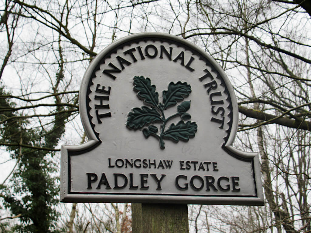
Where is Padley Gorge?
The gorge is located on the eastern fringes of the Peak District National Park, near the border between Derbyshire and South Yorkshire. The nearest towns and villages are Grindleford, Hathersage, Curbar and Hope Valley, with the city of Sheffield less than 10 miles away.
Is Padley Gorge Free?
Yes, it’s free to visit Padley Gorge. There are even free parking spots nearby as well as a couple of paid options, making this a cheap day out.
Padley Gorge Circular Walk
Don’t let the elevation gain put you off. This is a scenic and easy walk in the Peak District countryside through Padley Gorge and to impressive viewpoints such as Owler Tor, Millstone Edge and Mother Cap. To best enjoy the views, you’ll want to visit on a clear day.
Distance: 4.0 miles/6.5 kilometres
Elevation gain: 193 metres
Difficulty: Easy
Walking time: 2 hours
Padley Gorge Walk Map
3 Padley Gorge Walk Start Points
The beauty of this circular walk is that there are three different points you can start and end at along the route. Each of these has a Padley Gorge car park, although spaces are limited.
You can start at the southernmost point at Grindleford Train Station (blue pin) or in the northeast corner along the B6521 (red pin) or at Surprise View Car Park (green pin).
GRAB MY LIST OF MY FAVOURITE PEAK DISTRICT WALKS…
➡️ Is your New Year’s resolution to spend more time outdoors or exercise more?
➡️ Looking for more ideas for Peak District walks?
➡️ Want to explore more of this beautiful national park?
Save yourself the hours of research finding hidden gems and local favourites…
with this digital list of 52 beautiful Peak District walks full of my favourites from years of exploring.
Discover new places and spend more time in the great outdoors!
And – as a bonus – it includes 3 free trackers and challenge templates!
> > > BUY NOW FOR £2.99
> OR READ MORE

Where do you park for Padley Gorge?
Grindleford Station Car Park is the main Padley Gorge Car Park.
It costs £2 for all-day parking, payable by phone, app or website only by card payment. The car park is open 24 hours and charges apply at all times. Postcode: S32 2HY.
Surprise View Car Park is a more expensive Padley Gorge Car Park, particularly if you want to do a longer walk.
Parking charges apply from 9am to 6pm. £1.50 for up to 1 hour, £2.50 for up to 2 hours, £4.00 for up to 4 hours and £4.75 for all-day parking.
Motorcycles have a flat fee of £1.50 a day. Payment is by card or contactless only. Don’t use a postcode as it’ll try and take you to the middle of a field almost a mile away!
B6521 Roadside Parking is the free Padley Gorge parking option.
Spaces are available in marked bays alongside this B-road, near the Granby Discovery Barn. Do not park outside of the marked bays as the Police patrol this area and as the signs say, you can end up with a fine and points on your licence.
Also, don’t use a postcode for here unless you want to end up in the middle of Longshaw Estate. Instead, use this Google Maps pin location.
Padley Gorge Walking Route Directions
The Padley Gorge walk route is described below in a clockwise direction and you can simply pick up the directions from where ever you want to start and then loop around from the top.
Grindleford Station to Surprise View Car Park
- From the car park, make your way past the cafe and over the railway lines with Totley Tunnel on your right. The entrance to the trail is on the right.
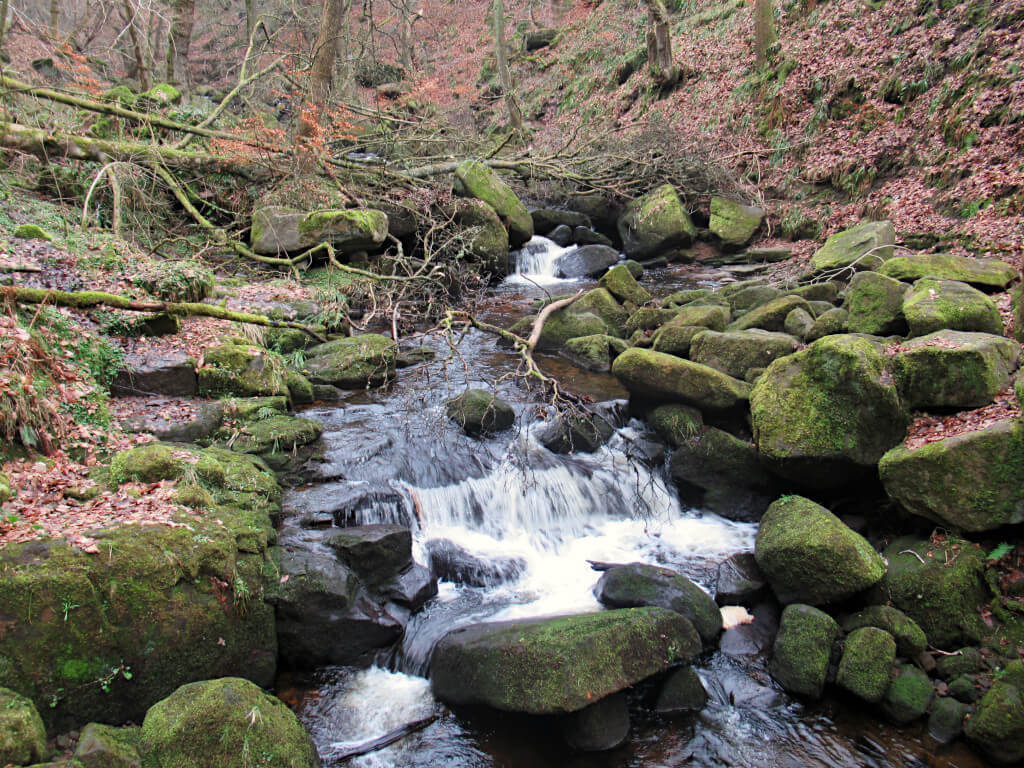
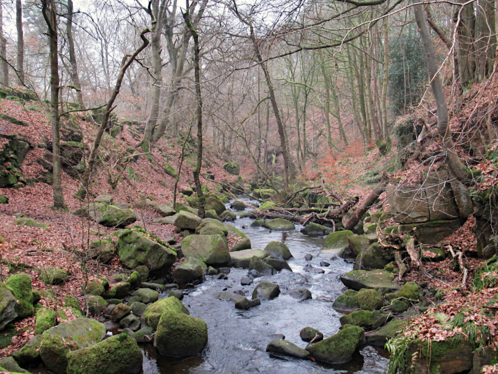
- Follow the path as it runs alongside Burbage Brook and to the small wooden bridge crossing the stream. You’ll need to cross the bridge and it’ll give you a good vantage point of the small waterfalls in this area.
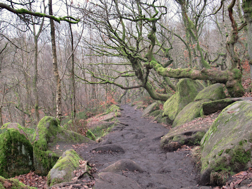
- After the bridge, walk uphill and then turn right onto the main path. Follow the path all the way until you emerge from the woodland onto open moorland and you’re no longer in the gorge.
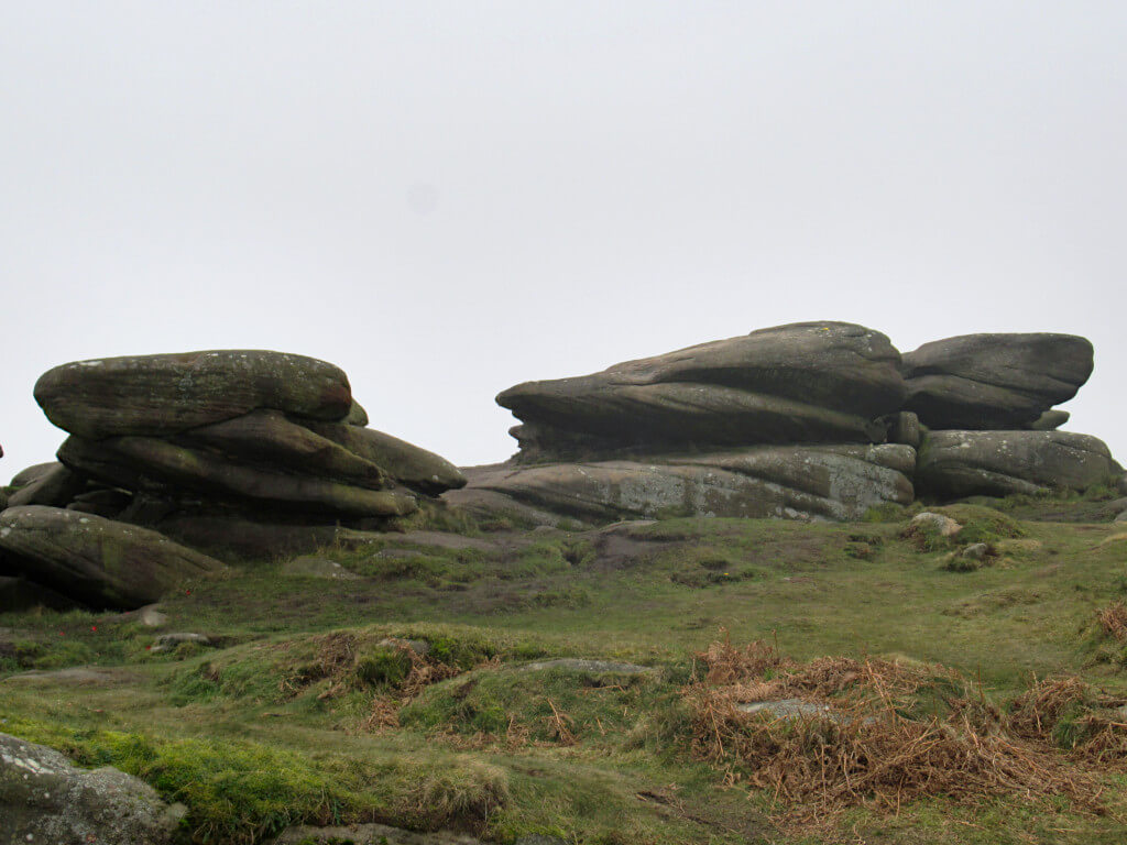
- When you see a wooden bridge on your right-hand side, turn left and head towards the large rock formation across the fields. Owler Tor is a great place for a break and a drink on this walk and has stunning views of the Peak area. That is unless you visit on a very foggy day as I did. In which case, you may see very little!
- From Owler Tor you’ll be able to see Surprise View Car Park just across the road, head here and be ready to start the next leg of this circular walk.
Surprise View Car Park to Padley Gorge and b6521 Roadside Parking
- When entering the car park from the road, head for the path in the top-left corner. Follow this all the way along until it meets another path, turn right and join this one.
- You’ll now be walking along the ridge of Millstone Edge, a place that is meant to put the surprise in Surprise View. Weather conditions permitting of course you’ll have great views of Stanage Edge and Hathersage.
- Keep following the path as it loops back around and you reach Mother Cap. This large rock in the middle of the path is hard to miss. Mother Cap is another great place to have a sit-down and rest for a few minutes, with incredible views to boot.
- From Mother Cap rock, continue following the path straight until you reach the road. Cross over and continue across the moorland towards the wooden bridge you passed earlier (if starting from Grindleford or the B6521).
- Cross the bridge and continue up to the roadside. If you’re continuing with the walk at this point, there’s no need to leave the path. Simply turn right and ignore the first direction in the next section.
B6521 to Grindleford Station Car Park
- From the roadside of the B6521, enter through the small wooden gate and walk down the stairs to join the path. Turn left and head into the wooded area.
- This part of the route and path is very easy to follow. Continue passed another small bridge as the trail continues to run alongside the river. Although, you might not always be able to see it from the higher point on the gorge walls.
- Keep following the path until you reach the road that Grindleford Station is on. If you’re continuing the Padley Gorge walk from here, continue using the directions in the first section above. You’ll need to head back on yourself but at river level, until you reach the small wooden bridge. Alternatively, if this is the end of the route for you, turn left onto the road and follow it back up past Grindleford Station.
How to Get to Padley Gorge Peak District
Unlike many popular walking spots in the Peak District, this one is actually well-served by public transport. If you don’t have your own car, you can get the train to Grindleford Station.
The Manchester-Sheffield trains stop here, with one train per hour in each direction. Additionally, the East Midlands service from Norwich to Liverpool also stops at Grindleford once per day in each direction.
A 5-times-a-day bus service between Meadowhall and Tideswell also runs along the B6521 with a stop right next to the roadside parking and Granby Discovery Barn.
By car, Padley Gorge is less than an hour’s drive from Sheffield, Doncaster, Glossop, Stockport, Derby, Nottingham and Macclesfield. Although, do expect roads to be busier during weekends, bank holidays and school holidays.
What Facilities are Available on the Route?
Limited facilities are available along the route. Next to Grindleford Station is a small cafe serving food and drinks during the day. Aptly named, Grindleford Station Cafe.
The cafe is open from 9 am to 4pm Wednesday to Friday and until 5pm on weekends, with indoor and outdoor seating. It is closed on Mondays and Tuesdays. There are no other food/drink stalls along the route other than an ice cream van that is regularly parked on the B6521.
Are there toilets at Padley Gorge Peak District?
Paying customers can use the toilets at Grindleford Station Cafe. However, there are no other toilet facilities along the route.
Can you Swim at Padley Gorge Sheffield?
Yes, the stream is easy to access and the current is not strong. However, the water is not very deep and there are many rocks creating pools and narrow areas. As such, the stream is much more suited to dipping your feet in or paddling than swimming.
Can dogs be off lead at Padley Gorge?
Yes. While rules on the nearby Longshaw Estate require dogs to be on leads, this does not apply in Padley Gorge.
There is little in the way of wildlife beyond birds in the trees. So you shouldn’t have to worry about any mismatched encounters or disturbances.
However, the banks of the gorge are steep in places. As such, your dog may go running off down to the river and you might not be able to follow. Easier river access for dogs and their owners alike is near Grindleford Station and the northern end of Padley Gorge.
Where is the Padley Gorge Waterfall?
There are many small waterfalls located in the southern part of the Padley Gorge Trail. You can see these best from the wooden bridge crossing the stream.
A larger Padley Gorge waterfall, cascading down the eastern side of the gorge is located around 30 minutes walk/halfway along the wooded section heading north on the trail from Grindleford Station. However, it is harder to see this waterfall as you need to be on the opposite side of the stream and the view is obscured by lots of trees.
Is This Padley Gorge Walk Suitable for Pushchairs or Wheelchairs?
Unfortunately not due to the narrow bridges, steps, steep uphill sections and uneven terrain (ie. tree roots growing across the path).

If you have any questions or want any more information drop a comment below and I’ll get back to you!
Prices and offerings mentioned are correct as of January 2023 but are subject to change in future.
More Peak District Walks…
SHINING TOR: Straight and Circular Walking Route Guides
THOR’S CAVE: 4 Circular Route Options From Wetton
LATHKILL DALE: 6-Mile Waterfall Walk
HARTINGTON: 5.3-Mile Walk in the Peak District Countryside
MAM TOR: 4 Routes with Stunning Views
BAMFORD EDGE: 3 Easy to Follow Short & Circular Routes
LADYBOWER RESERVOIR: 6-Mile Circular Route including Derwent Dam Viewpoint
CHROME HILL: 3 Routes to the Spectacular Summit Views
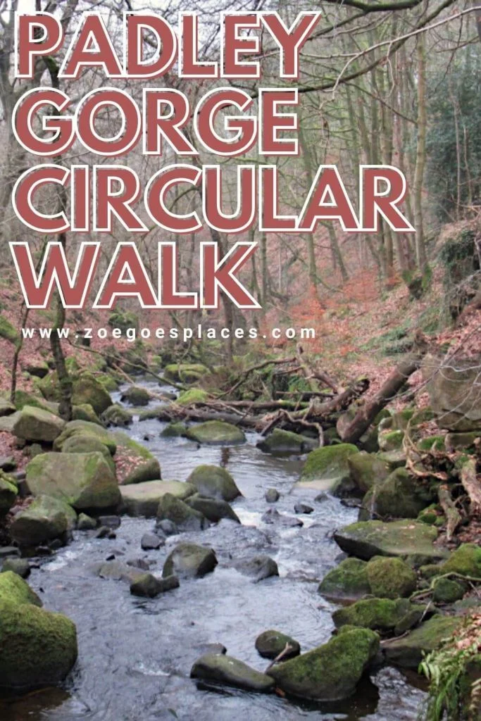
PIN IT FOR LATER!
Hi Zoe! I was so pleased when I stumbled across this post 😊 I absolutely love Padley Gorge, it’s a place I keep returning to as the years drift on. As you say it’s beautiful all year round and there is so much to see! I have some videos of it here http://bit.ly/AtlasVistas if you’re interested. The ice cream vans which park near the start of the walk on the B6521 are a lovely bonus too!
That’s one ticked off the bucket list (although I may well be back) my first visit to Padley Gorge today – stunning!
Q: Can you tell me what the history/geology is of the origin of the huge boulders that are dotted around the gorge please – we couldn’t work it out – like where they came from, how they got there?
No joy surfing the net 🙃
Hope you can help us, thank you 🙏
Douglas
Hi, glad to hear you like Padley Gorge!
Unfortunately I can’t be of much help, I’m not sure of their origin. And, despite my best googling, I also can’t find an answer. I spend a lot of time in the Peak District, so if I ever find out, I’ll let you know!