With its stunning limestone cliffs, waterfalls and abandoned mines, Lathkill Dale packs a whole lot of fun into a few-mile stretch of river. And, luckily for you, this 6-mile Lathkill Dale walk route takes you to all the best parts.
As a nature reserve, there’s no shortage of natural beauty. There are colourful flowers in spring and summer. As well as butterflies and birds making the most of the green surroundings.
Not only that, but this is one of the only walks in Derbyshire with waterfalls. So, you’ll want to keep reading for where to find free parking, the route to take and what you’ll see along this River Lathkill walk!
Where is Lathkill Dale?
Located towards the southern end of the Peak District National Park, Lathkill Dale is near the towns of Buxton, Bakewell and Matlock.
Lathkill Dale itself is the valley of River Lathkill, which flows into the River Wye just south of Haddon Hall. The dale is also part of the Limestone Way, a walking route from Castleton to Rocester, via Flagg, Bradford Dale and Tissington.
The nearest villages are Monyash (to the west) and Over Haddon (to the east).
Where is the Best Place to park for Lathkill Dale?
There is free roadside parking available on Church Street (B5055).
Spaces are limited but unless you are visiting at peak times (summer holidays, good weather weekends), then you should be fine. Arrive early for the best chance of getting a space at Lathkill Dale Car Park.
To navigate to the Lathkill Dale Parking area, use the Google pin ‘Toilets and Lathkill Dale footpath‘, the GPS coordinates 53.195002, -1.765925 or the Ordnance Survey grid reference of SK 15737 66459.
The postcode for Monyash (DE45 1JH) covers the whole village. So to get to the parking for this Lathkill Dale walk you’ll need to use the more precise options listed above.
Alternatively, if you want to explore Lathkill Dale Derbyshire from the other end, you can park in Over Haddon.
Lathkill Dale Walk Route
Distance: 5.9 miles/9.5 kilometres
Difficulty: Easy
Walking time: 3 hours
Start and endpoint: Head of Lathkill Dale footpath on Church Street (B5055), east of Monyash
Lathkill Dale Walk Map
Lathkill Dale Waterfall Walk Start Point
This Lathkill Dale waterfall walk starts where the path meets the road on the B5055, made obvious by the fence separating the two.
This is on the south side of the road, on the same side of the road as the toilet block. Use the navigation markers above to direct yourself to this point.
GRAB MY LIST OF MY FAVOURITE PEAK DISTRICT WALKS…
➡️ Is your New Year’s resolution to spend more time outdoors or exercise more?
➡️ Looking for more ideas for Peak District walks?
➡️ Want to explore more of this beautiful national park?
Save yourself the hours of research finding hidden gems and local favourites…
with this digital list of 52 beautiful Peak District walks full of my favourites from years of exploring.
Discover new places and spend more time in the great outdoors!
And – as a bonus – it includes 3 free trackers and challenge templates!
> > > BUY NOW FOR £2.99
> OR READ MORE

Directions
Few directions are needed for this Lathkill waterfall walk as you just keep following the path straight.
Nevertheless, I’ve included some pointers below to make sure you get to see the best bits of this Lathkill Dale Circular walk through the tall limestone cliffs…
Towards the River Lathkill and Lathkill Dale Waterfall
- After entering through the fence, keep walking straight over the stiles and across a couple of fields (watch out for cows!). The path narrows as you start to enter the valley, but just keep going straight although you may need to weave around the rocky parts.
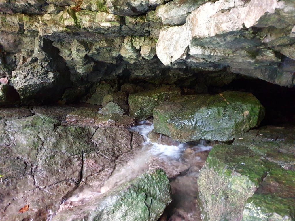
- About 1 mile from the road, there’s a small cave on the right-hand side. You should easily notice this, as the river starts following out of it.
- In wetter months, you may need to cross a small stream to get to the cave. And although you can’t get too deep inside, it’s cool nevertheless and worth spending a few minutes exploring.
- Return to the path and keep following it as it now runs parallel to the River Lathkill. Passing Cales Dale on the right-hand side, it is just under 1 mile until the Lathkill Dale waterfall.
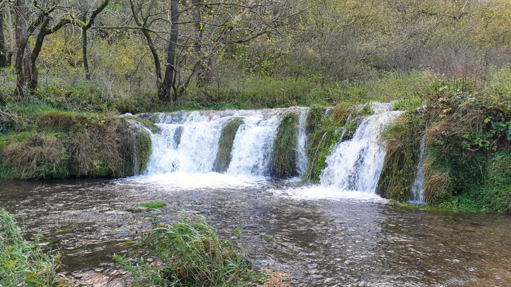
- At the waterfalls, there is a small embankment area to get closer and take photos. The River Lathkill waterfall is also a good place to stop for a snack or drink break and enjoy the surroundings.
Abandoned mines along this River Lathkill Walk
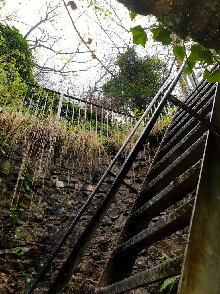
- Following the path for almost 1 mile, you’ll come to a small bridge across the river. Take this and you’ll reach the remains of a mining building and a well that you can climb down into on metal ladders.
- Spend some time reading the signs to learn about the history of the site. And in the well, be sure to turn the wheel to power the lights.
- Back across the river, on the main path, walk for another 200 metres where you’ll find a path heading to the left. Head uphill and then follow the path as it flattens out and runs parallel to the path on the lower ground.
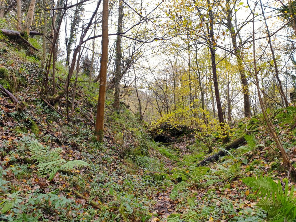
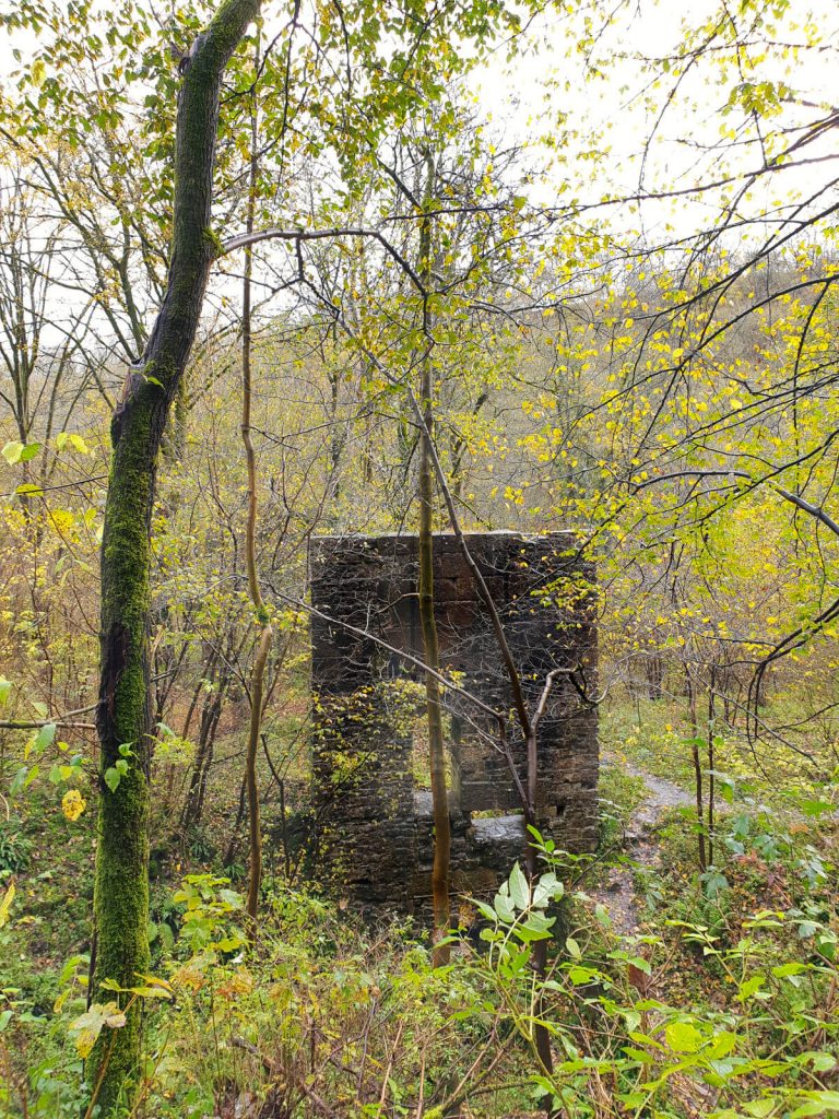
- You’ll first reach a small stone bridge that you can walk under before you’ll reach the closed-up entrance to Mandale Mine. In front of the mine is the stone remains of the building that once stood on this site.
- Once you’ve finished exploring the site of Mandale Mine, follow the path back towards the river. Turn right and retrace your steps all the way back to the roadside.
Although this Lathkill Dale circular walk route takes about 3 hours in total, with the different landmarks to see it’ll have probably taken you about 2 hours to get to Mandale Mine.
But, by not stopping at the sights on the way back, you’ll be at the roadside in around 1 hour.
How to get to Lathkill Dale Derbyshire
The easiest way to get to the start point of this Lathkill Dale walk is to drive. Parking is available on the road near Monyash
A weekend bus service (X71) connecting Monyash with Sheffield, Chesterfield and Bakewell also runs. Though do note there is only one bus each day (Saturday and Sunday only) in each direction.
Additionally, on Sundays only, a twice-a-day bus service connecting Monyash with Macclesfield, Buxton and Bakewell runs (bus number 58).
Check online for the latest bus services as these can change frequently and with little notice.
FAQs
No, both dogs and humans alike are not permitted to swim in the Lathkill Dale Nature Reserve, which includes the River Lathkill.
The area is an important habitat for many types of wildlife and plants. As such, people and their pets should stay out of the water to protect the habitat and ecosystem.
Also, don’t be surprised to see the higher parts of the river can dry up in the summer months.
Yes, the walking route keeps to public right-of-way footpaths. These allow access year-round.
During and after periods of heavy rain, parts of the footpath can be flooded preventing access. The flooding can also make it impossible to tell where a flooded footpath ends and the deeper river begins. Particularly, as the water is often muddy.
Walking through floodwater is not advised. Make sure you always dress appropriately for the current and recent weather too, with suitable footwear for puddles and mud!
Lathkill Dale is managed by Natural England, as it is part of the Derbyshire Dales National Nature Reserve. The pathways are public rights of way allowing access through the Lathkill Dale Nature Reserve.
Is this walk suitable for children?
While this River Lathkill walk is mostly flat on dirt paths, the length of it makes it less suitable for younger children. Additionally, there is one part of the path that crosses a very rocky area making it unsuitable for pushchairs.
However, one of the good things about this Lathkill Dale waterfall walk is that you can turn back at any point. You can just walk to Lathkill Dale waterfall and then head back (reducing the total walking distance by about half), or to the first mine and then back.
This is particularly good if you have young children as you aren’t committed to the full 6-mile round walk.
What are the best nearby Peak District pubs to Lathkill Dale?
Ok, now we’re getting to the important question. Post-walk pints (other drinks are available) are an integral part of my weekend adventures! Luckily, there is no shortage of Peak District pubs!
The nearest pub is The Bulls Head in Monyash. But, there is also the option of The Royal Oak just a short drive down the road to Hurdlow or the Cock & Pullet in Sheldon, for countryside pub vibes.
Slightly further afield there is a good selection of pubs in Bakewell (The Red Lion, The Manners) and Buxton (The Queens, The Wye Bridge House [JD Wetherspoon]).
Do you have any questions or want any more information? If so, drop a comment below and I’ll get back to you!
Information is correct as of April 2023 but is subject to change in future.
Other Peak District Walks You Might Be Interested In…
SHINING TOR: Straight and Circular Walking Route Guides
CHROME HILL: 3 Routes to the Spectacular Summit Views
THE ROACHES: Walk Route & Full Guide for Panoramic Views
LUD’S CHURCH: 3 Walk Routes For An Other-Worldly Experience!
THOR’S CAVE: 4 Circular Route Options From Wetton
MAM TOR: 4 Routes with Stunning Views
WINNATS PASS: Winnats Pass Walk: Best Routes for Incredible Views
LADYBOWER RESERVOIR: 6-Mile Circular Route including Derwent Dam Viewpoint
BAMFORD EDGE: Bamford Edge Walk: 3 Easy-to-Follow Short & Circular Routes
PIN IT FOR LATER!
