The Roaches walk in Staffordshire represents one of the best all-around walks in the Peak District. It strikes a balance between effort and reward with great views and just one short, steep uphill climb.
In fact, once you’ve reached the 2-km-long ridgeline, it’s almost all flat or downhill. Perfect for those days you want some fresh air without a challenging hike.
And now, I’m going to share it with you. Because some things are just too good to keep to yourself!
Keep reading to find out how to get incredible views for miles around with very little uphill walking and a total walking time of just 2 hours!
What is The Roaches?
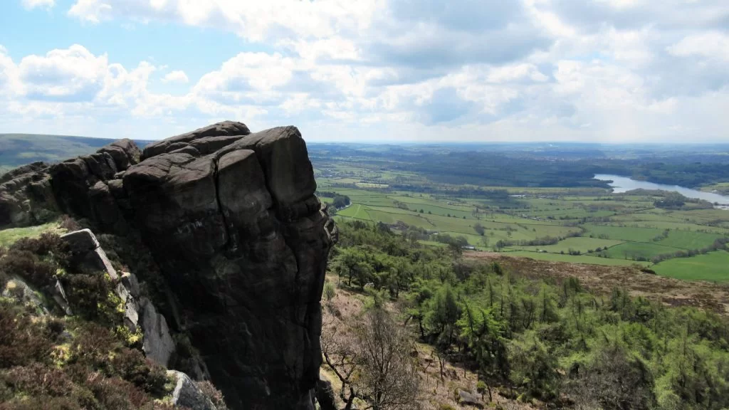
With spectacular rock formations and stunning views, The Roaches – near Leek – is a natural wonder of the English countryside. The name translates from French as ‘rocks‘. Which, is pretty bloody accurate!
The steep rockface is popular with climbers but has also created a ridgeline perfect for walks and illusion photographs.
Views over the Cheshire, Staffordshire and Derbyshire countryside are unobstructed from the summit at 505 metres. Whilst, on clear days it is thought you can see as far as Snowdon, Snowdonia and Lancashire! Th
Where is The Roaches Walk?
The nearby towns of Leek, Congleton, Macclesfield and Buxton surround The Roaches Staffordshire. And, it is conveniently located on the western edge of the Peak District National Park, near the A53.
How to get to the Roaches
To reach The Roaches, exit the A53 at Upper Hulme and then follow Roach Road until you are in the shadow of the overhanging rocks!
Then, follow the directions in this walk guide to reach the top of the ridgeline.
Where to Park at The Roaches
Parking at The Roaches Peak District is available in marked bays on the roadside and is free of charge. Traffic wardens do regularly ticket cars parked outside of the bays, so be warned.
You can see the location on Google Maps – although there are multiple layby parking locations along Roach Road. And on busier days, you may need to drive further along the road to find a space.
Alternatively, use the GPS coordinates 53.156293, -1.995408 in any navigation app to get to the nearest The Roaches parking area to the start point of this walk. Unfortunately, putting in a postcode won’t work as it covers a large rural area and will take you to the completely wrong place!
On weekends, bank holidays and during school holidays that don’t fall in the depths of winter, I recommend arriving as early as possible to secure yourself a parking spot. Once they’re gone, they’re gone!
A final option is to use private parking at a nearby farm that charges £2 for parking. This is clearly signposted when open from Roach Road.
The Roaches Walking Route: 3.6-Mile Circular Loop
Distance: 3.6 miles/5.8 kilometres
Elevation gain: 160 metres
Difficulty: Easy to moderate (in places)
Walking time: 1.5 to 2 hours
Start and endpoint: The Roaches UKC Parking (Google Maps marker)/Roach Road
The Roaches Walk Map
Walk Start Point
The start point of this Roaches walk is at the gate from Roach Road onto the pathway near the Don Whillians Memorial Hut. The GPS coordinates for this are 53.156125, -1.995206 or the Ordnance Survey grid reference is SK 00418 62111.
Directions
One of the great things about this walk (aside from the STUNNING views) is that it is very easy to follow!
Nevertheless, to get you off to a good start and give you an overview of the walk, I’ve included the directions below. For best results, combine these directions with The Roaches map above to avoid errors in navigation.
Getting to the Ridgeline
- As you enter the gate from Roach Road, the path immediately forks – take the more established path on the right heading uphill. After about 50 metres, turn to the left and follow the path up towards the wooded area.
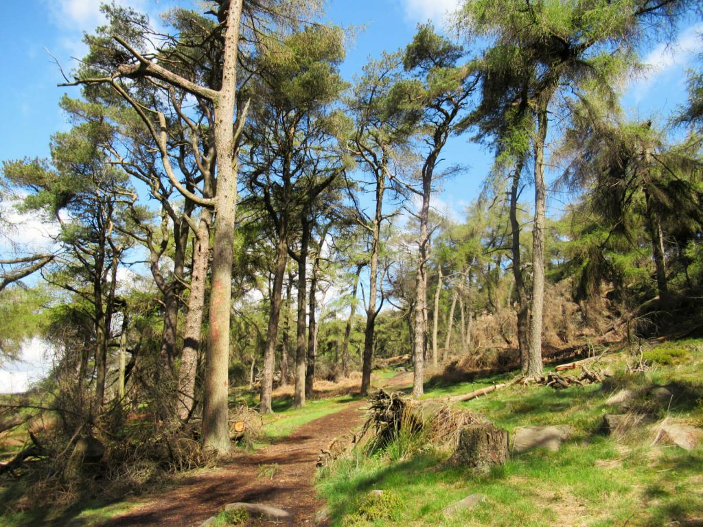
- On the approach to the hut, follow the path as it bends to the left. Then, continue walking alongside the wooded area (keeping this to your right-hand side) for about 300 metres.
- Next, the path turns to the right and cuts through the wood before reaching a steep ascent in the rock face. Luckily, on this The Roaches hike, most of the ascent in this very short stretch. So, once you’ve climbed this you’ll get to see the most amazing view and then enjoy a fairly flat walk along the ridgeline!
Walking Along the Top of The Roaches
- Emerging from the steep ascent of The Roaches Peak District, follow the path to the left as it heads north.
- You can enjoy fantastic photo spots along the whole ridge, but there are certainly some spectacular ones overlooking Tittesworth Reservoir just after the steep ascent. Additionally, after around 300 metres you’ll reach Doxey Pool – a small body of water, thought (by some) to be home to a mermaid!
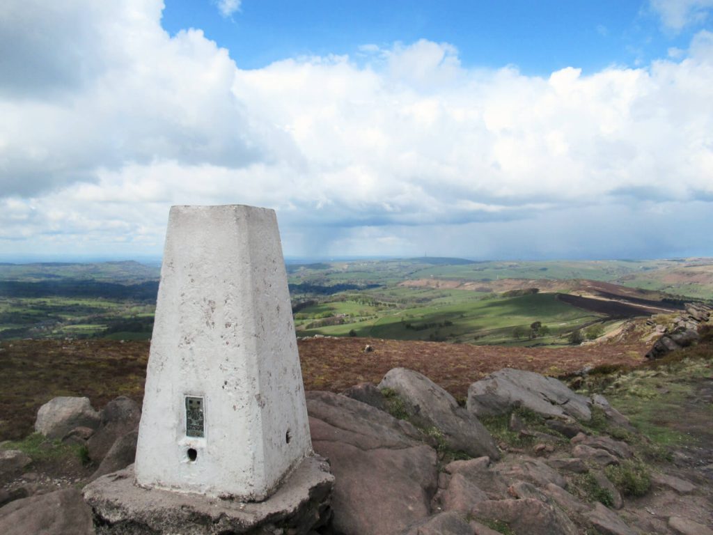
- Keep following the track for another 1 km to get to the trig point of The Roaches Staffordshire. But, be warned, it can be very windy!
- From the trig point, keep following the path for another 1 km where it meets a road. Here, you have the option to add on an extra 2-mile loop to visit Lud’s Church. For more details, see the section below on The Roaches and Lud’s Church walk.
The Gentle Descent
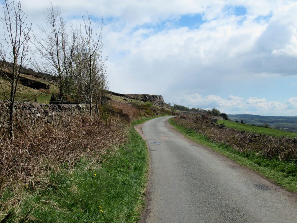
- Turn left onto the road (Hazelwood Road) and follow it all the way back down to where you are parked!
- The road has a gentle decline and is the perfect ending to the walk as no uphill walking is required! There are no pavements, but the embankments are wide enough and easy enough to walk on if and when a vehicle is passing.
- The walk back along the road is just under 3 km and can be completed in about 45 minutes at a reasonable pace.
Click the link above to download the file for use in a GPS viewer. This way you’ll be able to track where you are on the route using your phone’s GPS – avoiding accidental detours and providing reassurance for less experienced countryside walkers! Once you’ve downloaded the GPX file above, install a GPX viewer app (Google PlayStore or iPhone App Store) and load the GPX file.
Other Useful Information
A walk along The Roaches Peak District makes for an easy day out. But, you still need to make sure you’re prepared as British weather can be unpredictable, particularly in the countryside and at elevation.
Walking boots are ideal.
But, you’ll be able to complete the walk fine in good trainers if the weather is dry (and has been dry for at least a few hours!).
Layer up for all weather
The ridgeline is very exposed, bring layers such as lightweight running tops, waterproof jackets, hat and gloves to keep warm.
I visited in May and in the space of several hours experienced sun, rain, snow and high winds! However, The Roaches Staffordshire does offer a good vantage point to see if rain or storm clouds are on their way.
So, keep an eye out and be prepared to pick up the pace!
Treat yourself before or after
Check out the Roaches Tea Rooms & Restaurant, located just outside Upper Hulme.
Check out other nearby landmarks
If you’re up for more of a challenge, embark on a longer The Roaches hike via Hen Cloud from The Roaches Tea Rooms. Parking is available here for just £2 for the day.
Another walking route extension is to add on a loop to the stunning and mysterious Lud’s Church. Keep reading the next section to find out more on this The Roaches and Lud’s Church walk!
The Roaches and Lud’s Church Walk
From the most northerly point on The Roaches walk route, you can add on a 2.1-mile, 1-hour circular loop to visit the enchanting Lud’s Church. Once you complete the Lud’s Church circular walk, you can simply continue with the second half of the walk described in Step 3 above.
The Lud’s Church and The Roaches walk map above show how they form a figure-of-8 loop. It’s easy to follow and mostly flat.
And, Lud’s Church is not something you’re going to want to miss.
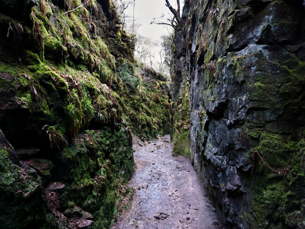
The Roaches Peak District offers fantastic views for miles around. But Lud’s Church is an 18-metre-deep chasm in woodland created by a landslip many years ago.
It’s spectacular in a different way.
You can walk into the chasm and explore the 100-metre-long, moss-covered, narrow passages. You’ll leave feeling like you’ve been transported to an alien planet!
If adding on this Lud’s Church circular walk, the total walking time will be about 2.5 to 3 hours. Although you may want to allow another 30 minutes for photos and view admiring!
The two walks also give a total walking distance of about 5.7 miles.
For more information, including detailed information on the walking route and its history, make sure to read this post on the circular Lud’s Church walk!
Do you have any questions or want any more information? If so, drop a comment below and I’ll get back to you!
Information correct as of April 2023 but is subject to change in future.
Other Peak District Walks You Might Be Interested In…
SHINING TOR: Straight and Circular Walking Route Guides
CHROME HILL: 3 Routes to the Spectacular Summit Views
LATHKILL DALE: 6-Mile Waterfall Walk
HARTINGTON: 5.3-Mile Walk in the Peak District Countryside
PADLEY GORGE: 4-Mile Route via Millstone Edge
THREE SHIRES HEAD: 5 Route Options from Gradbach & Wildboarclough
THOR’S CAVE: 4 Circular Route Options From Wetton
MAM TOR: 4 Routes with Stunning Views
LADYBOWER RESERVOIR: 6-Mile Circular Route including Derwent Dam Viewpoint
PIN IT FOR LATER!

thanks , going to try one of these tomorrow
Enjoy – hope the weather is good for you!