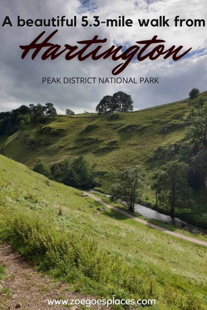
In the south of the Peak District, lies a small village known for its cheese-making and mining past. These days, more people visit the village for its farm shop, tea rooms and to enjoy a scenic Hartington walk in the countryside.
And with good reason, Hartington is located on the River Dove. Which runs through the picturesque and charming Beresford Dale and Wolfscote Dale. Both are perfect for visiting on this 5.3-mile walk from Hartington Peak District and back.
This helpful guide has all the information you need for a fun day out – where to park, the step-by-step Hartington walking route directions and a GPX download.
Distance: 5.3 miles/8.6 kilometres
Difficulty: Easy
Walking time: 2 to 3 hours
Start and endpoint: Path between Hartington Farm Shop & Cafe and Hartington Public Toilets
Contents
Where is Hartington Peak District?
Hartington is a small village located towards the southern tip of the Peak District National Park. It can be easily reached by car. As it’s just a 20-minute drive from the towns of Buxton, Leek, Ashbourne and Bakewell.
The village is situated on the outer limits of Derbyshire, with neighbouring Staffordshire just a few hundred metres to the west across the River Dove and Hartington Dales.
Nearby natural landmarks include Pilsbury Castle, Lathkill Dale, Dovedale, Dovestones, and Thor’s Cave in the Manifold Valley. Days out to all of these attractions can be combined with a trip to Hartington to see and experience the best the Derbyshire Dales has to offer.
Hartington Walk Route
Where to Park in Hartington
There are a few different car parking options in Hartington Peak District.
First of all, free on-street parking can be found throughout the village – just check the signs and don’t park like a dick irresponsible adult.
Secondly, there is pay-and-display parking at Parson’s Field Car Park (SK17 0BE). Which is just across the road from the start point of this Hartington walk. Payment is by coins or phone app only and charges range from £2.70 for up to 2 hours to £6.20 for all-day parking.
Finally, the parking closest to the start point of this Hartington Dales walk is customer-only parking at Hartington Farm Shop & Cafe (SK17 0AN). I stopped here for lunch before the walk and it was delicious – highly recommend it!
Hartington Walk Start Point
The walk from Hartington Derbyshire begins by joining the path between Hartington Farm Shop & Cafe and the public toilets building. The path heads behind the buildings and uphill.
Hartington Walking Route Directions
This Hartington walk is very easy to follow, especially once you reach the River Dove and towards Wolfscote Dale.
Nevertheless, to make sure you don’t get lost or off track on this walk from Hartington, here are some helpful directions. Plus, don’t forget, there’s the Ordnance Survey map route at the top of this page.
- First, follow the path as it heads behind the public toilets and farm buildings on the right-hand side. Cross the small country road and join the path directly opposite.
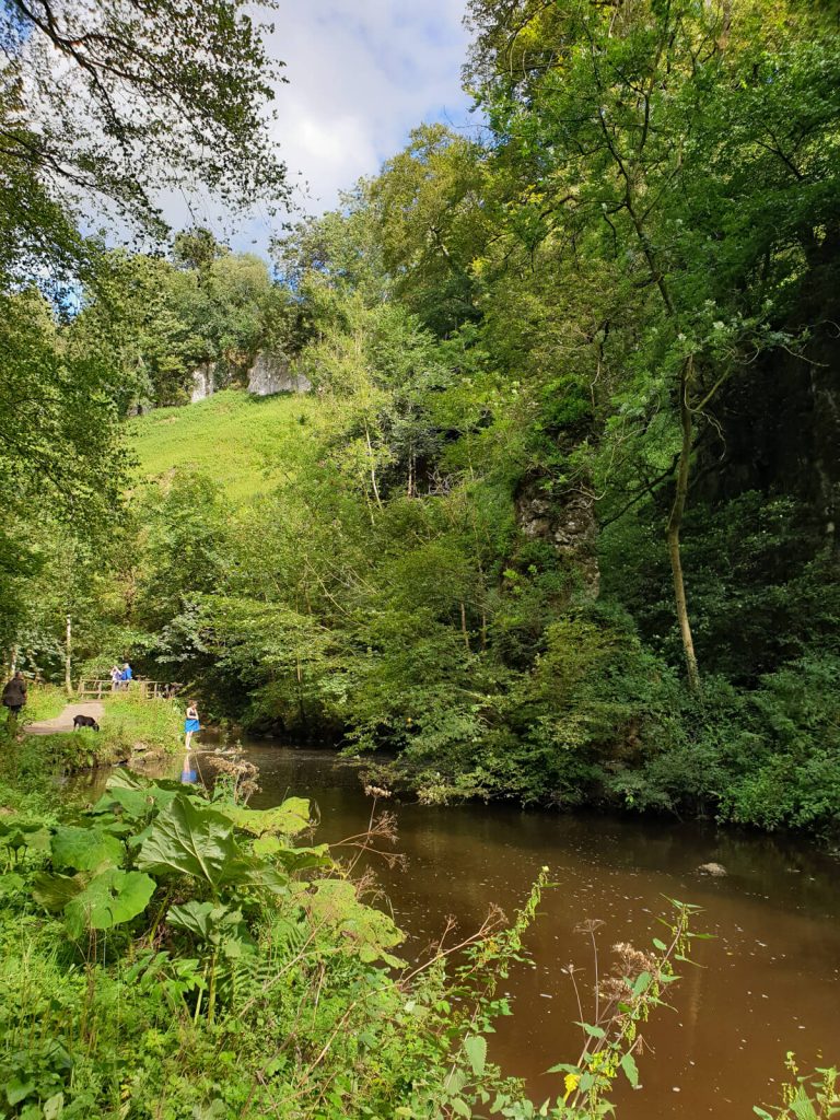
- Next, take the path crossing two fields with a stile in the middle into the woods and towards the River Dove. This is where you’ll enter Beresford Dale Derbyshire.
- From here, the path crosses the River Dove at Pike Pool, which will now be on your left-hand side. Cross back over the river via a narrow bridge when the path meets the road. Continue walking alongside the river through the next field.
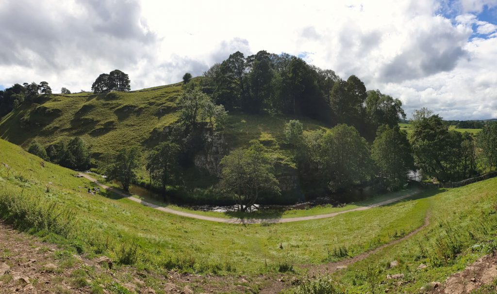
- Soon, the path continues beyond the wooden fence and large cliffs start to form a valley around you.
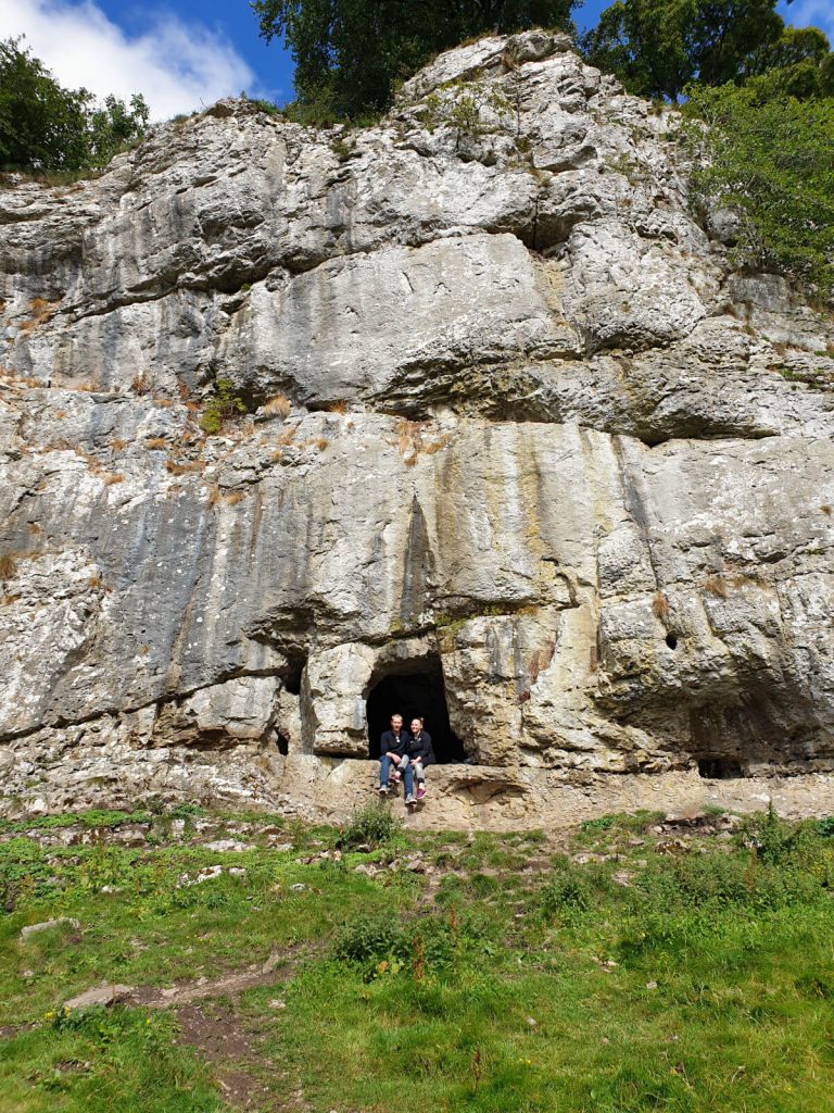
- In this area, you can explore lots of small caves and alcoves on the left-hand side, just uphill from the path.
- Once you’ve explored the caves, re-join the path and continue walking through Wolfscote Dale with its impressive surroundings.
- The path continues all the way through the valley until it splits in two just before the fence.
- To follow this route, turn around and retrace your steps back through Wolfscote Dale and Beresford Dale, along the River Dove and back to the village.
Et voila! You’re back in the village having spent a few hours enjoying the full variety of countryside that the Peak area has to offer. There’s definitely time for a well-deserved post-walk pint in one of the Hartington pubs nearby!
Walking Route GPX
Click the link above to download the file for use in a GPS viewer. This way you’ll be able to track where you are on the route using your phone’s GPS. Avoiding accidental detours and providing reassurance for less experienced countryside walkers! Once you’ve downloaded the GPX file above, install a GPX viewer app (Google PlayStore or iPhone App Store) and load the GPX file.
Circular Hartington Dales Walk Route
Looking for a circular route so you don’t have to walk back on yourself? Then you can make this route a circular Hartington walk via Biggin Dale back to the village. Here’s how…
Once you’ve reached the fence at the end of Wolfscote Dale, take the path on the left up through Biggin Dale. This area is a beautiful nature reserve with lovely surroundings.
After 2 km, the path splits in two. To the right is Biggin Dale continues but to the left is the route back towards Hartington Peak District.
It’s about 1 km until you reach the road. Continue straight along Reynards Lane to return back to Hartington. Follow the road all the back into Hartington.
Here, you can cut across the field to reach the Farm Shop. Or, head into the village and walk around Hartington, including the War Memorial, pond and shops to return to your car.
In total, this walk will be 5.5 miles (8.8 km), which is pretty similar to the there-and-back route detailed above.
Nearby Peak District & Hartington Pubs for a Post-Walk Pint
The Devonshire Arms and Charles Cotton Hotel are the only two Hartington pubs, both within walking distance of the end of this Wolfscote Dale walk.
Slightly further afield, The Waterloo Inn in Biggin is a 5-minute, 2-mile drive from the end of this River Dove walk. While The Manifold Inn in Hulme End is a similar distance in the opposite direction.
Do you have any questions or want any more information on this Hartington Dales walk? If so, drop a comment below and I’ll get back to you!
Information is correct as of January 2023 but is subject to change in future.
Other Peak District Walks You Might Be Interested In…
SHINING TOR: Straight and Circular Walking Route Guides
CHROME HILL: 3 Routes to the Spectacular Summit Views
THE ROACHES: Walk Route & Full Guide for Panoramic Views
STANAGE EDGE: 5 Best Walking Routes (1 to 8 Miles)
LUD’S CHURCH: Circular Walk Route For An Other-Worldly Experience!
BAMFORD EDGE: 3 Easy-to-Follow Short & Circular Routes
PADLEY GORGE: 4-Mile Route via Millstone Edge
THREE SHIRES HEAD: 4 Route Options from Gradbach & Wildboarclough
MAM TOR: 4 Routes with Stunning Views
LADYBOWER RESERVOIR: 6-Mile Circular Route including Derwent Dam Viewpoint
PIN IT FOR LATER!