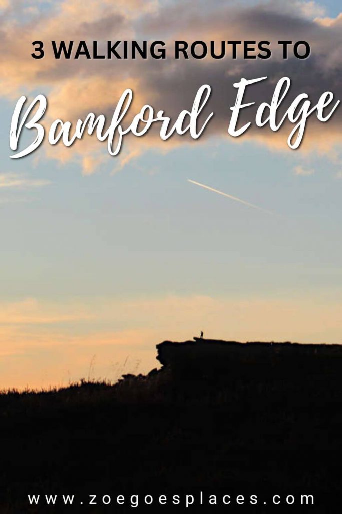
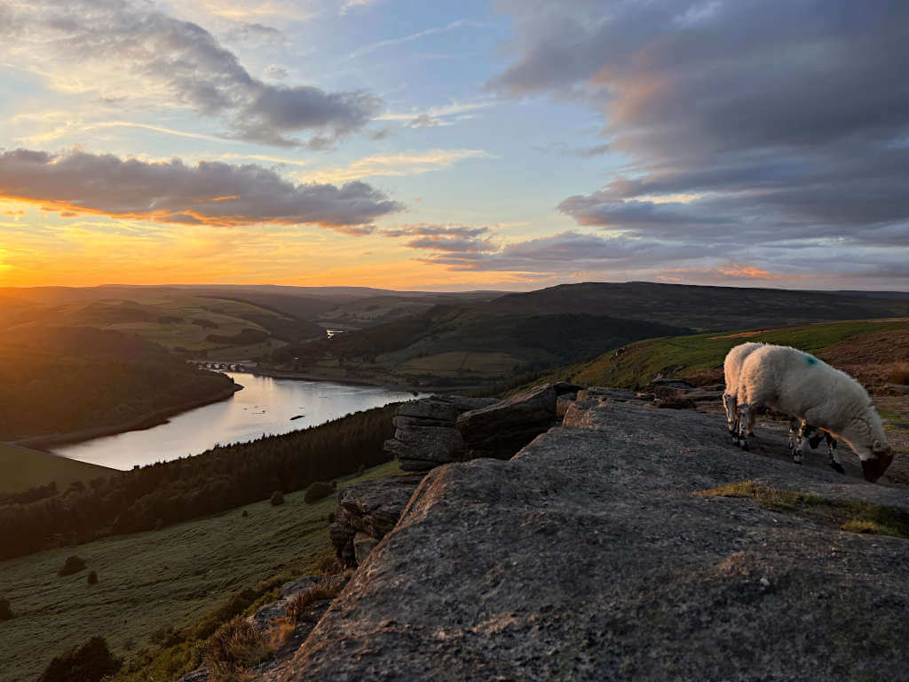
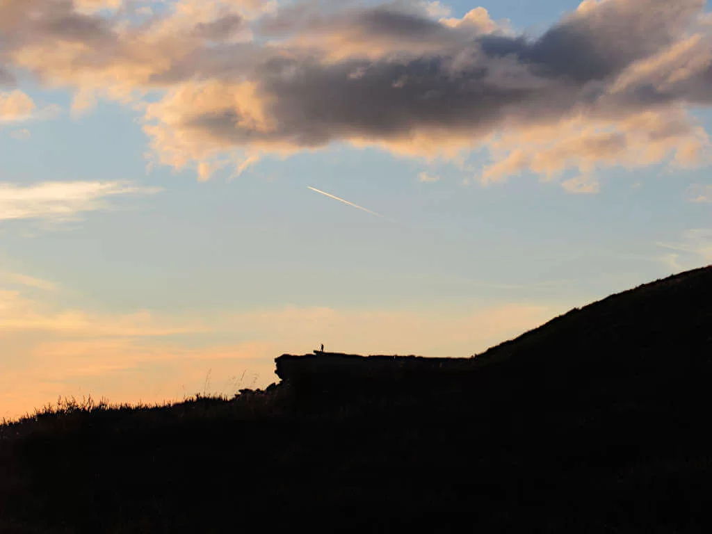
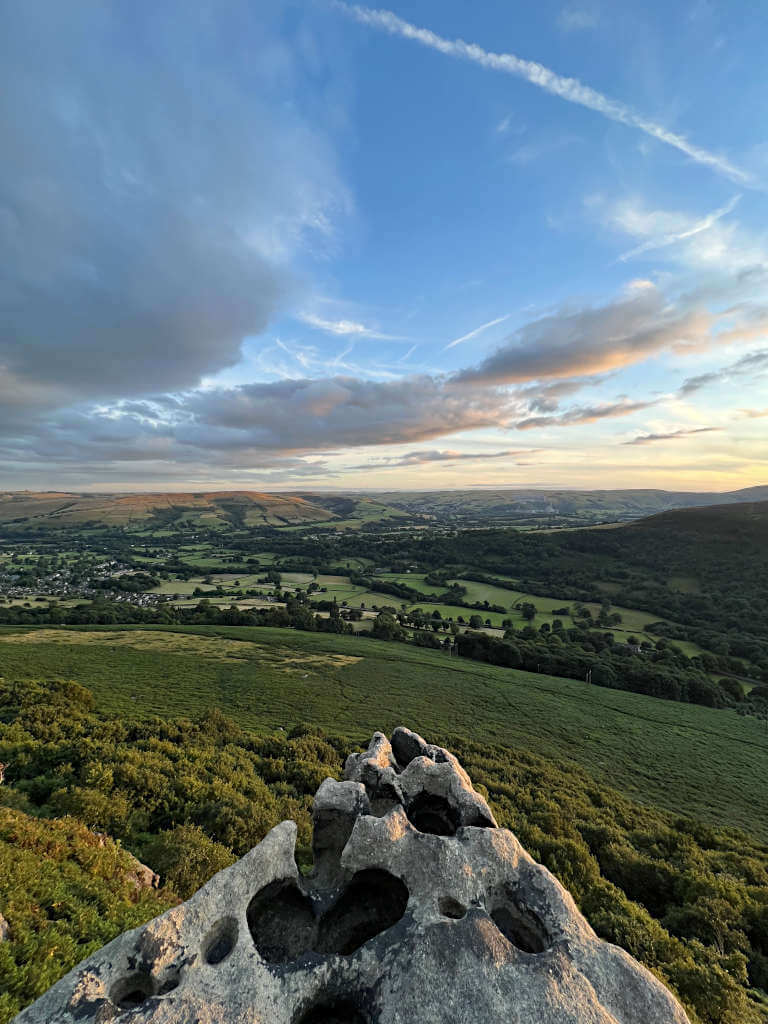
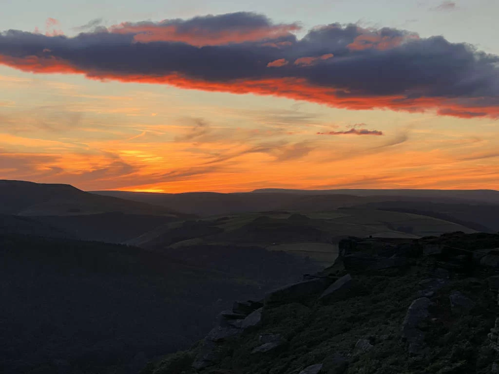
Panoramic Views. Stunning sunsets. Unique photo opportunities. A Bamford Edge walk is an absolute must to see one of the best Peak District National Park spots – one that’s only accessible on foot.
But, this doesn’t mean you have to take a long walking route. Instead, this guide has 3 options for you of 2, 3 and 5 miles.
So, whether you’re after a short walk or a circular walk, I’ve got you covered. Including where to park, how to get there and what to expect. Plan your next Peak District walk with this complete guide to the best Bamford Edge trails…
What and Where is Bamford Edge?
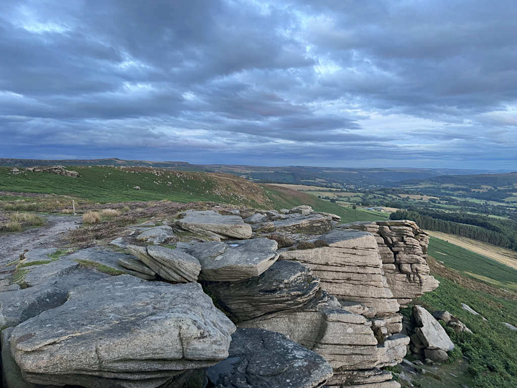
Bamford Edge is one of the Peak District’s best natural beauty spots. This striking rock formation runs for over 1 km along the southwestern edge of Bamford Moor.
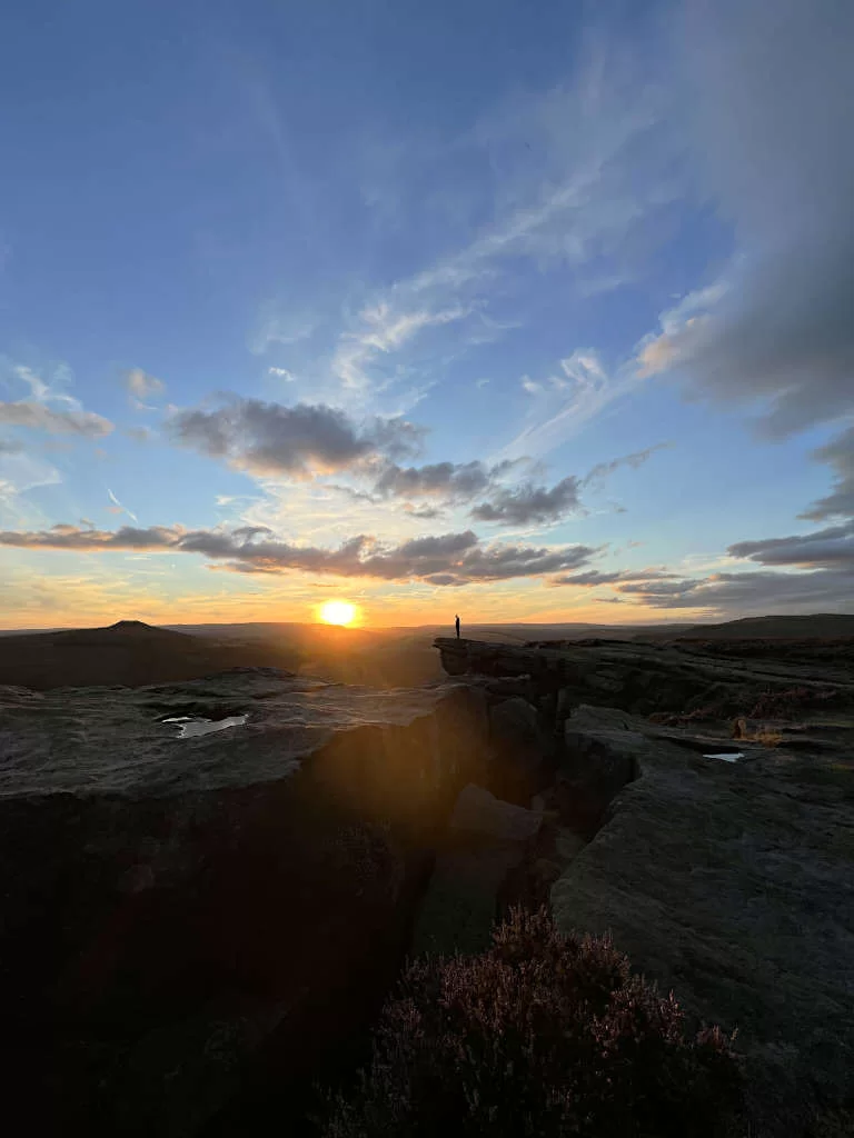
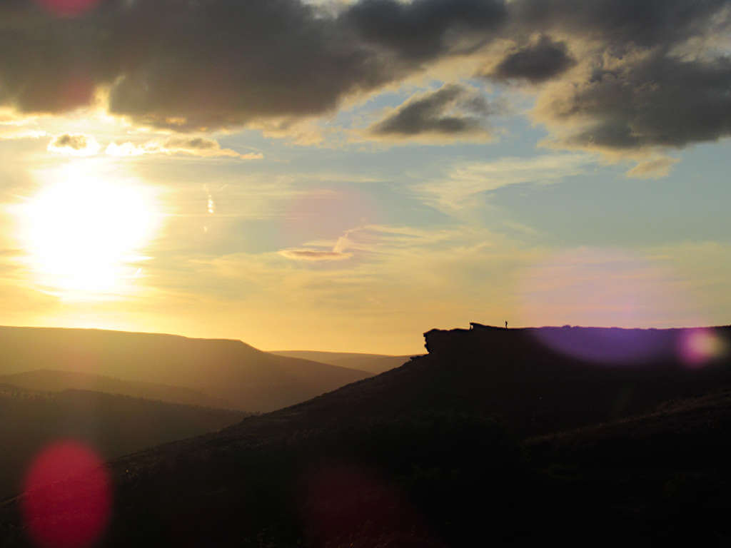
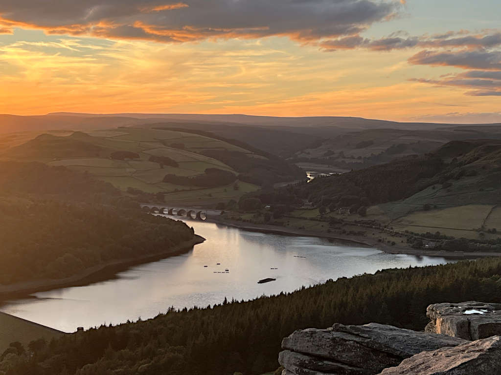
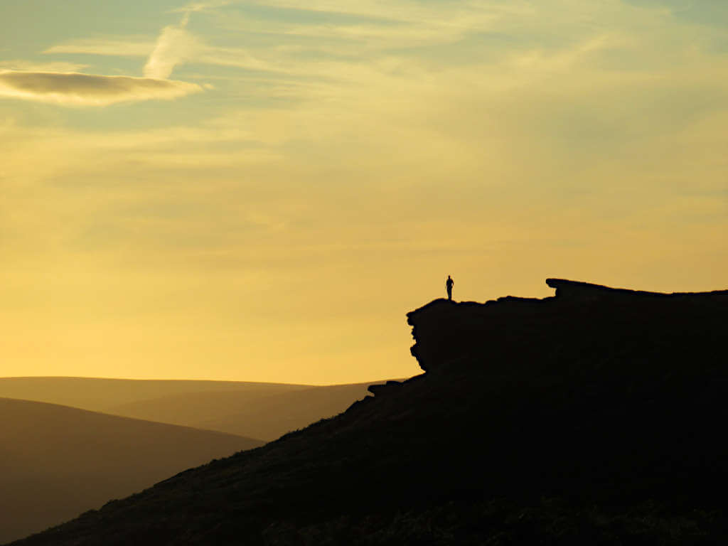
And this gives it incredible photo spots worthy of a visit at any time. But, particularly so at sunset when you’ll get to see the sky illuminate over the rolling hills and valleys of the national park.
At the highest point, Bamford Edge is 420 metres above sea level (1381 feet).
In addition to being over 400 metres above sea level, it’s over 200 metres above Ladybower Reservoir below. This elevation does mean that it’s fairly exposed, so definitely pack an extra layer for that crisp breeze.
Its elevated position also offers panoramic views over nearby Ladybower Reservoir, Win Hill and Derwent Edge. As well as Alport Castles and Hope Valley slightly further in the distance.
Similarly, Mam Tor, Winnat’s Pass, Hope Valley and Castleton are also within a few miles as are Padley Gorge and Millstone Edge.
And, while you can’t drive to the rocky overhang, you can take these easy-to-follow walking routes from nearby car parks or Bamford village.
Bamford Edge Walks: Overview
| JUMP TO: 1. Short Walk from New Road Best for quick visits & just seeing the view | 2.0 miles 2. From Heatherdene Car Park Steeper walk for more of a challenge | 3.1 miles 3. Circular walk via Ladybower Reservoir & Bamford Mill Longer walk, see other nearby attractions | 5.3 miles |
Route 1: Bamford Edge Short Walk from New Road
Distance: 2.0 miles/3.2 kilometres
Elevation gain: 109 metres
Difficulty: Easy
Walking time: 1 hour
Bamford Edge Walk Map
Directions
This Bamford Edge short walk starts at the layby parking on New Road and takes about 30 minutes to reach the far end of the ridge.
And, as an added bonus, you reach the rocky top in as little as 10 to 15 minutes from New Road. Meaning, that you get incredible views for about half of the walk – not just at the end like many walking routes!
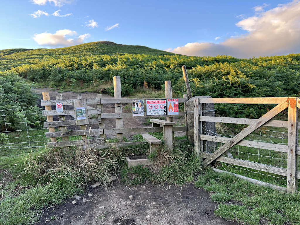
- From the layby, climb over the 3-step stile and head straight uphill on the footpath.
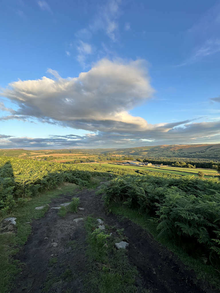
- As you walk through the shrubby greenery, the path is mainly fine dirt with some larger rocks underfoot. Continue uphill until the path levels out and turn left along Bamford Edge Peak District.
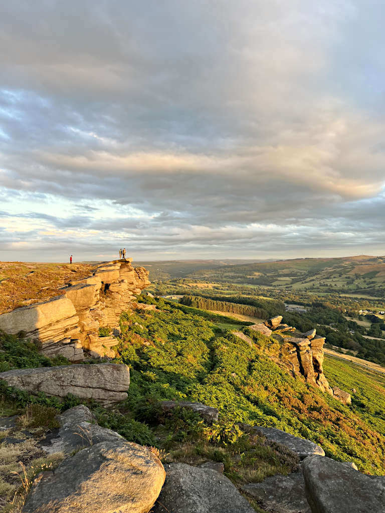
- Pretty quickly, you’ll reach the iconic rocky overhangs of the edge. Continue along the edge for as long (or short) as you’d like, stopping for photos and admiring the view at your own leisure. At one point, the path splits – but does rejoin shortly. Take the left side to be closer to the edge or the right side to climb over the highest point of Bamford Moor.
- When you’re ready to turn back, simply retrace your steps along the rocky edge before heading downhill and back to the roadside.
GRAB MY LIST OF MY FAVOURITE PEAK DISTRICT WALKS…
➡️ Is your New Year’s resolution to spend more time outdoors or exercise more?
➡️ Looking for more ideas for Peak District walks?
➡️ Want to explore more of this beautiful national park?
Save yourself the hours of research finding hidden gems and local favourites…
with this digital list of 52 beautiful Peak District walks full of my favourites from years of exploring.
Discover new places and spend more time in the great outdoors!
And – as a bonus – it includes 3 free trackers and challenge templates!
> > > BUY NOW FOR £2.99
> OR READ MORE

Route 2: Bamford Edge Short Walk from Heatherdene Car Park
Distance: 3.1 miles/5.0 kilometres
Elevation gain: 186 metres
Difficulty: Easy
Walking time: 1.5 hours
Bamford Edge Map
Directions
This Bamford Edge short walk route from Heatherdene Car Park is slightly longer and has more elevation gain than if you started on New Road. But, here there are more parking spaces and facilities, as well as public transport links for those without a car.
- For a more gentle climb, head south out the bottom of the car park past the toilet block and picnic benches. Follow the path round to the left as it starts to bend and then take the first right when it splits.
- Follow the path through the woodland, turning right when you meet another path. Keep following the path through the trees and uphill until you emerge from the woods.
- Take the first right after the woods and follow the path as it gains elevation and turns 180 degrees. You’ve now reached the top and can follow the rocky overhang all the way along Bamford Edge Peak District!
- When you’re ready to return, simply retrace your steps back along the edge, back through the woods and to the car park!
FANCY A SHORTCUT? For a shorter but steeper Bamford Edge walk, head east out of the car park, opposite the entrance on the road. Turn left when you get to the first gap in the trees and follow the path round to the right as it heads uphill. Turn right as the path flattens out on the moor and walk along to the incredibly scenic lookout!
Route 3: Bamford Edge Circular Walk via Bamford Mill and Ladybower Dam
Distance: 5.3 miles/8.5 kilometres
Elevation gain: 289 metres
Difficulty: Moderate
Walking time: 2.5 to 3 hours
Bamford Edge Circular Walk Map
Circular routes around Bamford Moor aren’t great for walkers due to boggy conditions and hard-to-identify footpaths. Instead, this Bamford Edge circular walk loops around past two of the best attractions in the area: Bamford Edge and Ladybower Reservoir.
Where to Start
As a truly circular route, you can walk this loop in either direction starting from any point along the trail. However, three parking spots along the route will be most convenient.
Heatherdene Car Park (the blue pin on the map above) is one option, but it costs £6 for all-day parking.
Alternatively, roadside parking on New Road (red pin) or Carr Lane (green pin) is free but with somewhat limited spaces. More details on these parking spots are available in the section below.
Bamford Edge Circular Walk Directions
These directions are from New Road via Bamford Mill, Ladybower Reservoir and Bamford Edge going clockwise. However, you can start from anywhere along the Bamford Edge circular walk route, just pick up from where you need.
New Road to Bamford Mill
- From the layby parking, head downhill for about 50 metres and then take the turning on the left. Follow the road all the way down to the triangular section with a tree in the middle of the road.
- Head left along the A6013, taking the 5th right – Mill Lane. Follow this road around until you pass all the buildings on the left-hand side. Take the small road after here and then left again towards the mill.
Bamford Mill to Ladybower Dam
- Cross over the River Derwent using the small bridge and stepping stones at the mill. Follow the trodden footpath across the field, through a gap in the trees and then towards the dirt track.
- Continue along the dirt track until you reach the road, turn left and then immediately right onto the Thornhill Trail. Follow the path straight crossing one farm access road and then across Carr Lane – where parking is located just a few metres down the road.
- Follow the Thornhill Trail straight until you reach a small track road that takes you uphill to Ladybower Dam. Turn right and walk across it admiring the view of the reservoir and Bamford’s famous rock formation above!
Ladybower Dam to New Road (via Heatherdene)
- Once you meet the main road on the other side of Ladybower Dam, cross the road and head left towards Heatherdene Car Park. You can either walk along the road on the pavement, for the best view of Ladybower. Or, take the path in from the road and then pass the picnic tables and toilet block to Heatherdene.
- At the car park, head right and uphill at the far end of the car park. The path climbs steeply through the trees and you’ll need to turn left at the first gap in the woods. Follow the trail round to the right as it continues to climb all the way until you reach the plateau of Bamford Moor.
- Turn right at the top and follow the striking rocky overhang as you make your way along the Bamford edge trail. The path is easy to follow although you’ll definitely want to stop for photos as you go on the cool rock formations. Continue until the rocks become less and less, then turn right heading steeply downhill through the green shrubbery towards New Road.
How do I get to Bamford Edge?
It’s not always easy to reach countryside beauty spots by public transport. But, luckily you can catch a train or bus to Bamford Edge Peak District, as well as drive there using one of the nearby car parks.
By Car
Bamford Edge is conveniently located between two of the main roads that run through the Peak District, making it easy to access by car.
The A57 Snake Road is just to the north, connecting Sheffield to Glossop and onto Manchester. While to the south, the road from Hathersage to Chapel-en-le-Frith provides a good link to towns like Buxton, Whaley Bridge, Macclesfield and Leek.
Parking for the Bamford Edge walking routes in this guide is available at New Road, Heatherdene Car Park and Thornhill Trail. There’s more information on these Bamford Edge parking spots in the section below!
By Train (And Bus or Foot)
The nearest train station to Bamford Edge is Bamford, although this is located outside of the town of Bamford.
The station is served by the Northern Rail Manchester Piccadilly-Sheffield line. On this route, trains run in either direction approximately every hour.
One option is to catch the 256, 257 or 158 buses towards Ladybower Reservoir for Heatherdene Car Park where the second short walk in this guide starts.
Alternatively, if you’re looking to do the circular walk, then Bamford Train Station is just 0.5 miles from the southernmost point of this walk – Mill Lane. From here, you can complete the loop in either direction.
Or, follow the route anti-clockwise up to New Road and Bamford Edge. Then, if you don’t want to do the full circular route, you can just retrace your steps back whenever you’re ready.
By Bus
The 256 and 257 are buses that run variations of the same route between Castleton and Bakewell to Sheffield Interchange, respectively.
Additionally, on Sundays, the Bakewell-Sheffield bus operates with the number 258 instead. These buses run alongside Bamford Edge by Ladybower, you should get off at Heatherdene. You can check the latest timetables for these buses here.
Another option is the 271 and 272 buses, which run from Castleton to Sheffield via Hope, Bamford Station and Hathersage.
However, these buses only go to Bamford Station. From there you’ll need to catch another bus towards Heatherdene (or walk to Mill Lane) as described above to reach Bamford Edge Peak District. See the 271/272 timetable here.
Where do you park for Bamford Edge?
The closest Bamford Edge car park is the layby parking on New Road.
It’s free to park here any time of day, all year round. However, there aren’t many spaces and these do fill up quickly, especially on weekends and holidays.
An additional bonus is that parking here really reduces the amount of uphill walking you need to do to get to the top!
Other nearby parking options are:
- Heatherdene Car Park: costs £6 for all-day parking (cash or card). Has a free public toilet block, drinking water fountains and picnic benches
- Free roadside parking on the A6013 (50 metres north of Heatherdene Car Park on the reservoir side)
Alternative Bamford Edge parking options mean walking further, but if it’s a sunny weekend or school holiday then you might need them.
- Free roadside parking on the A57 Snake Road: about 0.5 miles from Heatherdene before you cross the Ashopton Viaduct.
- Dennis Knoll Car Park: about 1 mile from the parking places on New Road (free).
- On-street parking in Bamford village (very limited). Try Fiddlers Wheel, Joan Lane or Taggs Knoll (an 800-metre walk to the footpath entrance to the moor on New Road from Bamford).
The final option is only suitable for the Bamford Edge circular walk in this guide. Parking is available on Carr Lane next to the Thornhill Trail.
This is the road that takes you from Bamford Mill to Ladybower Dam. Use the What3Words location of ///blunders.hype.nights or the Google pin linked here.
Facilities
It probably won’t surprise you to find out that there are no facilities on Bamford Edge. Not even a single bench to sit on! Instead, here are the nearest facilities…
The nearest toilets are at Heatherdene Car Park and they’re free to use. Additionally, free drinking water taps are located in the car park too.
The Yorkshire Bridge Inn and the Anglers Rest are the nearest pubs, both serve food and drinks throughout the day with outdoor and indoor seating. A Nisa Local convenience shop is located at the Texaco petrol station near Bamford Station.
FAQs
How long is Bamford Edge walk?
The shortest Bamford Edge hike takes you from New Road to the top in about 15 minutes with a further 10 to 15 minutes to the main lookout. Distance-wise, this is a 2-mile round trip.
But, as with all walks, it can be as long as you make it. The route from Heatherdene Car Park and back is 3 miles, while longer options from Stanage Edge, Ladybower Reservoir and Bamford Village are possible.
Is Bamford Edge a difficult walk?
The walk isn’t particularly difficult, the routes are pretty straightforward and the terrain isn’t challenging.
The biggest difficulties you’ll face on this Bamford Edge hike are the length (if you do the longer walk) and the steep uphill climb. Although, at least with the uphill climb it is over pretty quickly and there’s no prolonged incline.
For most, you’ll find these walks fairly easy. If you’re out of shape or new to hill walking, then Bamford Edge Peak District is a pretty perfect first challenge.
Is Bamford Edge dog friendly?
Unfortunately not since dogs are currently banned from Bamford Edge. This is because the land is privately owned and is a grouse moor with no public rights of way. Because of this, the land owners can implement bans on dogs to protect the birds and their nests.
The current ban on dogs runs until November 2024 across Bamford, Derwent and Moscar Moors – see details here. Very small signs advising on this are located at entrance points to the moor but can be easily missed.
Is this Bamford Edge walk suitable for children?
In terms of the walk, if your child is fine walking up and downhill as well as over uneven terrain then they should be fine. At the top, there’s lots of large rocks embedded in the ground that sometimes require a big step up or down.
Unfortunately, the route isn’t pushchair friendly, so a child carrier might be the best backup option – if that works for you.
At the top of Bamford Edge, you’ll need to be particularly careful around the rocky overhangs. As well as the sheer drops over the edge, there’s also pretty big gaps between some of the rocks.
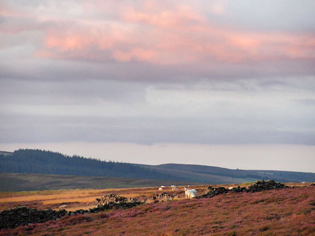
Also, keep an eye out for roaming sheep who have become quite accustomed to people and do get quite close!
I’d recommend taking one of the Bamford Edge short walk routes rather than the circular one, which might be too long for little legs.
Best time to visit
Across the year, the best time to visit Bamford Edge Peak District is generally from late spring to early autumn. But, as you’re probably well aware, the weather in the Peak District is far from predictable even in the height of summer.
As such, you’ll want to plan your visit based on the weather forecast more than the current month.
A crisp, clear winter’s day is going to be better than an overcast, grey and scattered-showers day in the summer. Try to avoid days when low clouds or fog, high winds, rain, hail, storms and snow are forecast.
And, if visiting during the day, try to be there in the morning as by lunchtime and in the afternoon, the car parks get pretty full and the number of people there increases.
Within a day, the best time to visit is just before sunset.
Can you see sunset from Bamford Edge?
Looking west over Ladybower Reservoir and Win Hill, you’ll get a stunning showing of a Bamford Edge sunset from Mother Nature. Watch as the sky and clouds change colour and the light slips away.
And, it’s also surprisingly not that busy late in the day! I visited on a weekend evening in August and the only people I saw were one other couple and one group of 4 friends.
I’d recommend arriving at the lookout about 30 minutes before the sunset time for that day. This way you’ll have plenty of time to get photos and enjoy the Bamford Edge sunset.
To avoid walking in complete darkness, I’d leave the top no more than 10 or 15 minutes after the sun passes the horizon – sooner in winter.
Bamford Edge sunrise
Sunrise isn’t as spectacular here (compared with sunset) as the sun rises over Bamford Moor. Meaning you don’t have a view of it looking out from the rocks because it’s behind you.
That said, the colour of the sky can still be beautiful. And it can be a quiet time to visit.
If you have any questions or want any more information drop a comment below and I’ll get back to you!
Prices and offerings mentioned are correct as of December 2023 but are subject to change in future.
Other Peak District Walks…
STANAGE EDGE: 5 Best Walking Routes (1 to 8 Miles)
THOR’S CAVE: 4 Circular Walking Route Options From Wetton
MAM TOR: 4 Routes with Stunning Views
WINNATS PASS: Best Routes for Incredible Views
SHINING TOR: Straight and Circular Route Guides
HARTINGTON: 5.3-Mile Walk in the Peak District Countryside
ROACHES: Walking Route Map & Full Guide
LUD’S CHURCH: A Walk For An Other-Worldly Experience!
PIN IT FOR LATER!