If you’re planning on doing any hikes in Colombia, you won’t be short on choices. But, knowing which walks deliver the goods and which just leave you tired and disappointed is best for making the most of your time in the country.
Whether you’re after a one-day mountain hike or a multi-day jungle trek, this complete guide to the best Colombia hikes has you covered. Here are 15 walks that are sure to make your trip to Colombia a memorable one…
Is there good hiking in Colombia?
In a country home to part of the Andes mountain range and Amazon rainforest as well as other unique landscapes such as huge canyons and vast deserts, there’s no shortage of superb hiking trails. Hiking in Colombia is a varied pursuit. There are countless one-day hikes as well as a good number of multi-day Colombia hikes in the most beautiful and remote parts of the country.
The hikes that I completed during my 3 months in Colombia were definitely a highlight. But, even on such a relatively long time scale, I couldn’t hike everywhere.
Instead, I’ve collated this list of 15 incredible hikes in Colombia based on my travels and those of some fellow travel bloggers. As such, this is a truly comprehensive guide to hiking in Colombia, covering multiple regions, distances and difficulties.
Remote Hikes in Colombia
Colombia is a huge country and some of the best hikes are in the most remote areas. Naturally, these are places you have to plan to go to rather than end up passing through. But, incredible experiences await for those heading to these lesser-visited places.
The Isolated Mavecure Hills in Guainía
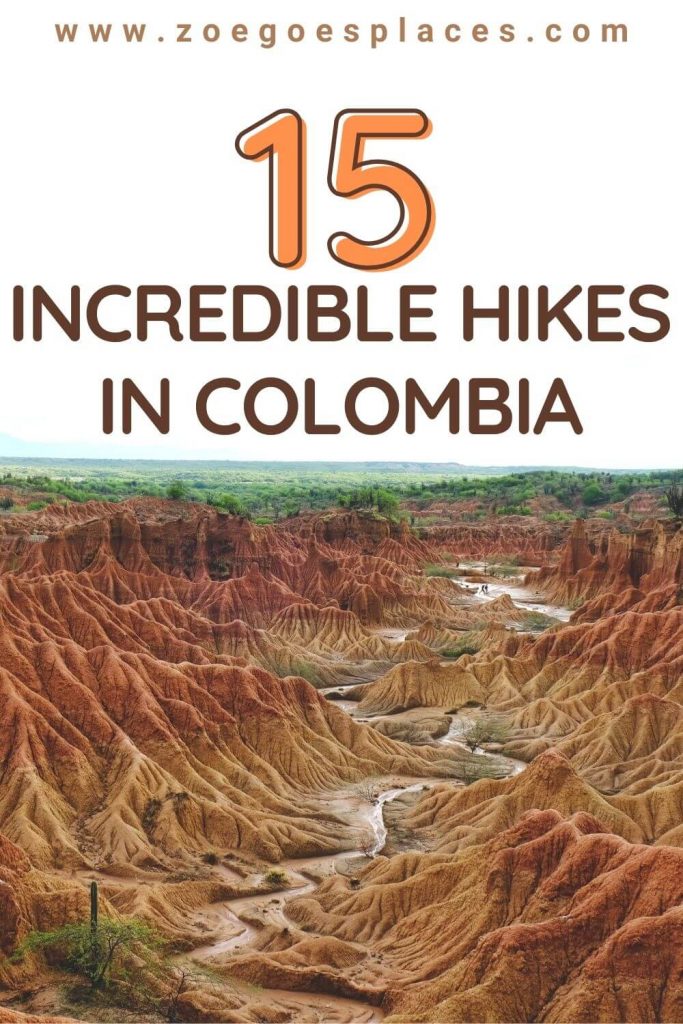
A trip to visit and scale the Mavecure Hills (Cerros de Mavecure) is not only one of the best hikes in Colombia but one of the best adventures in the country. These isolated hills, featured in the closing scenes of the Colombian film Abrazo del Serpiente are located in the jungles of the far southeastern corner of Colombia near the border of Venezuela.
This area of Colombia is not reachable over land. You’ll have to fly to the small town of Puerto Inírida and then hitch a boat ride up river to one of the communities such as El Remanso. For most travellers, booking a tour package that includes river transportation and overnight accommodations, and occasionally plane flights is a good choice. These usually include some other experiences such as visiting the nearby Gran Orinoco delta.
Regardless, once near the hills, there are several hikes worth doing. You can catch sunset by hiking up the hill known as El Diablo located behind El Remanso. From La Ceiba a short distance from the hills, it’s also possible to hike in search of the famous Inírida flower.
However, the most impressive hike is up the shortest of the 3 hills themselves. The Cerros de Mavecure are part of the Guiana Shield, a geological formation over a billion years old, and they have a mysterious look to them. The hike up Mavicure, the only one that is traversable is not for the faint of heart. There is a tough rocky incline and a few short wooden ladders. If you come on your own, you’ll need to hire guides at the hill to accompany you.
At the top of the two larger hills, Mono and Parajito, the view across the river is spectacular. You can learn more about what to expect on this unique adventure in this complete guide to the Mavecure Hills.
By Adam from CartagenaExplorer.com.
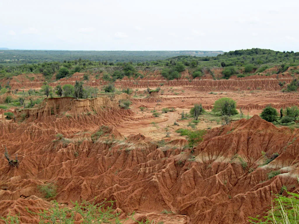
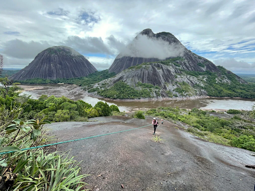
The Striking Tatacoa Desert in Huila
This arid and striking landscape is one of Colombia’s finest, with its weaving jagged peaks that look something out of a sci-fi film.
Increasingly popular with those backpacking Colombia, the Tatacoa Desert is located within Central Colombia, in the lesser visited region of Huila. It’s roughly 330 square km in size, with the landscape varying from deep red canyons to white rock formations.
The closest city to Tatacoa is Neiva, roughly 40km to the south. From Neiva, you can reach the desert with an organised tour. Or, you can also take the bus from Neiva to the small town of Villavieja, which sits on the outskirts of the desert. From Villavieja you can either take a tour or a tuk-tuk into the Tatacoa Desert.
The difficulty level of the hike is relatively easy with some uphill walking. However, it’s very hot so be sure to bring lots of water and sunscreen.
One of the best things to see here is The Red Desert. This is a small part of the Tatacoa which is a labyrinth of jagged red peaks and cool rock formations. Another top visit is the contrasting Grey Desert. This area is home to the surreal Valle de las Fantasmas, with many white rock formations resembling ghosts and some animals.
We recommend heading on the tour where you’ll see all of these within a day (as you’ll be getting around by 4×4).
Contributed by Dan & George from Backpacking Latin America.
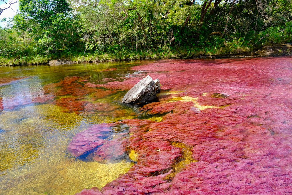
The Majestic Caño Cristales in Meta
Located outside the tiny town of La Macarena in south central Colombia is Caño Cristales. It is one of the country’s most beautiful and unique natural wonders.
An aquatic flower grows here that blooms into hues of reds, pinks and even greens. Minerals in the water and rocks add a yellow colour giving the river its rainbow effect. But, the colours are only visible when the flowers bloom from July to November. If you’ve seen the recent Disney movie Encanto, Caño Cristales is featured in the film’s climax.
Entering the national park here requires a guide. For most travellers, it’s best to book a package that includes flights and accommodation in the very isolated La Macarena. Overland travel is possible, but it’s a long and difficult journey. You can learn more about planning a trip in this complete guide to Caño Cristales.
There are several trails in the park. However, the most popular is to Los Pianos waterfalls. This trail takes you along sections of Caño Cristales, including the majestic Cascada de la Virgen waterfall. After arriving at Los Pianos, you’ll head back along the section of the river known as El Tapete, which looks like a colourful rug. You’ll stop at another waterfall for lunch, then head to the Los Ocho waterfalls and the nearby pool where you can swim.
3-day packages are the most popular, giving one full day in the park. However, a 4-day package gives you a second day in the park. And, will usually mean you also do the Los Pailones trail through the denser jungle where the plants are mostly green in colour. It’s highly recommended.
The trails in Caño Cristales are of moderate difficulty over terrain that is often rocky and slippery with some inclines. Most tours include a visit to Caño Cristalitos, a smaller river, on the first day that is more difficult with a steep incline. Still, it’s very doable if you are in average shape.
You’ll need good hiking shoes and sun-protective clothing. You’re not allowed to take in single-use plastics so a refillable water bottle is needed. Also note, there are no facilities past the entrance to the park.
By Adam from CartagenaExplorer.com.
The Coffee Triange & Medellín Hikes
Colombia’s coffee region – a large area south of Medellín with endless coffee farms and beautiful scenery – is one of the most popular places in the country for tourists to visit. The perfect place for an introduction to hiking Colombia!
With good transport links between Medellín and the coffee triangle, these hikes are easily accessible. And, they come with some of the best views of all the hikes in Colombia.
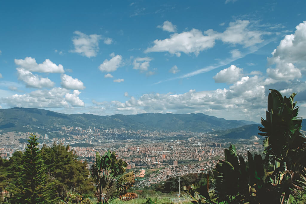
Hike Cerro Pan de Azucar in Medellín
If you’re looking for a more relaxed half-day hike rather than one of Colombia’s more challenging treks, consider adding the Pan de Azucar hike to your itinerary. Pan de Azucar is a hilltop overlooking Medellín, and the 3-hour loop hike is the perfect excursion from the big city. It’s challenging enough to warrant an extra arepa or empanada for lunch but easy enough for families.
Overlooking the La Candelaria area of the city, the view from Pan de Azucar is spectacular and well worth the hike alone. If you’re still looking for where to stay in Medellín, steer clear of this hilltop area – though it’s home to many of the attractions in Medellín, it can be sketchy at night.
Medellín public buses or taxis can take you to the base of Pan de Azucar, where your hike will begin. The paths and routes are well marked as Pan de Azucar is a rather popular hike. Although the paths are never overcrowded or excessively busy.
A popular guided excursion in Medellín includes completing the hike in the evening for a nighttime view over the city with the lights glittering in the town below. It’s an incredible excursion, though only possible with a tour.
By Carley from Home to Havana.
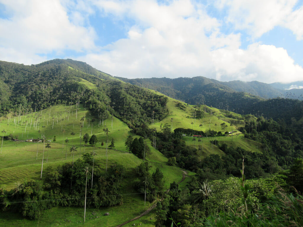
Walk between the world’s tallest palm trees in the Cocora Valley, Quindío
Salento is one of the most popular towns in Colombia, located around 300 km south of Medellín in the department of Quindío. What draws most visitors here is the Cocora Valley, home to the world’s tallest palm trees amongst spectacular natural scenery.
From the centre of Salento, you can take a short jeep ride to reach the Cocora Valley for 8000 COP return. Once in the valley, you have two choices of hike. The first is a short, 5-km loop to two viewpoints and then back to the entrance. The second is the full 12-km loop through the valley, which takes around 4 to 5 hours. The first is well-suited to leisurely walkers and families. While the second is more difficult in terms of steepness and length, so more suited to seasoned walkers and hikers.
You don’t need a guide as the Cocora Valley hike is easy to follow. Additionally, the route is quite up and down so expect uphill walking. To note, once you leave the entrance there are no more facilities on the route so make sure you have all the drinks and snacks you’ll need.
The palm trees are mostly located along the first 2.5 km of the trail when heading clockwise from the entrance. If you’re doing the full loop you’ll also pass a hummingbird reserve, although the trail is the steepest around this point.
To best enjoy this scenic walk visit during the week. Because on weekends it is perhaps the most popular Colombia hike! Alternatively, visit early in the day – the first jeep leaves Salento at 6.30 am.
Experience Life in the Cloud Forest at Cerro Las Nubes in Jericó, Antioquia
Jericó, located among the coffee farms of Antioquia, a few hours outside of Medellin, is a low-key little pueblo patrimonio well worth a visit. In recent years, some foreign tourists have begun to discover this colourful town and its beautiful scenery, outdoor adventures and agritourism.
Cerro Las Nubes is one of Jericó’s most popular hiking destinations. The name of the nature reserve refers to the clouds that frequently drift over the mountains. When the clouds part, the views from above are incredible.
The hike can take 3+ hours and roughly 5 miles – or more, depending on the route you take. There is a significant uphill climb, making this hike moderately difficult.
You can start and end from the northwest side of town, off of Carrera 1, following a loop on La Gruta and Los Aguacates trails. Alternatively, you can add on a visit through the botanical gardens and the Cristo Redentor statue, one of Jericó’s most iconic landmarks with a great view overlooking the town.
While a guide is not mandatory for this hike, it is highly recommended. If there has been recent rain, be prepared for a slippery descent. There’s an option to take a longer way down, avoiding more risky spots.
By Michelle C. of IntentionalTravelers.com.
Hikes in Bogotá, Boyacá & Santander
Bogotá is home to Colombia’s busiest and best international airport, meaning most people start or end their time in the country here. Boyacá and Santander are the two departments (think of them like states or regions) to the north of Bogotá.
With good transport links from Bogotá to these hikes, there’s no need for long and arduous journeys. Instead, you can focus your energy on completing these beautiful Colombia hikes.
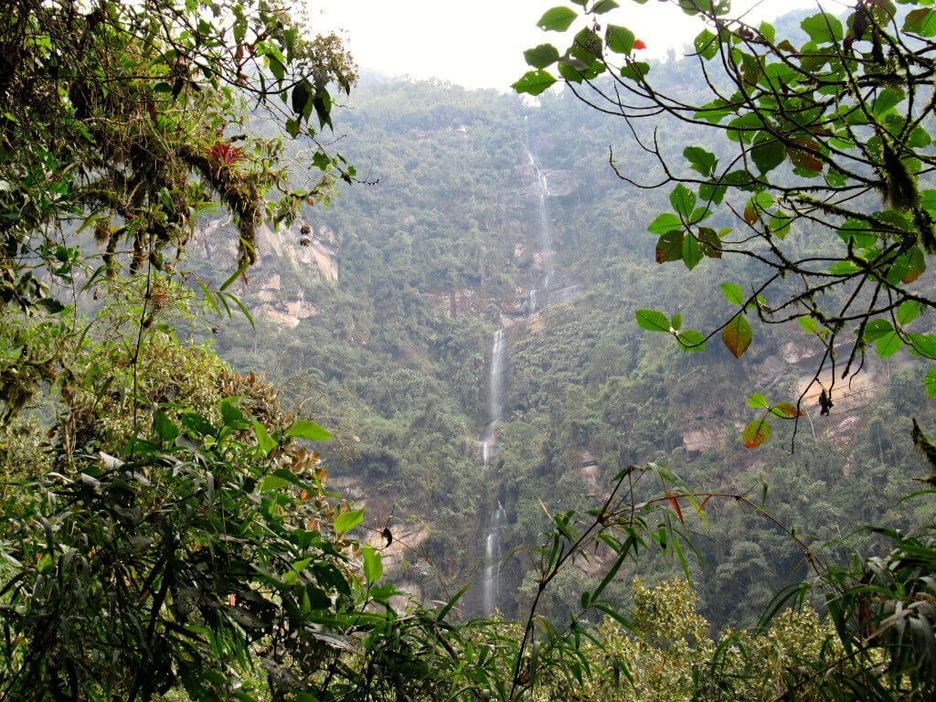
Hike to Colombia’s Tallest Waterfall, Cascada La Chorrera in Bogotá
Bogotá doesn’t have the best reputation among visitors to Colombia’s capital. Known for being a grey concrete jungle that’s often cloudy and wet, activities in nature aren’t what people typically think of here. But, just an hour from the city centre is Colombia’s tallest waterfall – Cascada La Chorrera.
To get to the trailhead, you’ll need to take a bus from central Bogotá towards Choachi, asking to get dropped off at La Chorrera. Unfortunately, the bus doesn’t go all the way there though, so you’ll need to take a taxi or walk the 5 km mostly downhill to the trailhead from the roadside.
Entrance to the park costs 35,000 COP for the basic package that includes water, snacks, a bag and some biosecurity bits. From here, the trail is a 5 km loop to La Chorrera and the smaller El Chiflon waterfall – two of Colombia’s finest waterfalls. The trail is mostly a dirt path, which can be muddy and slippery in places. But is otherwise easy to follow and suitable for most ages and abilities.
In total, the walk should take around 2 hours including stops for photos and snacks. Beware of the altitude though, as it can really catch up with you as you’re almost at 3000 metres!
You don’t need a guide but the park provides a few wardens along the route to answer questions and point you in the right direction. You can also stop at the on-site restaurant to refuel before making the journey back to Bogotá.
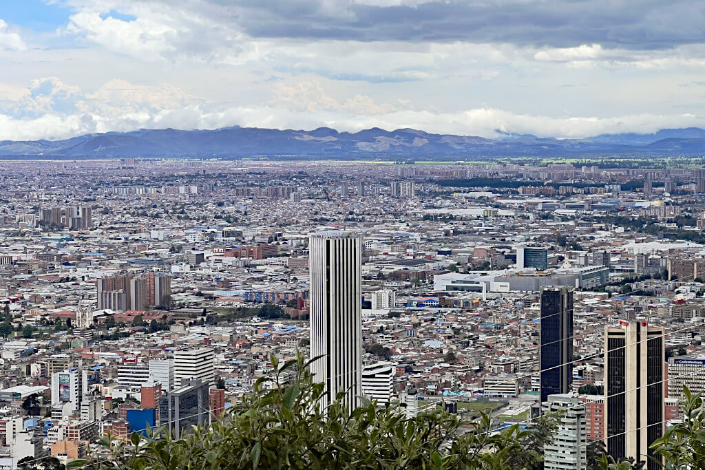
Climb to Bogotá’s Best Viewpoint: Monserrate
If you are visiting Bogotá in Colombia, a great half-day activity is a hike to the top of Cerro de Monserrate. Here, you’ll be rewarded with spectacular views of downtown Bogotá as far as the eye can see. You’ll get to appreciate how this urban metropolis sprawls out of the valley and climbs up the surrounding mountains on all sides.
The start of the hike is an easy 25-minute walk from the popular tourist neighbourhood of La Candelaria in the middle of the city. Head for the Casa Museo Quinta de Bolivar and you will see the start point next to the funicular. The hike can be completed alone, no guide is required.
The hike is moderate in difficulty, being quite steep at times. Follow the cobblestone staircase trail past numerous vendors selling snacks, drinks, and souvenirs on the way. Markers dotted along the walk allow you to track your progress as you ascend to the summit.
The path is 2.4 km and will take about one hour to complete. Spend time enjoying the views on the journey as you get higher and higher.
Once at the summit visit the beautiful 17th-century church, still fully operational and very popular for Sunday mass despite its location. There are also many restaurants to eat and refuel as well as more souvenir shops to visit. At the summit and on the trail, there are many public toilets to use for a small fee.
There are three options to return to the starting point. Walk back the same route, it will be quicker downhill, about 30 minutes. If you’ve reached your physical limit, consider the funicular or cable car for a small cost.
Contributed by Wes of Walkaboutwes.com.
Trek to Little-Known Waterfalls and Natural Wonders in Guadalupe, Santander
Hidden in the hills of Santander is Colombia’s best little-known gem. Few international travellers visit Guadalupe each year, although it’s popular enough with locals. Yet, here are some of the best natural attractions around including two fabulous countryside walks.
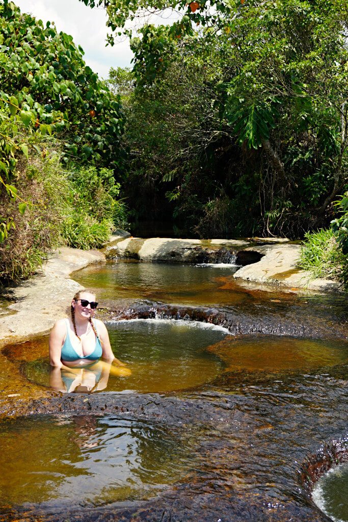
To the south of this small town is the natural phenomenon of Quebrada Las Gachas. This is a mostly shallow stream that flows over vibrantly coloured rocks with a lot of natural plunge pools, both large and small.
The 5-km, one-way walk from Guadalupe to Las Gachas is on a newly paved pathway. Along the way, you’ll find a couple of shops (perhaps more stands in people’s houses) and shelters to rest. The walk is not difficult but take precautions to protect yourself from the year-round sunshine.
Once there, you can slip and slide along the stream and into the pools to your heart’s content. As no sun lotion is allowed to be worn (to protect the ecosystem), make sure to cover up and limit your time in the sun to avoid burning.
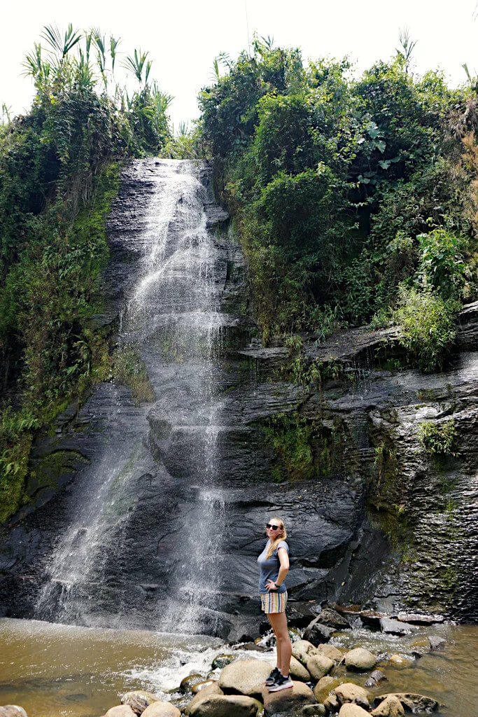
A second hike option in Guadalupe is to visit the stunning Cascada El Perico and nearby Tres Cascadas. Tucked away in the Santander countryside, you’ll probably need maps.me to navigate to these waterfalls. Once you leave the town there is little in the way of facilities, so come prepared. The waterfalls are visited by only a handful of visitors each day, really adding to the unexplored, rustic charm.
The route is not difficult and a large portion of the 5-km each way walk is on single-track roads. However, the last 1 km from the road to the waterfalls crosses fields, look for the trodden path and small signs.
Walk the Royal Road from Barichara to Guane in Santander
Barichara is often touted as Colombia’s prettiest town. The cobbled streets and colonial buildings attract plenty of tourists from nearby San Gil.
Perhaps the most popular activity is enjoying the cafes, bars and restaurants of Barichara. However, if you’re looking for something a little more active, consider the 5-km, downhill walking trail from Barichara to Guane.
Called the Camino Real, this path was created hundreds of years ago to connect the local people for trade, employment and social gatherings. The trail starts in the north of the town, marked with a large engraved stone. Then, heads mostly downhill through the Santander countryside until you reach Guane.
You don’t need a guide – the path is very obvious, at times with stone walls on both sides. There is one small shop along the way, otherwise, you can stop for a drink or ice cream in Guane. Buses run from Guane back to Barichara throughout the day, saving you a long, sweaty uphill walk in the year-round hot temperatures.
There’s little shade on the trail, so make sure to bring plenty of water and avoid the midday sun. Good, sturdy shoes are also needed as the path is mostly rocky and downhill requiring you to watch your step a lot.
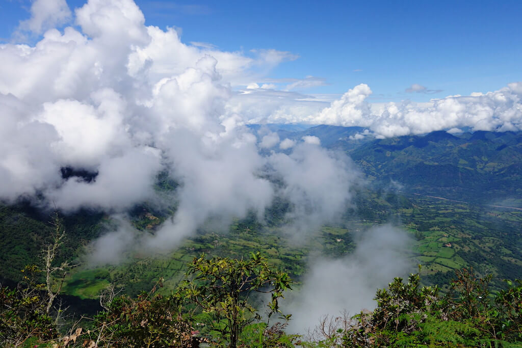
Hike The Beautiful Páramo de Ocetá in Boyacá
Páramos are a unique habitat that exist only in the Andes. It is similar to tundra and is a mixture of green and desolation.
Particularly neat about the páramos in Colombia is a plant known as a frailejón, literally translated as big friars, due to their look from a distance as marching friars. The plant is actually an important source of groundwater as its leaves capture passing water vapour.
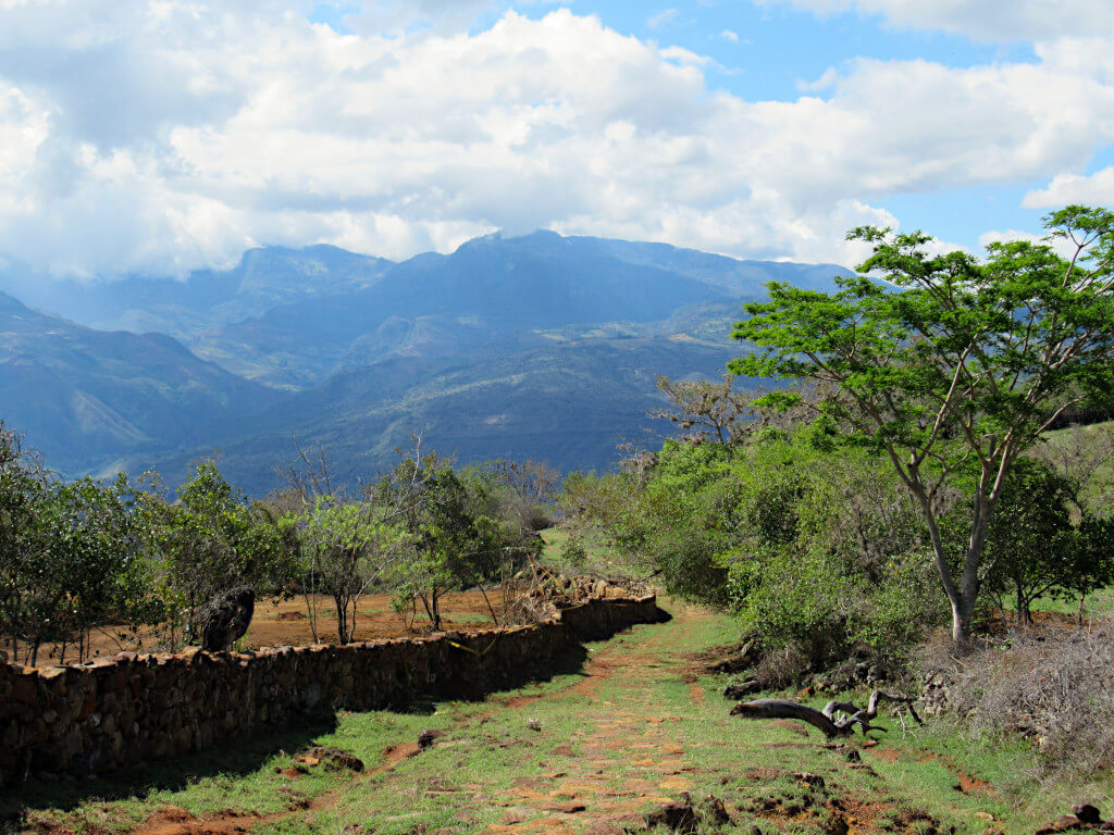
There are several areas where you can hike páramos in Colombia, however the most impressive is the Páramo de Ocetá. It is located in the province of Boyacá, not far from the charming town of Villa de Leyva, and just outside the tiny town of Monguí.
It is required to hire a guide to hike the Páramo de Ocetá, and several agencies in Monguí offer both private and group hikes. A hike takes all day, approximately 6-8 hours, and will take you up to some of the highest areas of the páramo, where you can get some truly amazing views. You’ll also see tons of frailejones.
The hike’s inclines are not too tough, but the high altitude makes it tough and is likely to leave you breathless at times all the same. Temperatures also drop the higher you get, so you’ll need a good jacket that protects you from the cold and the wind.
By Adam from CartagenaExplorer.com.
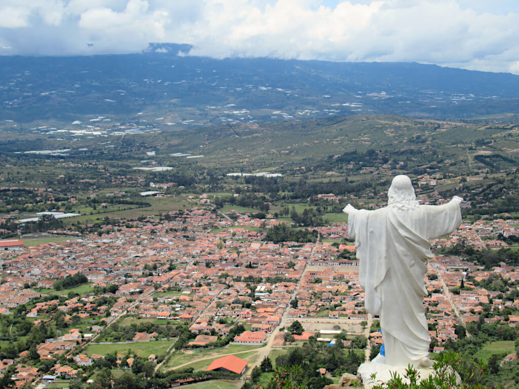
Take a Steep walk to the Viewpoint of Villa de Leyva, Boyacá
Villa de Leyva is a colonial town 150 km northeast of Bogotá known for its gorgeous architecture and cobblestone streets. One of the best things to do in Villa de Leyva is a hike to the town viewpoint, the Mirador El Santo Sagrado Corazón de Jesús.
The hike only takes 20-30 minutes, but it’s sneaky difficult because it’s all uphill and the terrain is rocky. Once you reach the top, you’ll be rewarded with sweeping views of Villa de Leyva and the surrounding countryside.
You’ll want to wear proper trainers because it’s a steep and somewhat slippery hike to the viewpoint. It’s tempting to stay for the sunset, but I recommend descending before dark because of the difficulty of the trail.
The best place to start the hike is at the beautiful Plaza Mayor. From here, follow the road to the right of the church until you reach the sports field. The trail starts on the left-hand side of the field near the workout equipment. You’ll want to bring your own snacks and water because there is nowhere to buy these items along the trail. After the hike, follow the same trail back to town.
By Mark George of George’s Backpacking Guides.
Best Hikes in Colombia: North Coast
With pristine beaches, the Caribbean Sea and warmer weather than much of the country, the north coast is a popular destination for visitors. With international airports located all along the coast, with many domestic flights too, it’s easy to get here without 16-hour buses from Medellín!
Whether you’re basing yourself in Santa Marta, Taganga or Palomino, you’ll be perfectly placed to enjoy these tropical Colombian hikes. Expect lots of jungle (and mosquitos here), so pack your bug spray and long-sleeved clothes!
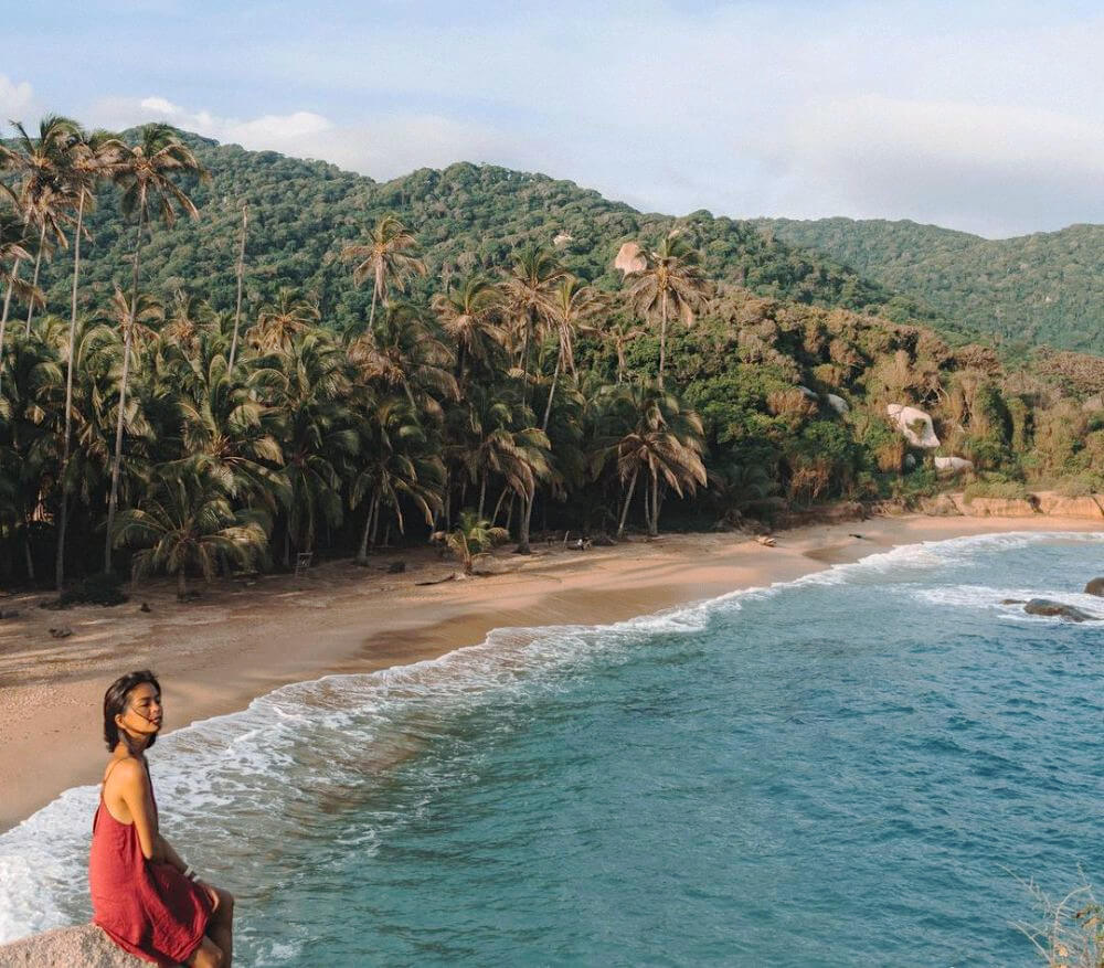
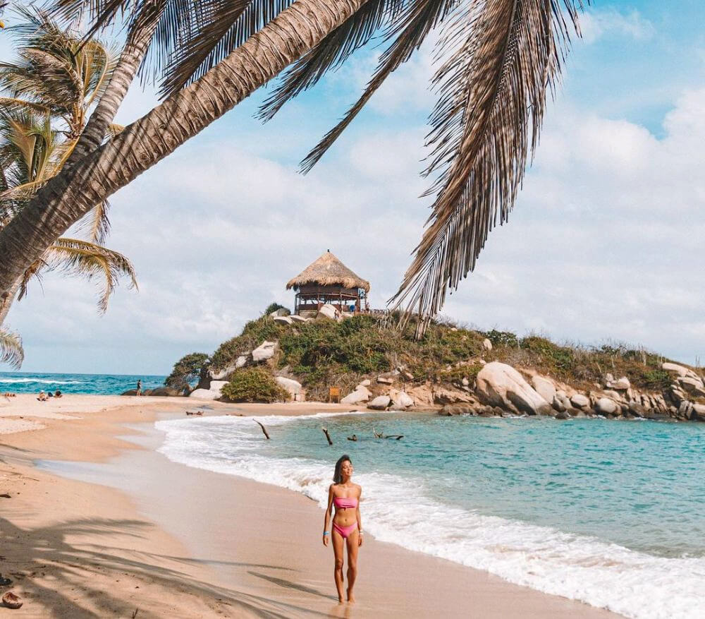
Trek to Paradise Beaches through Jungle Paths at Tayrona National Park in Magdalena
Located near Santa Marta, Tayrona National Park is one of the best hikes in Colombia. Travellers are drawn to visit this park not only because of the hike but also for the experience of camping or sleeping in a hammock in the park. There is no phone signal here so this is one of the best ways to unplug while travelling in Colombia.
The hike is about 29.6 km and can take 6-8 hours depending on your speed. You don’t have to be a pro hiker or extremely physically fit to hike Tayrona. You will even see children doing this hike with their families. The trail is easy although you still need to wear proper shoes.
Once you reach the campsite, you can rent tents or hammocks for 17 USD and stay the night. The campsite only has one restaurant but they are pretty efficient in attending to everyone. There is also a small store where you can buy basic stuff like water, shampoo, soft drinks and snacks.
There is no other way to get back but the same route you took. When going back, it’s best to start early so you can stop at all the beaches without hurrying the hike.
You don’t need a guide to hike Tayrona since there aren’t many trails and paths. You only have to pay an entrance fee of 15 USD once you arrive or you can reserve online. For cars, there are many parking spots within the park cingost less than 5 USD per night.
By Trisha from P.S. I’m On My Way.
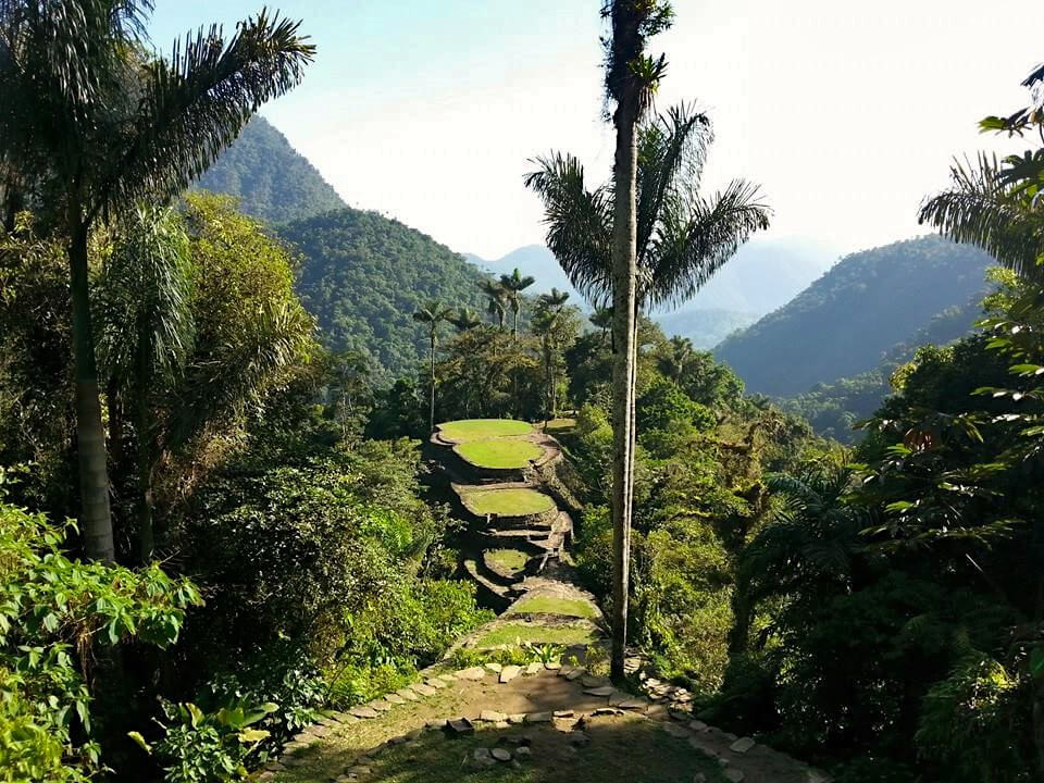
Take a Multi-Day Hike to the Lost City in the Jungle of Magdalena
La Ciudad Perdida or Lost City Trek is one of the best hikes in Colombia and South America. The Lost City refers to the ruins of an ancient city deep in the forest of the Sierra Nevada National Park, built by the Teyuna people around 800 AD and lost for centuries to the outside world until it was rediscovered by accident in 1972.
The Lost City can only be reached on foot, and tourists are not permitted to visit alone – you must be accompanied by an official guide. Various companies in Santa Marta offer guided tours from Santa Marta for around 360 USD, including some such as Wiwa Tours which have indigenous guides.
The hike is a challenging one, walking around 45 km through the jungle for 3 days to reach the Lost City. There are some steep ascents and descents peaking at an altitude of 1200 m above sea level. And in the rainy season, the paths can get very muddy. There are several river crossings too, and the heat, humidity and mosquitoes mean this hike is not for the faint-hearted!
Those who meet the challenge though are rewarded with beautiful scenery as they walk through the National Park. Spotting wildlife and learning about the culture of the Teyuna and their descendants who still live in the area. The city itself is in ruins, and while the view might not be as iconic as Machu Picchu, it is definitely worth the trek!
Facilities along the route are basic, the camps have bunk beds or hammocks and toilets but it certainly isn’t luxury. Once you have visited the Lost City, you return along the same route. The tour is 4 or 5 days long, depending on how quickly you want to make the trek back.
Contributed by Claire, Tales of a Backpacker
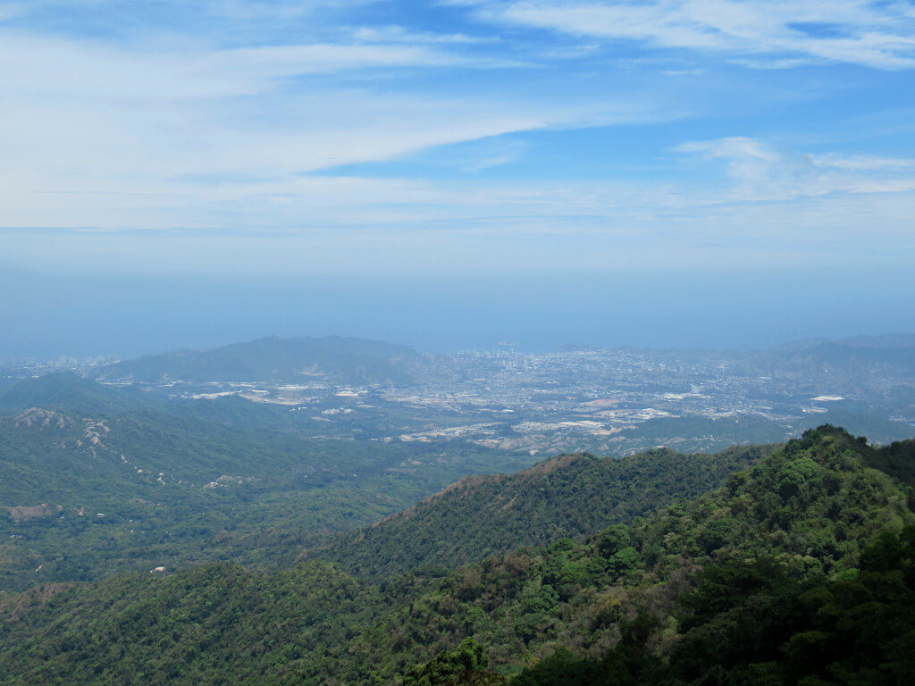
Climb to the Top of the North Coast’s Mountain Town of Minca, Magdalena
Although not as popular as the hikes to the blue pool (pozo azul) or Los Pinos viewpoint, the Minca 360 Mirador hike gives the best views. At the top, you’ll have (not quite) 360-degree views over the Sierra Nevada foothills, Caribbean Sea, Santa Marta and Gaira.
The walk itself is not particularly difficult as it is mainly along paved roads and dirt paths. However, it is uphill the whole way including an elevation gain of over 500 metres from the centre of Minca. The route is easy to follow with somewhat regular signs and you don’t need a guide.
From the centre of Minca, the walk will likely take you at least two hours. But, if you are staying at Mundo Nuevo Eco Lodge Minca, which is located on the route, you’ll save half that time by already being up in the hills.
If you’re walking from Minca town, you’ll pass a few hotels and restaurants on the path. However, once you get past Mundo Nuevo, there are no more facilities. Make sure you have plenty of water and sun cream for the duration of the hike.
Do you have any questions or want any more information? If so, drop a comment below and I’ll get back to you!
Information and prices are correct as of July 2022 but are subject to change in future.
More Colombia Travel Guides
MEDELLIN: Comuna 13 Medellín (Guide & Recommendations For This Must-Do)
PALOMINO: Santa Marta’s More Trendy Neighbour (A Complete Guide)
SAN GIL: Ultimate Guide to Colombia’s Adventure Capital in Santander
VILLA DE LEYVA: Pozos Azules Villa de Leyva (Complete Guide to the Blue Wells)
PIN IT FOR LATER!