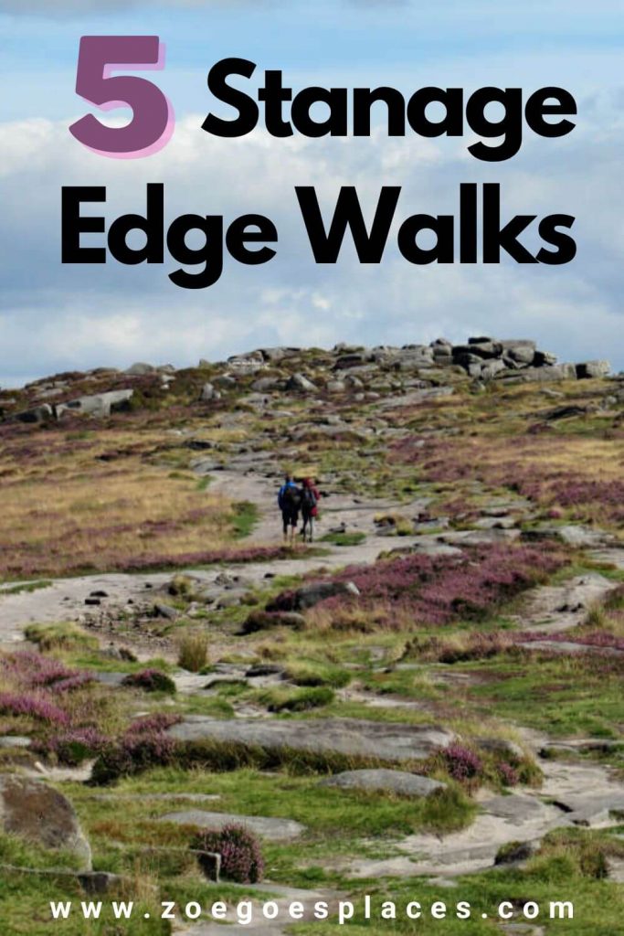
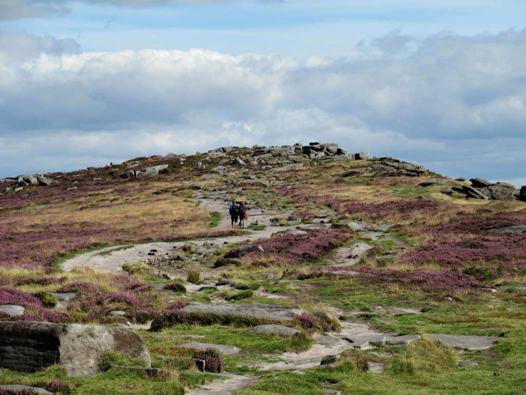
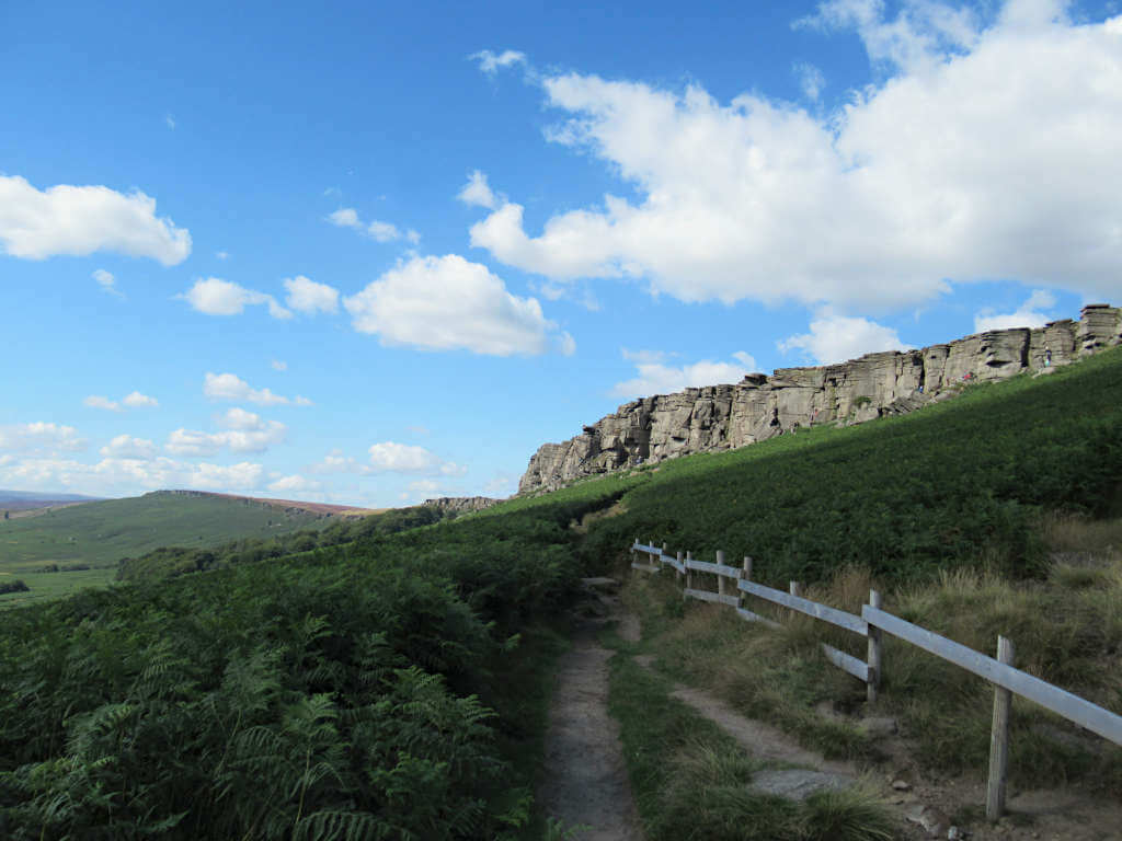
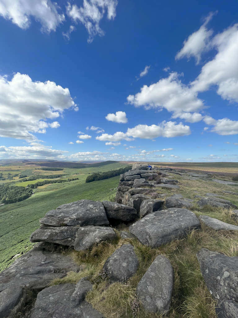
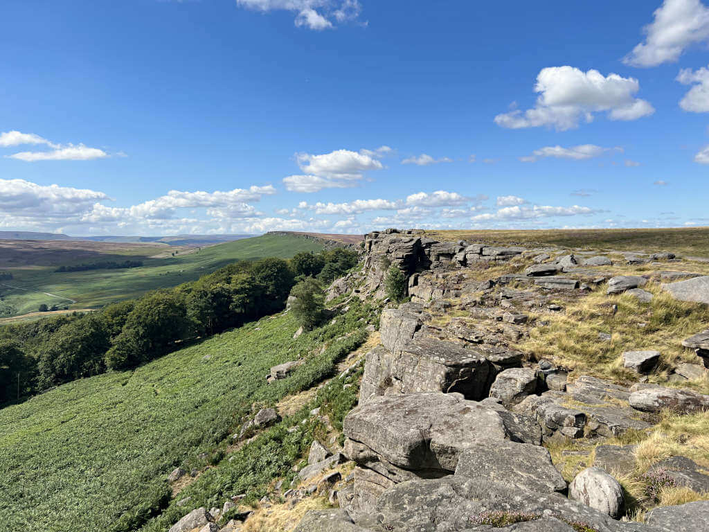
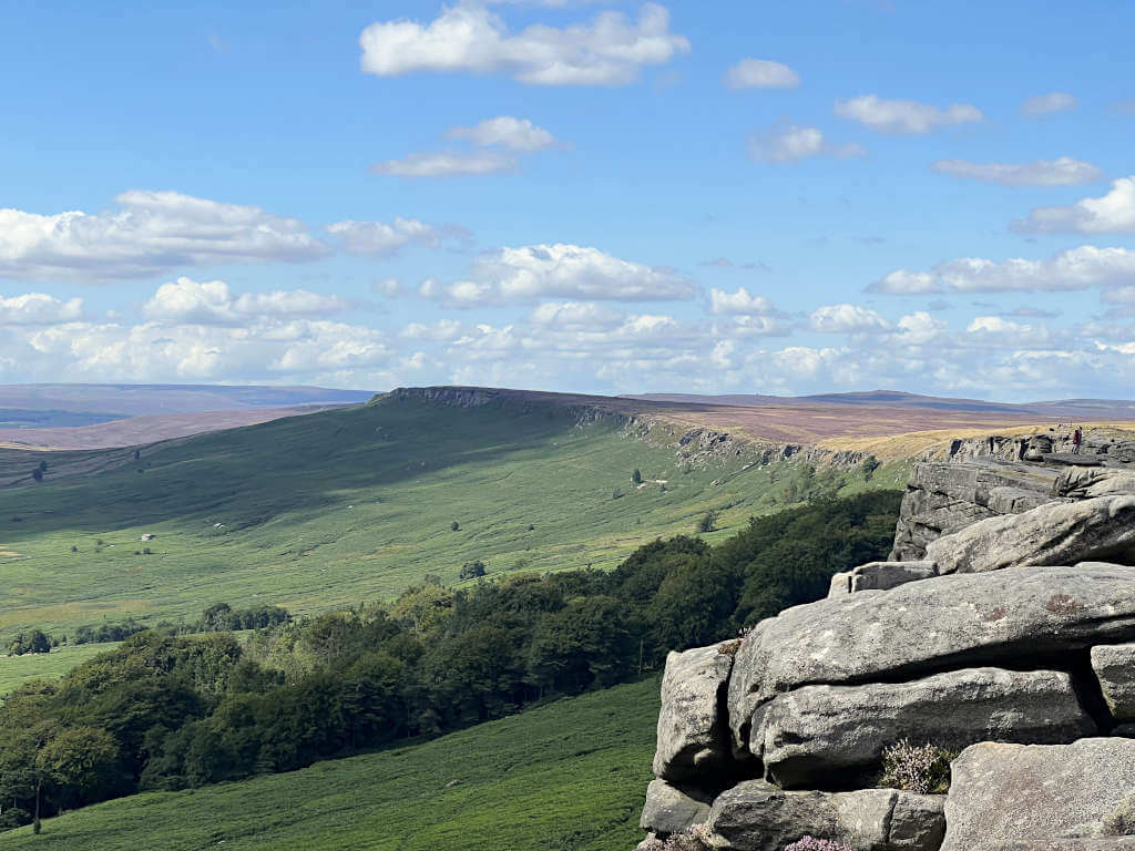
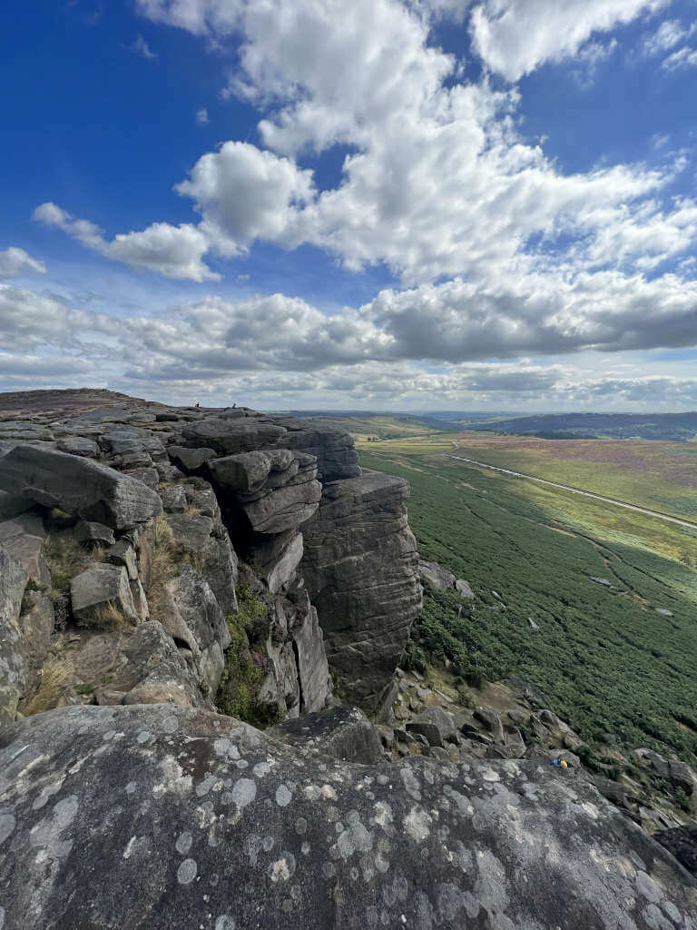
Spanning 3.5 miles from top to bottom in the Derbyshire and Yorkshire countryside, a Stanage Edge walk is the best way to see this striking natural attraction.
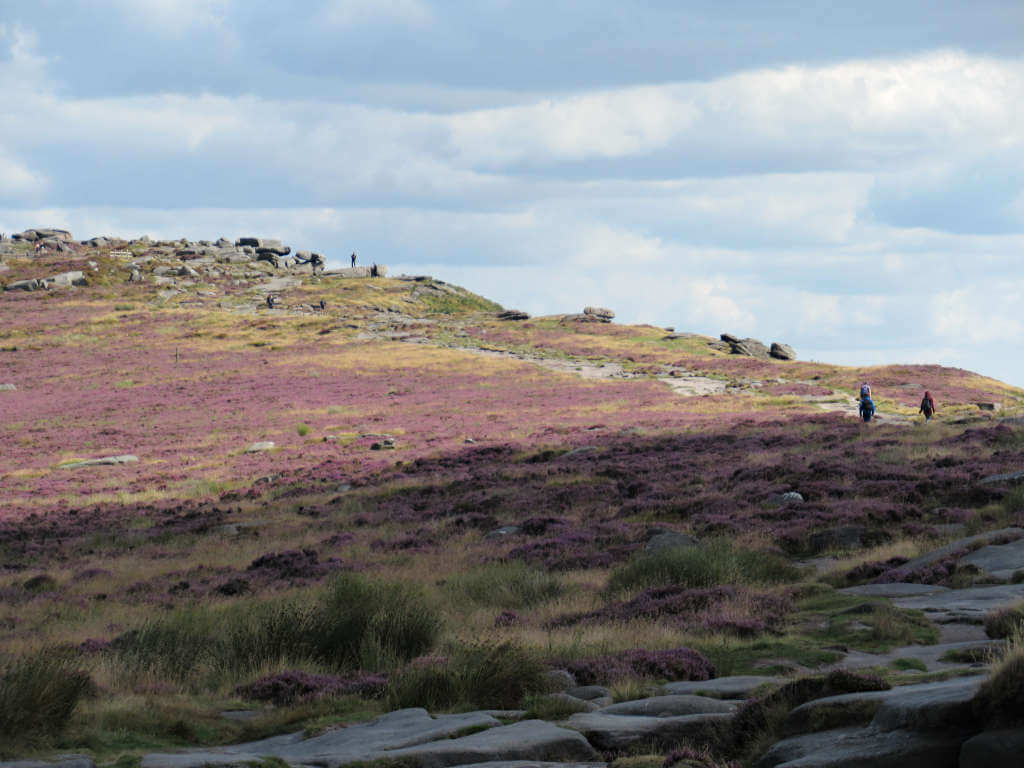
Its steep rocky cliffs are popular with climbers, while the network of paths and viewpoints are popular with hikers, families and photographers. Making it the perfect place for a weekend walk or afternoon escape.
So, whether you’re looking for short, long or circular walks around Stanage Edge Peak District, this guide has everything you need. Here, you’ll find maps, downloadable GPX files, directions, parking and plenty of useful information.
Best Stanage Edge Walk Routes
So, whether you use the Stanage Edge walking routes below as inspiration or follow them to the letter, you’ll be sure to experience the best of the British outdoors.
Whether you’re after a short Stanage Edge hike, a circular walk from Hathersage or a long stroll through the countryside, here are 5 great options…
| JUMP TO: 1. Short walk For stretching your legs and seeing the view | 1.2 miles 2. The Edge & the Stanage Pole For getting those steps in | 4.1 miles 3. The Full Length Walk To see all of the edge | 8.3 miles 4. From Hathersage Combine with a cafe or a pub visit | 4.9 miles 5. Stanage & Bamford Edge To see two top natural attractions | 7.4 miles |
Stanage Edge short walk
Distance: 1.2 miles/2.0 kilometres
Starting point: Hooks Carr Car Park
Elevation gain: 60 metres
Difficulty: Easy
Walking time: 30 to 45 minutes
The simplest and shortest of walks, this is perfect for those short on time or just wanting to take in the views.
- Start from Hooks Carr Car Park, it’s the best placed to get you to the top viewpoints quickly.
- Follow the path uphill, turning left once you reach the top. Next, follow the path along the rocky edge and past the large boulders where Robin Hood’s Cave is located.
- Continue past the turning for the Stanage Pole until you reach a gap in the rocks where you’ll head downhill. Followed the trodden path as it turns back on itself and along the underside of Stanage Edge, close to the rocks.
- When the path splits, take the right-hand option in the direction of the road. The path becomes paved and you’ll soon be back at the car park
Click the link above to download the file for use in a GPS viewer. This way you’ll be able to track where you are on the route using your phone’s GPS – avoiding accidental detours and providing reassurance for less experienced countryside walkers! Once you’ve downloaded the GPX file above, install a GPX viewer app (Google PlayStore or iPhone App Store) and load the GPX file.
GRAB MY LIST OF MY FAVOURITE PEAK DISTRICT WALKS…
➡️ Is your New Year’s resolution to spend more time outdoors or exercise more?
➡️ Looking for more ideas for Peak District walks?
➡️ Want to explore more of this beautiful national park?
Save yourself the hours of research finding hidden gems and local favourites…
with this digital list of 52 beautiful Peak District walks full of my favourites from years of exploring.
Discover new places and spend more time in the great outdoors!
And – as a bonus – it includes 3 free trackers and challenge templates!
> > > BUY NOW FOR £2.99
> OR READ MORE

Stanage Edge & Stanage Pole walk
Distance: 4.1 miles/6.6 kilometres
Starting point: Upper Burbage Bridge Car Park
Elevation gain: 141 metres
Difficulty: Easy
Walking time: 1.5 to 2 hours
This mid-length walk takes you to the best parts of Stanage, including the Derbyshire-South Yorkshire border.
- From Burbage Bridge Car Park, turn left onto the road and walk up towards the bend. Take the path on the right-hand side at the bend, passing the large, singular rock on your right.
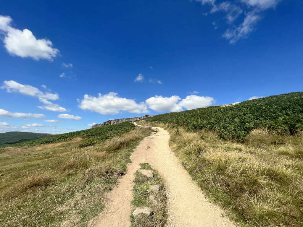
- Follow the clear path as it heads uphill and onto the rocky plateau. Keep on the path as it follows the rocky edge on your left with sweeping views over the nearby Peak District.
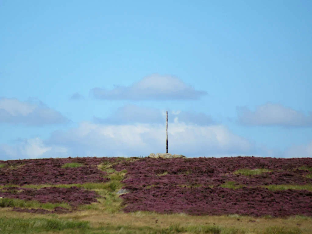
- About 100 metres before you reach the area with trees below Stanage Edge, take the well-trodden path on the right. You’ll soon reach the Stanage Pole. Then once you’re done with any photos, turn left along the dirt path back towards the edge.
- As the path bends to the right, take the cut across over the grassy area. Then, turn left back along the edge.
- At this stage, an alternative to the route shown on the map above is to continue along the top of the edge and retrace your steps back to the car park. But, if you want to follow the route as is, take the path down from the rocky edge after you pass the wooded area below Stanage.
- Follow the path as it weaves around the bottom of the rocks, close to the cliff edge. Once you can go forwards and level no more, head back uphill, turning right at the top. Then, follow this path as it rounds to the left and then right, before returning you to the car park.
Full length of Stanage Edge Hike from the A57 via High Neb
Distance: 8.3 miles/13.4 kilometres
Starting point: A57/Heathy Lane Junction
Elevation gain: 250 metres
Difficulty: Easy to Moderate
Walking time: 3 to 4 hours
This long but easy-to-follow Stanage Edge walk takes you all the way along the rocky prominence and over the highest point – High Neb.
- Join the public footpath just west of the Heathy Lane-A57 junction. Follow this all the way south as the path snakes along the top of the rocky edge.
- It’s about 6.5 km to reach the southern tip of Stanage Edge Peak District, where you can walk a small loop to turn back on yourself.
- Next, take the path down from the edge, turning right as the path you’re currently on turns left and heads downhill towards the road. Follow this path as it weaves along the base of Stanage, at times close to the cliff face.
- Keep going all the way until this path reaches the A57 again, enjoying the view as you go!
Hathersage to Stanage Edge walking route
Distance: 4.9 miles/7.9 kilometres
Starting point: Oddfellows Car Park, Hathersage
Elevation gain: 290 metres
Difficulty: Easy to Moderate
Walking time: 2 to 3 hours
This Stanage Edge circular walk starts a couple of miles away in nearby Hathersage, a quintessential Peak District village. Whether you’re arriving by car or public transport, this Stanage Edge walk from Hathersage will take you through the countryside and back with amazing views.
- From the car park, head to the main street in Hathersage (unsurprisingly called Main Road), turn right here and then left onto School Lane at the bend. After 200 metres, turn left onto Church Bank and then keep right when the road splits again.
- After another 200 metres, join the path on the left, immediately turning right and following the path as it runs parallel to the road. Keep going until it reaches the road, where you’ll turn left.
- Take the path on the left after 400 metres, turn left when it meets The Dale road, then left again as you reach Hooks Carr Car Park. Next, follow the path on the right as it heads up onto Stanage Edge Peak District.
- Keep on the path along the top, taking in the views as you go. You’ll pass Robin Hood’s Cave and the wooded area before turning left and taking the paved path downhill.
- The path soon reaches the road – cross directly over and pass the toilet block before turning right onto the footpath. Take the left-hand trail as the path emerges from the woodland and splits in two.
- Turn left at the T-junction of paths surrounded by dry stone walls. Follow this until you reach the next road, turn right followed by the next left through the gate. Follow this path as it weaves around the farm buildings before emerging into Hathersage. Cross straight over to return to the car park.
Stanage Edge and Bamford Edge walk
Distance: 7.4 miles/11.9 kilometres
Starting point: Hooks Carr Car Park
Elevation gain: 310 metres
Difficulty: Easy to Moderate
Walking time: 3 to 4 hours
While these route directions start and end at Hooks Carr Car Park, starting from the New Road layby parking near Bamford Edge or Dennis Knoll Car Park is also possible as these are on the route.
And, since this is a circular (perhaps more of a flat figure-of-8, in reality!) Bamford Edge and Stanage Edge circular walk, you can pick up the directions wherever you start.
- From the car park, head uphill along the established path through the ferns and shrubbery. At the top, turn to the left and follow the path along the overhang of Stanage Edge Peak District.
- Once you pass the wooded area on the left, you’ll soon merge with Long Causeway – a rocky, dirt path that dates back thousands of years. Follow this downhill path in front of the rocky cliff to Dennis Knoll Car Park.
- Pass the car park on your right and continue straight, taking the first right onto New Road. Keep going until you reach layby parking on the right side and cross the stile to enter Bamford Moor.
- Climb uphill, turning left at the top and then continuing along the rocky overhang until Ladybower Reservoir and Dam come into sight. Once you’ve taken in the views, retrace your steps back along Bamford Edge and down to New Road.
- Turn left at the road and walk back along New Road until you return to Dennis Knoll Car Park. This time, turn right at the car park to return to Hooks Carr Car Park, getting a fantastic view of the edge from below.
How to get to Stanage Edge
Where is Stanage Edge?
Stanage Edge is located on the eastern fringes of the Peak District National Park, approximately 8 miles from the centre of Sheffield. Other nearby towns include Hathersage, Bamford and Grindleford.
Padley Gorge and Millstone Edge are located to the south, while Bamford Edge is just to the west overlooking Ladybower Reservoir. The famous Mam Tor with its iconic collapsed side is also easily seen from the Stanage ridgeline.
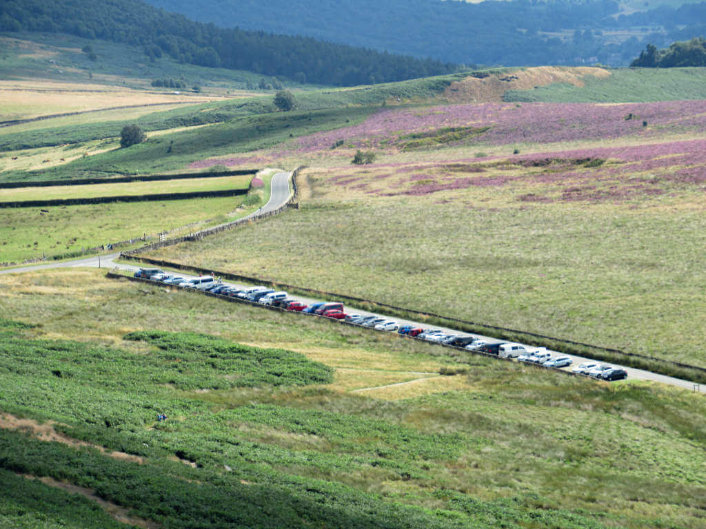
Stanage Edge Car Park Options
In November 2023, the Peak District Authority introduced parking charges to some of the previously free car parks. As such, the only free Stanage Edge car parks are:
- Roadside parking on the road between Upper Burbage and Hooks Carr
- A57 roadside/layby parking by the Heathy Lane junction/Derbyshire sign (far northern end of the Edge)
In addition, the following Stanage Edge parking places have charges:
- Upper Burbage Bridge Car Park (25 spaces, coins only)
- Hooks Carr Car Park (50 spaces, card only)
- Dennis Knoll Car Park (10 spaces, card only)
- Hollin Bank Car Park (75 spaces, coins and card)
The cost is £1.50 for 1 hour, £2.50 for 2 hours, £4.00 for 4 hours and £4.75 for all day. Parking charges apply from 9 am to 6 pm every day.
In Hathersage, there’s limited on-street and free parking. The best option is to use Oddfellows Road Car Park (next to the swimming pool). Parking charges apply from 8 am to 6 pm, with a flat £1 charge before and after this time.
Getting here by Public Transport
The nearest train station to Stanage Edge is Hathersage.
It’s on the Northern Rail Manchester Piccadilly-Sheffield line, with trains running in either direction approximately every hour. The station is located a short walk from the town centre.
Alternatively, Hathersage Peak District is served by the 256/257/258 buses, the 271 and 272 buses, and the 772 bus. All run from either Castleton or Bakewell to Sheffield Interchange with varying regularity and days of service.
If you’re taking the train or bus to Hathersage, the circular route starting in the town is your best option.
Key Information
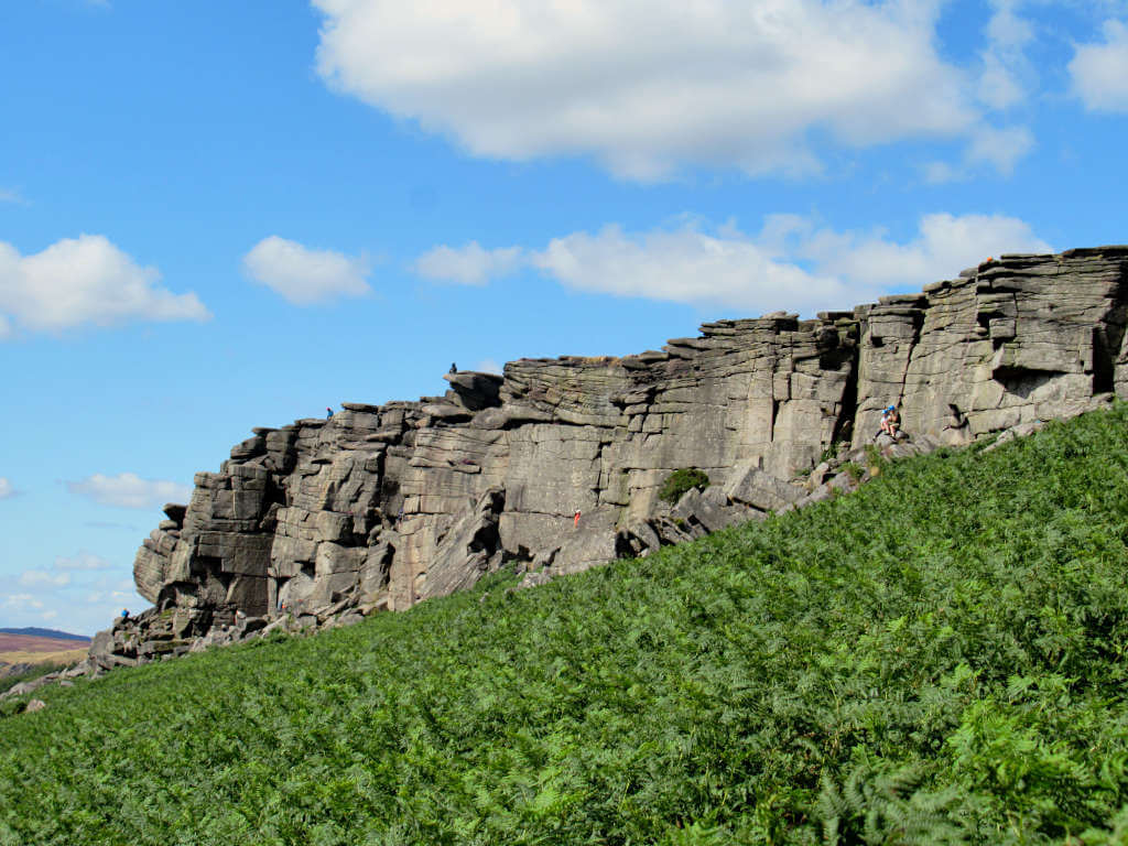
- Stanage Edge is a 3.5-mile-long rocky edge in England’s Peak District popular with climbers. The highest point sits at 458 metres above sea level – roughly 1500 feet.
- The technical term for the edge is a gritstone escarpment. More simply, gritstone is a type of sandstone rock commonly used in building materials. An escarpment is a long cliff caused by rock erosion or movement of the earth’s crust, separating two areas that are both relatively flat but on different elevations.
- This natural attraction marks the boundary between Derbyshire and South Yorkshire. The Stanage Pole marks the divide, which can be easily seen from across the moorland.
- Here, you’ll also find Robin Hood’s Cave – though not so easily. This hidden cave is tucked away in the rockface, the treasure at the end of the hunt however is a stunning view out over the national park (weather permitting!).
- Does the rock edge look familiar? It was a filming location for Pride and Prejudice featuring Kiera Knightly back in 2005.
facilities
As a natural landmark in the fairly remote countryside, limited visitor facilities exist.
Public toilets are located about a 3-minute walk along the road from Hollin Bank Car Park. Alternatively, there’s public toilets in Hathersage opposite the petrol station.
Similarly, it’s in Hathersage where you’ll find the nearest pubs, restaurants, cafes and shops.
FAQs
Is Stanage Edge difficult?
Not at all! The great thing about Stanage Edge is that the car parks are all located just a few minutes walk from the top.
And, the uphill section isn’t too steep and doesn’t go on for long. As such, there are plenty of Stanage Edge short walk routes that you can enjoy easily.
Once you’re at the top, the walk is pretty flat the entire way along. Although the terrain is a little uneven with large rocks along the top, the path is easy to follow.
Is Stanage Edge dog friendly?
Dogs are permitted only on the southern section of Stanage Edge, as far as the Stanage Pole and the small wooded section past Robin Hood’s Cave. The only exception to this is for assistance dogs and dogs on leads on public rights of way.
The only public right of way on Stanage Moor runs under the rock edge, not on top. This means you cannot walk away from the path on the open moorland past Robin Hood’s Cave or let your dog off the lead.
This is because the areas north and west of here are privately owned, restricted open access land with ongoing dog bans. These bans have been implemented to protect the moorland birds.
The current ban runs until November 2024 but is likely to be renewed for many years to come. For more information on the restrictions, check out the documentation here.
Is Stanage Edge in Yorkshire or Derbyshire?
Both – kind of! Stanage Edge Peak District is typically referred to as the border of South Yorkshire and Derbyshire.
However, the boundary only runs down the northern part of the edge before heading into the moorland (roughly parallel with the southern tip of Ladybower Reservoir), where it’s marked by the Stanage Pole. The most commonly visited southern section is firmly in Derbyshire.
If you have any questions or want any more information on these Stanage Edge walks, drop a comment below and I’ll get back to you!
Prices and offerings mentioned are correct as of December 2023 but are subject to change in future.
Plan Your Peak District Visit with these guides…
LADYBOWER RESERVOIR: 6-Mile Circular Route including Derwent Dam Viewpoint
CHROME HILL: 3 Routes to the Spectacular Summit View
THREE SHIRES HEAD: 4 Walking Route Options from Gradbach and Wildboarclough
LATHKILL DALE: 6-Mile Waterfall Walk
THOR’S CAVE: 4 Circular Walking Route Options From Wetton
PIN IT FOR LATER!