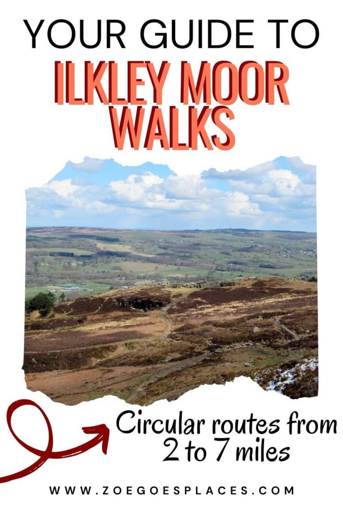
Are you looking for some Ilkley Moor walks inspiration? This vast moorland has miles of trails and pathways just waiting to be explored, making it a hiker’s paradise!
With 4 different circular walks on Ilkley Moor Yorkshire in this guide, you’ll be able to visit the coolest landmarks without getting lost. Such as the small but lovely Ilkley Waterfall, the famous Cow and Calf Rocks, the Twelve Apostles Stone Circle and even a mysterious crop circle!
Each of these Ilkley walks comes with a map, downloadable GPX file, directions and advice on where to park.
Overview of the Ilkley Moor Walks: 4 Circular Routes
| Twelve Apostles and the Eastern Ilkley Moor Walk *MY TOP PICK* 5.7 km | 1.5 to 2 hours The Peak of Ilkley Moor and the Twelve Apostles Walk 11.5 km | 3 hours Hebers Ghyll Waterfall and Moorland Views Walk *BEST SHORT WALK* 4.4 km | 1 hour Ilkley Moor Cow and Calf Rocks and White Wells Walk 3.7 km | 45 mins to 1 hour Ilkley Moor Parking |
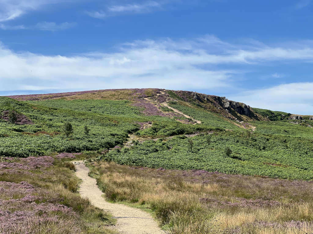
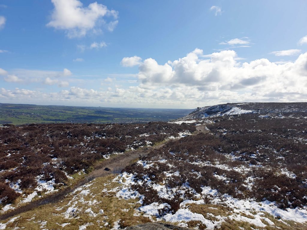
The Twelve Apostles and Eastern Ilkley Moor Circular Walk
Distance: 3.5 miles/5.7 kilometres
Difficulty: Easy to moderate
Walking time: 1.5 to 2 hours
Start and endpoint: Ilkley Moor Car Park (by Cow & Calf Rock Cafe)
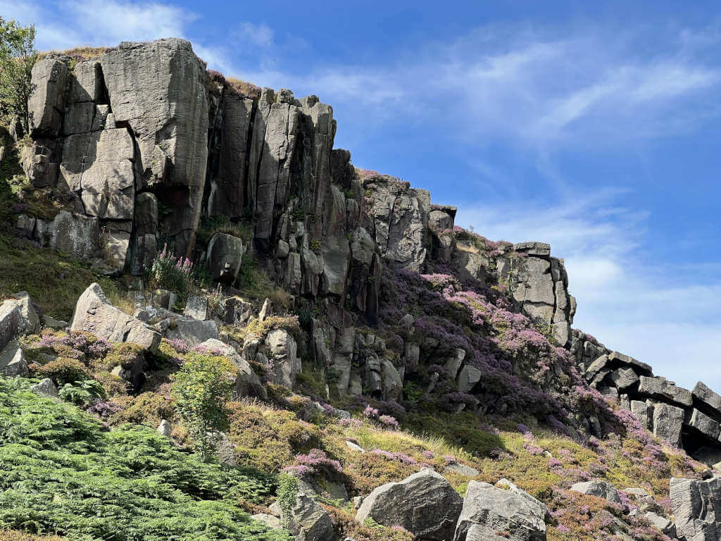
Haystack Rock | Grub Stones | Twelve Apostles Stone Circle | Ilkley Crags
Ilkley Moor Circular Walk Map
Directions
This Cow and Calf walk has great photo spots. Particularly if you like standing on top of rocks with a view!
- Head uphill out of the car park (not into the Cow & Calf rocks, it’s a dead end there). Then turn left at the top of the hill, immediately veering off the more trodden path to go diagonally across the moorland on the right.
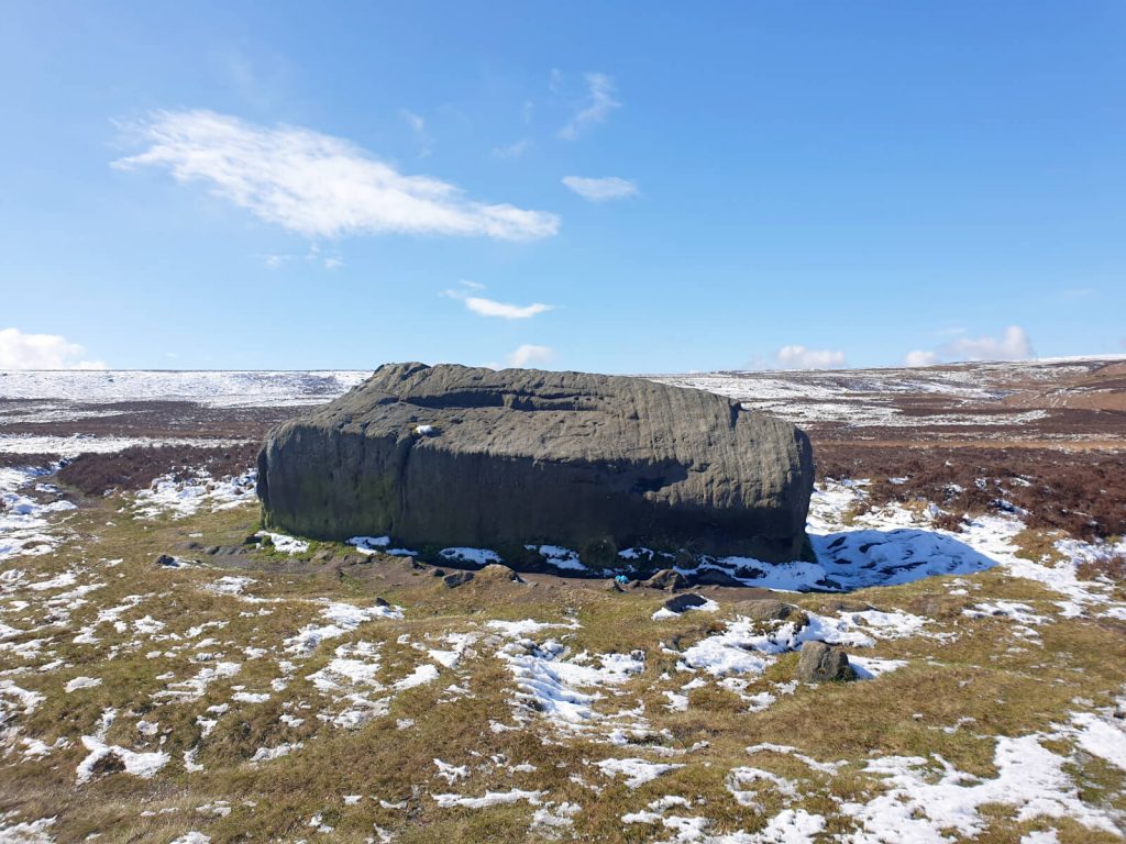
- Next, you’ll reach Haystack Rock – a large rock to the side of the path but not the most impressive. Continue on diagonally behind Haystack Rock, the path is fairly easy to follow.
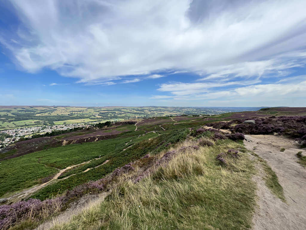
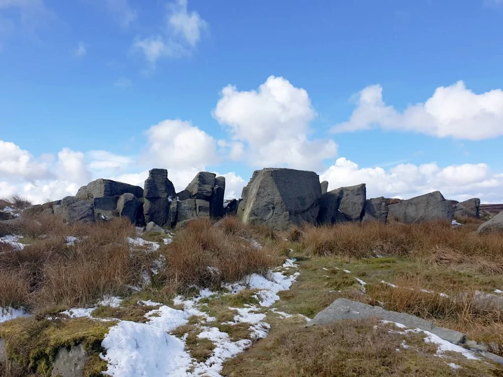
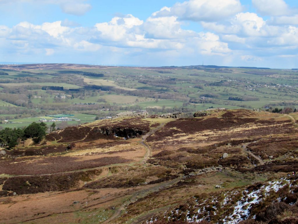
- Carry on past the small lake and you’ll start to see the striking rock formation of Grub Stones ahead. It’s easy to climb and has fantastic views over North and West Yorkshire including Lower Lanshaw Dam and Carr Bottom Reservoir.
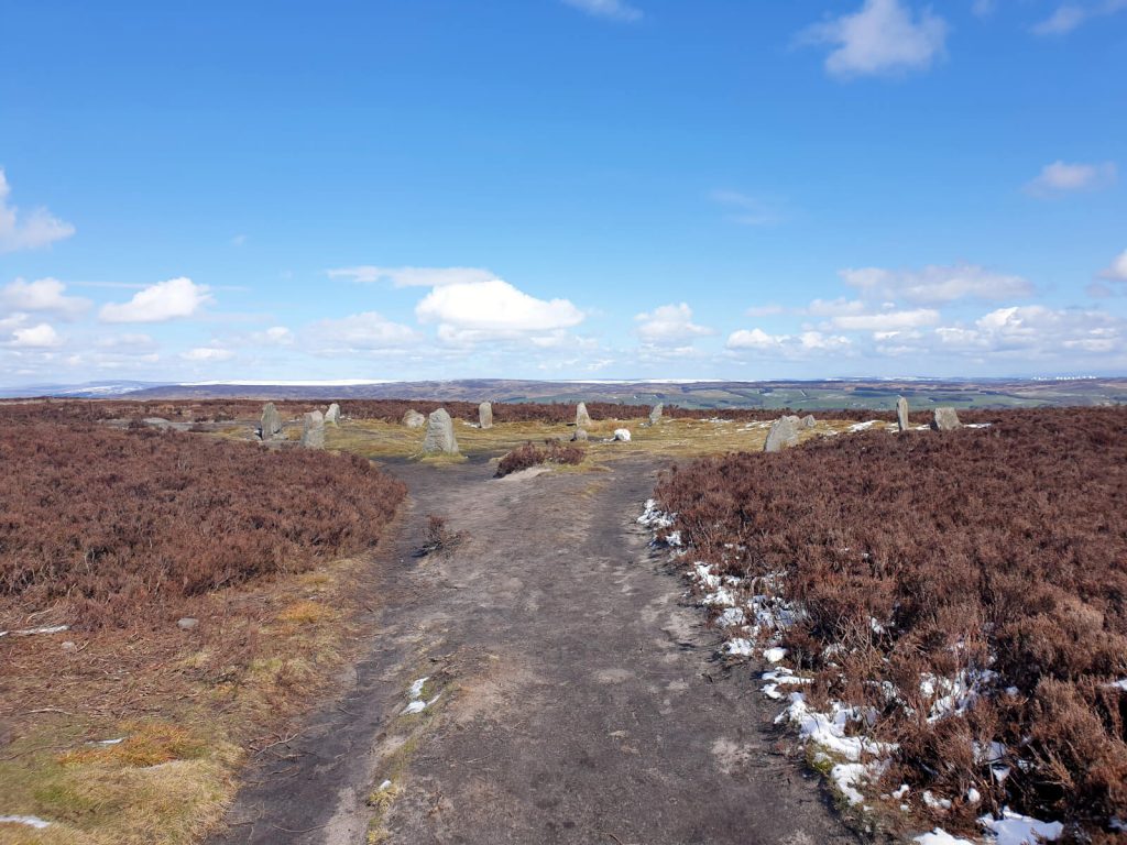
- From here, walk back on yourself slightly as you head up along the main path to the Twelve Apostles Stone Circle. The stones were placed in the 1970s to replace the originals that had eroded over time
- From the Twelve Apostles Ilkley Moor, re-join the main path and continue in the same direction. At the top of the hill, turn right and walk back across the moor in a straight line for about 1.5 km.
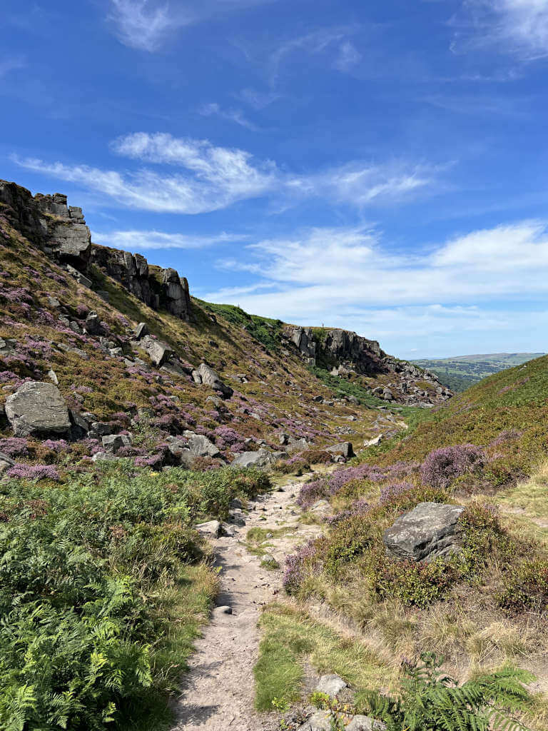
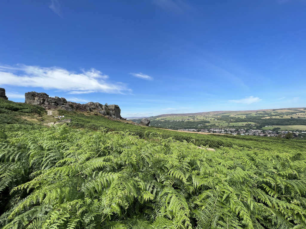
- As the path turns right, you’ll be at the top of Ilkley Crags. This is another impressive rock formation with views over Ilkley and the Yorkshire Dales, perfect for photos.
- Finally, to get back to the car park, simply follow the path straight. Cross over Backstone Beck and then head steeply downhill towards the café.
GRAB MY LIST OF MY FAVOURITE YORKSHIRE WALKS…
➡️ Is your New Year’s resolution to spend more time outdoors or exercise more?
➡️ Want to explore more of beautiful Yorkshire?
➡️ Wishing you knew of more great spots for walks and days out?
Save yourself the hours of research finding hidden gems and local favourites…
with this digital list of 52 beautiful Yorkshire walks full of my favourites from years of exploring.
Discover new places, spend more time in the great outdoors and have fun!
And – as a bonus – it includes 3 free trackers and challenge templates!
> > > GET IT NOW
> OR READ MORE
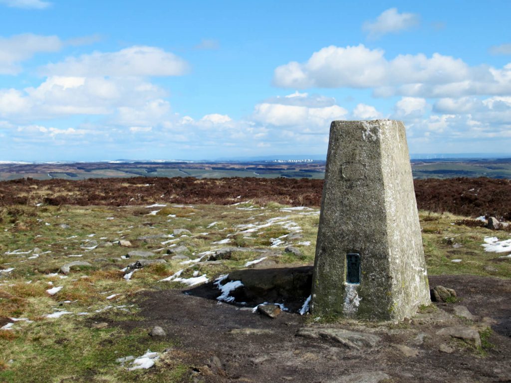
Peak of Ilkley Moor and the Twelve Apostles Walk
Distance: 7.1 miles/11.5 kilometres
Difficulty: Moderate
Walking time: 3 hours
Start and endpoint: Ilkley Moor Car Park (by Cow & Calf Rock Cafe)
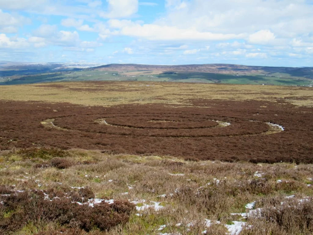
Ilkley Crags | Twelve Apostles Stone Circle | Peak of Ilkley Moor | Cowpers Stone Cross | Ilkley Moor Crop Circle | Ilkley Crags
Ilkley Walk Map
Directions
If you’re looking for a fairly long Ilkley Moor circular walk, then this one is for you! You’ll get a full tour of the best natural and man-made attractions the moorland has to offer…
- From the Cow and Calf Rocks Car Park, head uphill and then continue straight at the path crossroads. Cross over the small beck and keep going straight.
- Take in the striking views from the top of Ilkley Crags – a top-of-the-world feeling! Continuing on, turn left heading uphill for about 1 km and left again when the path splits.
- After another 400 metres, head left and then quickly right along the main path to the Bronze Age-era Twelve Apostles Stone Circle (more recent restoration likely).
- To reach the highest point of Ilkley Moor Yorkshire, marked by a trig point, retrace your steps for about 200 metres. Then, continue straight along the path made of large stones for 1.1 km to take in the dazzling views of the Yorkshire Dales – as far as Pen-Y-Fan on a clear day!
- Next, continue until the path splits in a T-shape and head right on the dusty and rocky path. The next landmark you’ll reach is Cowper’s Stone Cross to the left of the path, originally from the 12th Century but restored since then.
- From the stone cross, return to the main path and turn left in the same direction you were heading before. After about 200 metres, turn left off of the path and over more wild terrain until you have a good view looking down on the Ilkley Moor Crop Circle.
- From the crop circle, it’s the home straight back to the car park. Return to the main path, continuing north and downhill for 600 metres until you turn right off the main path.
- Finally, walk along the top of Ilkley Crags and back across the stream. After which, it’s just downhill into the car park.
You’ll sure deserve a well-earned drink at the Cow and Calf pub over the road after this Ilkley Moor circular walk!
Ilkley Moor Waterfall Walk: Hebers Ghyll Waterfall and Moorland Views
Distance: 2.7 miles/4.4 kilometres
Difficulty: Easy
Walking time: 1 hour
Start and endpoint: White Wells Car Park
Hebers Ghyll Waterfall | Swastika Rock
Walk Map
Ilkley Moor Waterfall Walk Directions
If you don’t want steep hills, then this will be your top pick of these Ilkley Moor walks. Stretch your legs on this short walk along the northern edge of the moor to Ilkley Moor Waterfall (it’s pretty flat too!).
- From White Wells Car Park, walk along Wells Road and then left onto Keighley Road. After 300 metres, head off-road and onto the Millennium Way path signposted as a public footpath.
- Continue for 1.2 km until you reach the Hebers Ghyll Waterfall (located to the right of the path). This small but pretty Ilkley waterfall is under the cover of the woodland making it perfect for exploring.
- From the waterfall, the next landmark is the Swastika Stone – 400 metres further along the path. Named as you may guess, as it has a swastika carving in it – one that pre-dates the Nazis by possibly a couple of thousand years – it’s not associated with them!
- The final leg of this Ilkley Moor waterfall walk takes you back to White Wells Car Park along a path parallel to that you have already walked. Follow the path straight for about 1.6 km, where it crosses Keighley Road again.
- Lastly, continue heading east on the path and turn left once you reach a road called White Wells. The car park is another 300 metres from here.
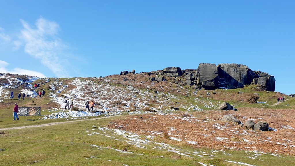
Ilkley Moor Cow and Calf Rocks and White Wells Walk
Distance: 2.3 miles/3.7 kilometres
Difficulty: Easy
Walking time: 45 minutes to 1 hour
Start and endpoint: Ilkley Moor Car Park (by Cow & Calf Rock Cafe)
Bottom of Ilkley Crags | White Wells | Northern Moor | Top of Ilkley Crags
Walk Map
Cow and Calf Rocks Walk Directions
Just want to get out for some fresh air rather than a hike across the countryside? Then this Cow and Calf walk is for you!
- Starting at Ilkley Moor Car Park, head uphill and continue on straight at the path crossroads. Keep going across Backstone Beck.
- Next, take the path on the left that heads slightly uphill towards Ilkley Crags. At the top, you’ll have fantastic views over Ilkley and the valley looking towards Skipton.
- Moving on, continue walking along the ridgeline of Ilkley Crags then take the left-hand option keeping straight when the path splits. Further on, the path then turns to the right running right behind a small wooded area.
- Keep heading towards White Wells – the iconic white building overlooking the town of Ilkley. It’s the perfect place to stop for lunch or just to take in the view.
- From White Wells, take the path that is at 4 o’clock (when facing towards Ilkley), southeast back towards Ilkley Crags. This path is less prominent than the main path heading directly south from White Wells.
- Continue straight for about 300 metres and then take the path to the right towards the Dales Way. Here, turn left and follow the path for about 800 metres in the rocky valley of Ilkley Crags, cross Backstone Beck and head downhill to the Ilkley Moor Car Park.
Ilkley Moor Parking
The two main car parks are Ilkley Moor Car Park (next to the Cow & Calf Rocks/cafe) and White Wells Car Park (on the northern side of the moor).
In addition, there’s plenty of roadside (grass verges) parking along Hangingstone Lane, Wells Road and Moor Road.
The roads around the area get busy and congested on weekends and on sunny days during the school holidays. Try to arrive early to beat the crowds.
The Cow & Calf Pub is customer-only parking. But I do recommend a visit after a walk on Ilkley Moor Yorkshire !
Do you have any questions or want any more information on these Ilkley walks? If so, drop a comment below and I’ll get back to you!
Information correct as of February 2024 but is subject to change in future.
More Yorkshire Walks
WEST YORKSHIRE: Withens Clough Reservoir (Walks, Parking + More Info)
CENTRAL YORKSHIRE DALES: Little Known Malham Walk to Malham Cove, Janet’s Foss & Gordale Scar)
CENTRAL YORKSHIRE DALES: Buckden Pike Walk (The Perfect Yorkshire Dales Day Out)
SOUTHERN YORKSHIRE DALES: Grimwith Reservoir Walk (Circular Route)
NORTHERN YORKSHIRE DALES: A Yorkshire Dales Waterfalls Walk (to 5 Keld Waterfalls)
YORKSHIRE DALES: Malham Cove, Yorkshire Dales (Ultimate Visitor’s Guide + Info)
PIN IT FOR LATER!
Thanks! This is great info.
Glad you found it useful 🙂
We did the Ilkley Moor peak walk and it was lovely! Cow and Calf is a great pub too. Thank you so much
No worries, glad you enjoyed it – I really love Ilkley Moor.