Are you looking for a scenic and quiet yet challenging circular walk in the Yorkshire Dales National Park? Then this Buckden Pike walk is for you.
The summit of Buckden Pike offers stunning views over North Yorkshire. But it doesn’t attract the visitor numbers of the Three Peaks and other popular spots nearby.
This guide walks you through the Buckden Pike circular walk route step-by-step and with pictures. Plus, it answers all your FAQd to ensure a wonderful Yorkshire Dales day out!
Buckden Pike Walk Overview
Distance: 5.5 miles/8.9 kilometres
Elevation gain: 473 metres
Difficulty: Moderate
Walking time: 2 to 3 hours
Start and endpoint: Buckden Car Park
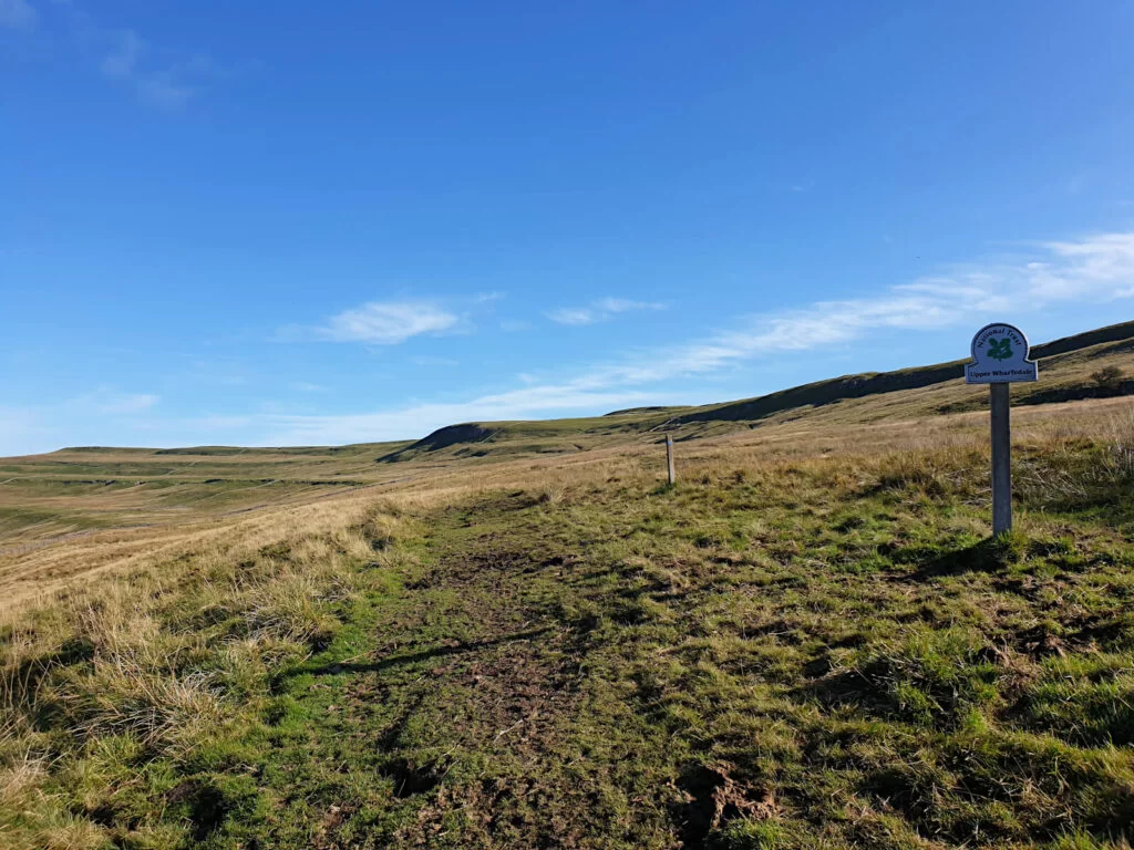
Where is Buckden Pike Yorkshire Dales?
Buckden Pike is located at the heart of the Yorkshire Dales, north of Grassington.
The town of Buckden is approximately 20 miles from Skipton along the scenic roads of Upper Wharfedale. Driving time from Skipton is around 30 mins and from Leeds is around 90 mins.
Buckden Pike Map (Circular Route)
Click the link above to download the file for use in a GPS viewer. This way you’ll be able to track where you are on the route using your phone’s GPS – avoiding accidental detours and providing reassurance for less experienced countryside walkers! Once you’ve downloaded the GPX file above, install a GPX viewer app (Google PlayStore or iPhone App Store) and load the GPX file.
Buckden Circular Walk Details
Buckden Pike Car Park and Start Point
Public parking is available in Buckden Car Park, on the north side of the village. This is also the starting point of many Buckden walks.
The cost of parking for one day is £4.80 and you can pay by card on the machine.
To navigate to Buckden Car Park use the following postcode: BD23 5JA, Ordnance Survey Grid Reference: SD 94229 77341 or GPS coordinates: 54.191872, -2.089735.
Difficulty & Distance
From my experience, I would rate this Buckden walk as moderate. This is for a couple of reasons.
Firstly, there’s a sustained and somewhat steep ascent from the very start. Secondly, the descent back to Buckden Yorkshire isn’t well-marked and the terrain underfoot can be challenging, due to loose rocks from the disused mines.
This Buckden Pike circular walk route is 5.5 miles long. Some people might consider this a short walk, others perhaps not.
But, including time to stop to rest and enjoy the view, the walk can easily take 4 hours to complete.
GRAB MY LIST OF MY FAVOURITE YORKSHIRE WALKS…
➡️ Is your New Year’s resolution to spend more time outdoors or exercise more?
➡️ Want to explore more of beautiful Yorkshire?
➡️ Wishing you knew of more great spots for walks and days out?
Save yourself the hours of research finding hidden gems and local favourites…
with this digital list of 52 beautiful Yorkshire walks full of my favourites from years of exploring.
Discover new places, spend more time in the great outdoors and have fun!
And – as a bonus – it includes 3 free trackers and challenge templates!
> > > GET IT NOW
> OR READ MORE
Directions
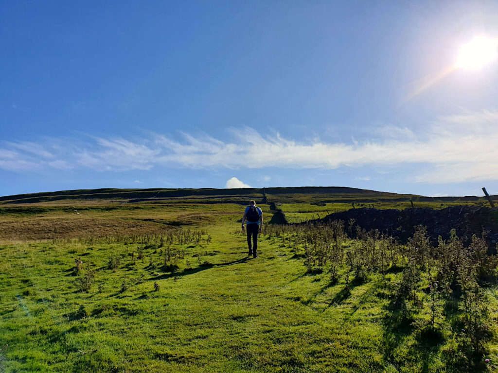
Your journey to the summit starts by heading north out of the Buckden Pike car park.
Consider this fair warning that it’s steep from the get-go. It’s certainly a good way to blow off the cobwebs and get yourself moving after the journey here.
Buckden Pike Walk: Stage 1 (Car Park to Summit)
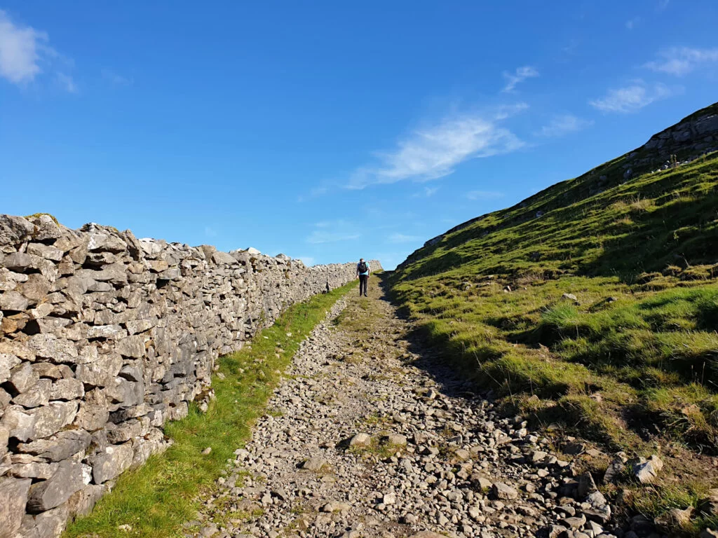
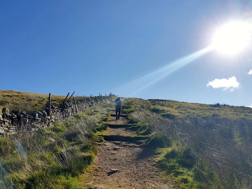
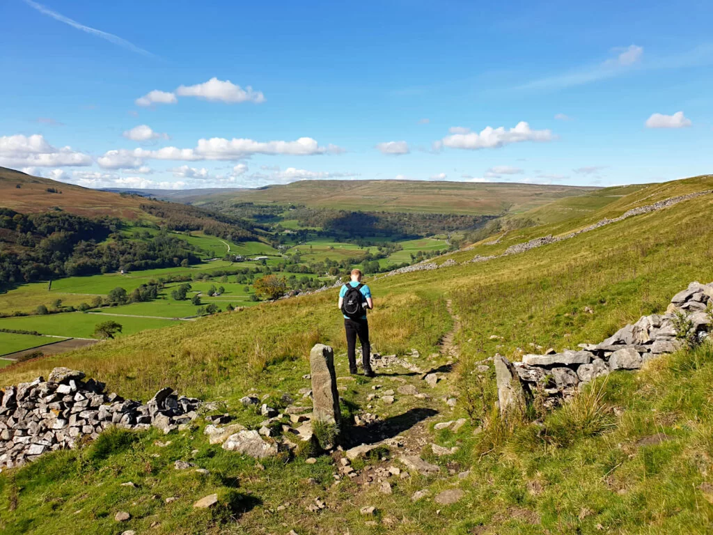
- From the path entrance on the north side of the car park, keep heading uphill until you reach a split in the path (photo above). Keep left at the split, pass the drystone wall and then head right immediately after the wall.
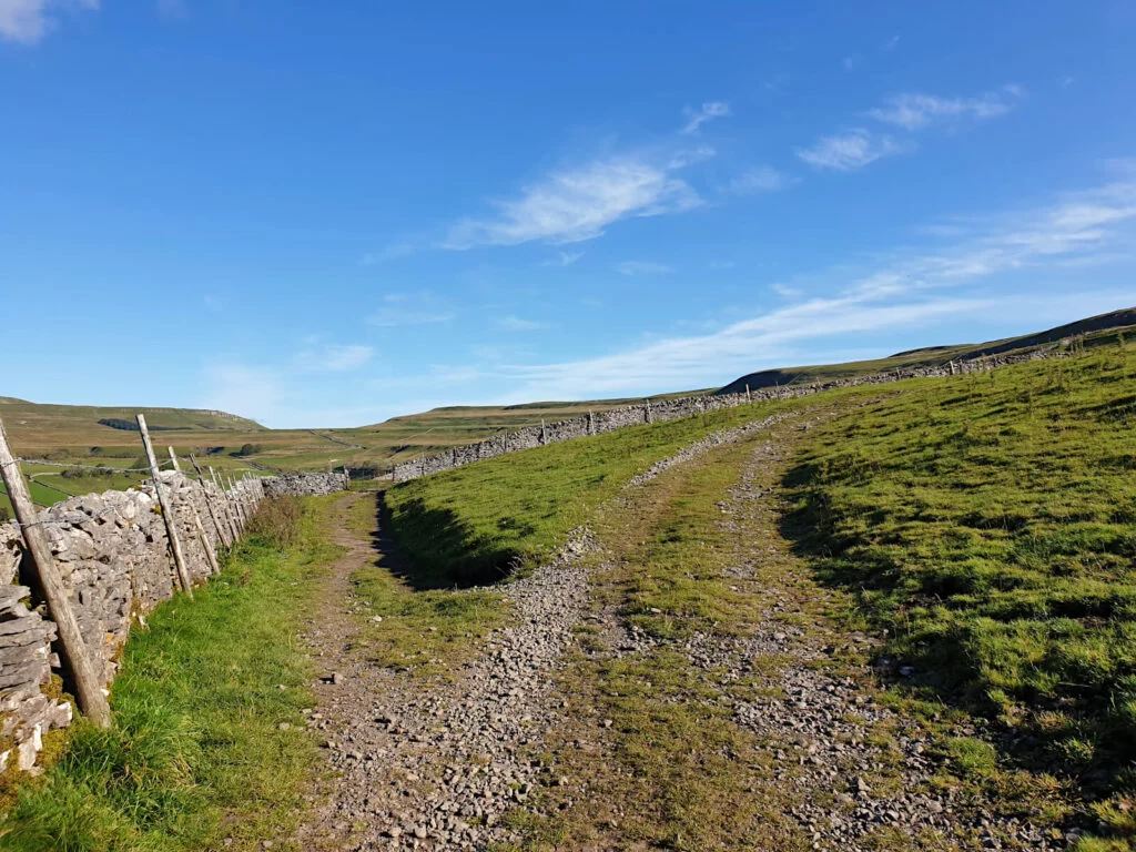
- Next, cross diagonally through the fields, using the gaps in the drystone walls to keep you on track. This section isn’t as steep as the initial climb out of the car park, yet, it’s still deceivingly tiring!
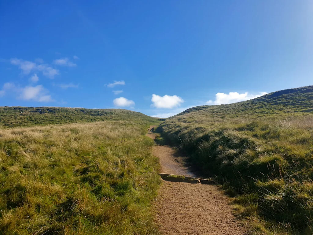
- Follow the trodden grass until you reach a dirt path, as you continue uphill. You might feel like you’re almost at the top several times, only to see more of Buckden Pike’s height appear in view up ahead.
- Don’t forget to look back on yourself during this uphill walk from Buckden Yorkshire to the summit. The scenery behind you is spectacular, particularly on a clear day!
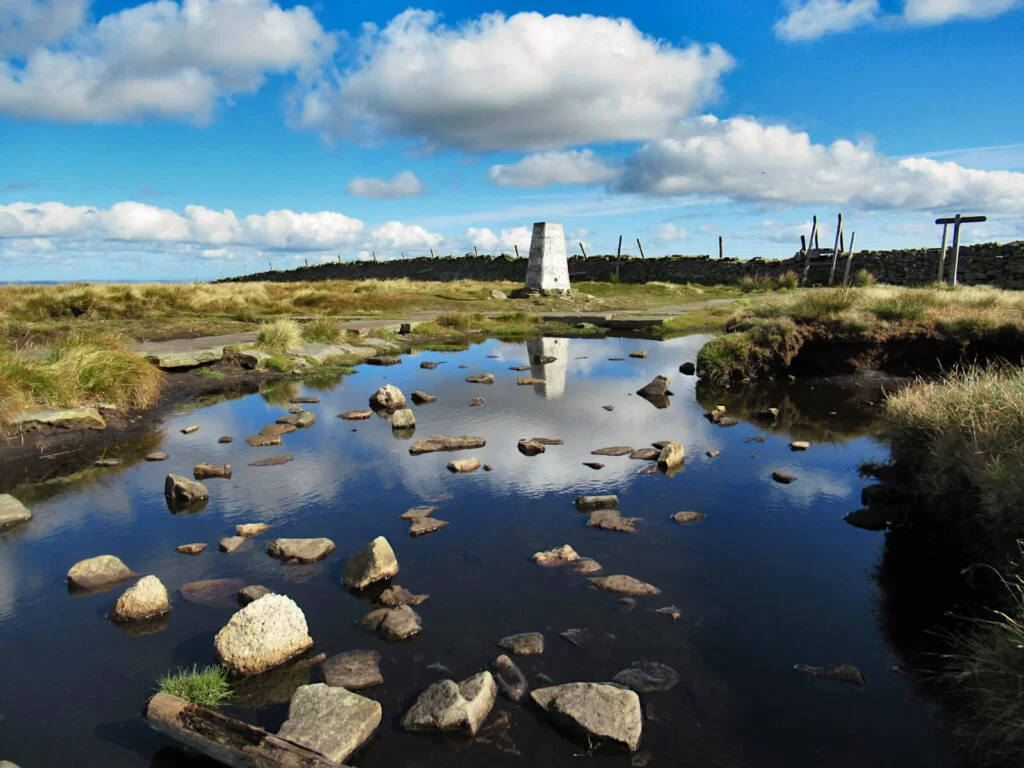
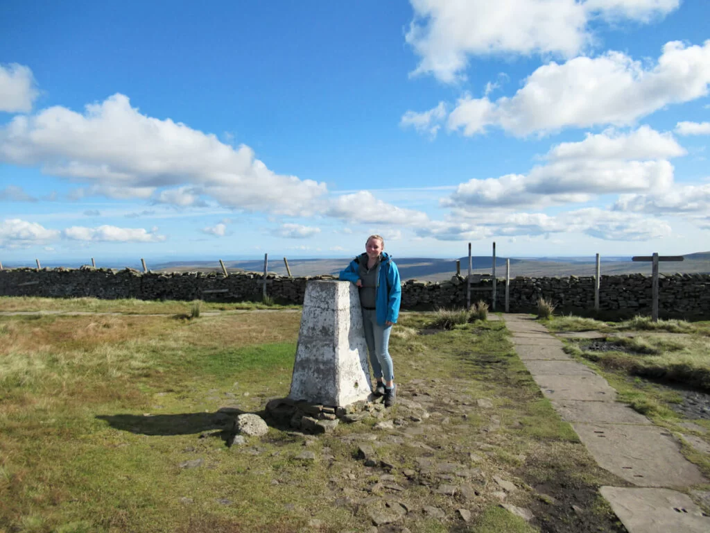
- Soon, you’ll reach the trig point marking the highest point of Buckden Pike Yorkshire Dales. A rewarding end to the uphill walking on this route.
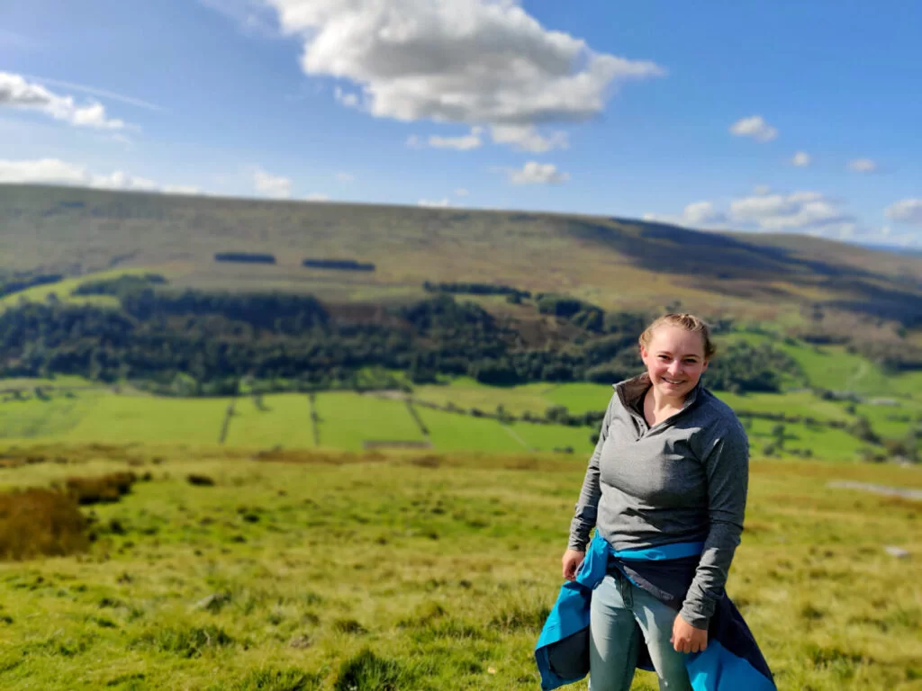
The view from the top is simply stunning. On a clear day, you can see for miles over North Yorkshire and the Yorkshire Dales National Park.
The distinctive shape of Pen-y-ghent, as well as Ingleborough and Whernside, are visible in the distance.
My sheer exhaustion from climbing one mountain suddenly put the thought of climbing these Yorkshire Three Peaks in one day into perspective!
Buckden Pike Walk: Stage 2 (Summit to the Polish Memorial)
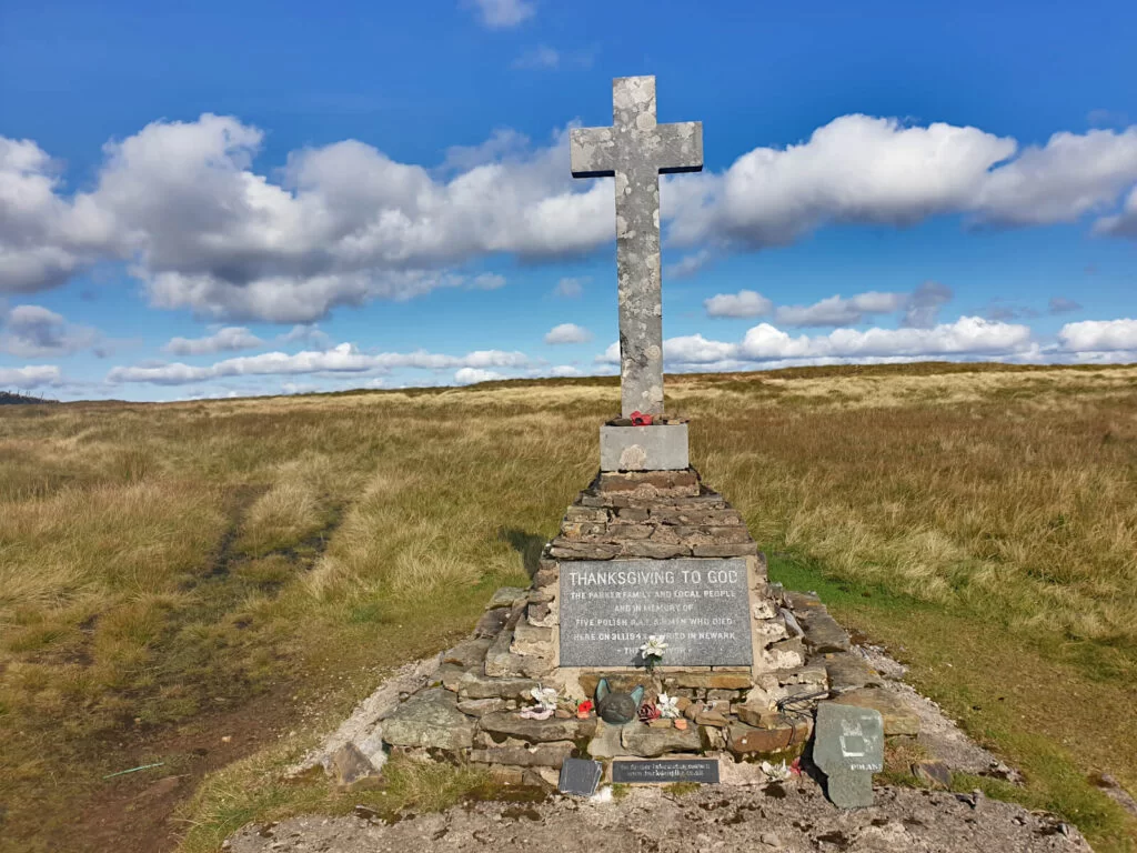
The next stage of this Buckden Pike circular walk is to head along the ridge to the Polish War Memorial. After the long uphill climb to the summit, this flat section will be a breeze!
The Polish War Memorial is about 750 metres south of the summit. A small but poignant memorial to the 5 Polish soldiers killed when their plane crashed into the hillside mid-snowstorm in 1942.
Miraculously, 1 other person survived the crash. They managed to navigate down off the mountain in heavy snow and with a broken ankle to get to safety.
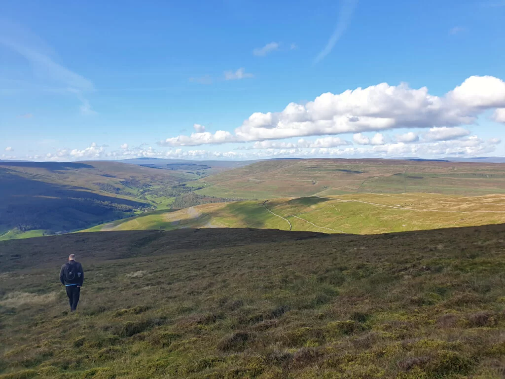
Buckden Pike Walk: Stage 3 (Polish War Memorial to the Car Park)
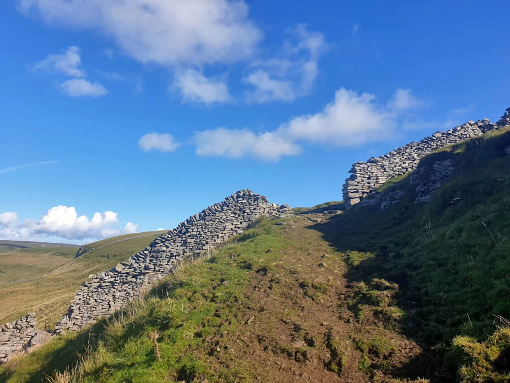
For the final stage of this Buckden circular walk, the path is much less obvious initially. Plus, with lots of loose rock from the lead mines it can be quite tricky and requires some concentration.
This is where the GPX navigation came in really handy.
Even when I had no phone signal, the app told me where I was and how far off course I was. Which, was a few hundred metres at times so it was reassuring to know I was heading back on track!
- From the memorial, head back along the ridgeline until you reach the next drystone wall along from the war memorial, which is perpendicular to the path.
- Turn left off of the path and walk alongside the dry stone wall for 400 metres. You’ll start to see an old lead mine come into view further downhill, start to walk diagonally towards this.
- At this point, you’ll have to navigate the downhill terrain and boggy areas. And you’ll likely be weaving and zig-zagging.
- Once you reach the path, turn left and continue walking downhill. After 1.5 kilometres, the path splits in two – turn right to head back towards Buckden Yorkshire.
- The path runs all the way to Buckden Beck at the point where it enters the village. You’ll have to cross the shallow water, then turn right onto the road. And now, you should see the car park just ahead of you.
Time for a well-deserved sit down – or maybe even a drink in the nearby The Buck Inn pub!
FAQs
Yes, Buckden Pike Yorkshire Dales is a mountain. In the UK, 610 metres is used as the threshold that hills become mountains.
Buckden Pike is also classified as a fell, but fells can be mountains as it’s a broader term. Being a ‘fell’ simply means it has a high and barren landscape
Similarly, the word pike is old northern English for a hill with a peaked top. Perhaps, the most famous pike is Scafell Pike – England’s highest mountain and the jewel of the Lake District.
The summit of Buckden Pike is 702 metres above sea level. In fact, Buckden Pike’s height makes it the 7th highest peak in the Yorkshire Dales. Just 34 metres off being the tallest mountain in the national park.
Yes, a public toilet block is next to Buckden Pike Car Park. These toilets are free to use and are kept in a clean condition.
The village of Buckden has both a shop and a pub.
A small village store (named Buckden Village Stores) is located near the entrance to the car park.
Also, The Buck Inn is a pub that serves food. It’s open throughout the day and has plenty of outdoor seating for sunny days!
This Buckden Pike circular walk sadly doesn’t pass any waterfalls!
However, there are waterfalls on Buckden Pike.
For instance, one Buckden Pike waterfall walk you could take is to head directly from Buckden village to the summit via Buckden Beck. This more strenuous and scrambling route is steep and boggy. Mud and Routes describe this waterfall route in detail.
If you have any questions or want any more information drop a comment below and I’ll get back to you!
Prices and offerings mentioned are correct as of April 2023 but are subject to change in future.
More Walks You Might Be Interested In…
WEST YORKSHIRE: Ilkley Moor Walks: 4 Beautiful Circular Routes
YORKSHIRE DALES: Malham Cove, Yorkshire Dales (Ultimate Visitor’s Guide + Info)
YORKSHIRE DALES: Little Known Malham Walk to Malham Cove, Janet’s Foss & Gordale Scar
LAKE DISTRICT: Old Man of Coniston Walk (Lake District): Circular 4-Peak Route
YORKSHIRE DALES: Grimwith Reservoir Walk, Yorkshire Dales (Circular Route)
YORKSHIRE DALES: A Yorkshire Dales Waterfalls Walk (to 5 Keld Waterfalls)
PIN IT FOR LATER!
This hike is lovely. I studied in London over 20 years ago and I regret that one of the things I didn’t do was really take advantage of the countryside.
I feel like I’ve only started to realise what the UK has to offer in the last few years and I’ve lived here my whole life! Wish I’d started exploring more sooner!