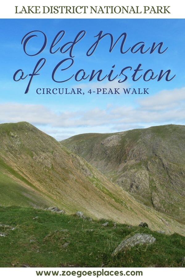
The Lake District National Park is one of the most scenic areas in the British Isles. And, what better way to enjoy such natural beauty than with a walk through the countryside to the top of a mountain… This Old Man of Coniston walk is the perfect answer!
Old Man Coniston is a popular peak in the Lake District’s southern fells. It offers incredible views along its challenging route.
This circular walk route takes you up three slightly lower peaks. As well as the Coniston Old Man to offer the best views of the summit from all angles.
This post has all the information you need to enjoy a day out including maps, photos, the Old Man Coniston walk time, step-by-step instructions and answers to all your FAQs!
where is Old Man Coniston?
The Old Man of Coniston – an 802-metre-tall mountain – is in the Lake District in England. It’s located in the southern part of the national park, just west of the village of Coniston and the large Coniston Water lake.
Coniston is a 30-minute drive from Windermere, 50 minutes from Keswick and 40 minutes from Kendal.
Old Man of Coniston Walk Overview
Distance: 6.3 miles/10.1 kilometres
Elevation gain: 699 metres (cumulative)
Difficulty: Moderate
Walking time: 3 to 4 hours
Realistic total time: 4 to 6 hours
Start and endpoint: Walna Scar Car Park
Realistic total time includes stopping for snack breaks, photographs and enjoying the view.
Old Man of Coniston Parking
The two closest car parks to the mountain are Walna Scar Car Park and Old Station Car Park.
Walna Scar Car Park is the closer of the two.
Here, charges apply from 9 am to 6 pm, 7 days a week including bank holidays. Parking fees are:
- £4 for up to 4 hours
- £8 for up to 9 hours
- Payment by card or cash
To note, Walna Scar Car Park used to be free, but charges were introduced in 2021.
If you’re using a Sat Nav or Google Maps to get to the car park, you won’t be able to use a postcode.
This is because the postcode covers a large rural area and won’t take you to the exact place you need to be. Search by name and you should be able to find both on Google Maps.
The alternative option is to park at Old Station Car Park in Coniston village.
Parking charges also apply from 9 am to 6 pm, 365 days a year. The charges are:
- £2.50 for up to 2 hours
- £4.50 for up to 4 hours
- £7 for up to 9 hours
- Card and cash payment
Additional parking can be found next to the visitor centre in Coniston.
Old Man of Coniston Circular Walk Map
If you park at Walna Scar Car Park, follow this route…
Click the link above to download the file for use in a GPS viewer. This way you’ll be able to track where you are on the route using your phone’s GPS – avoiding accidental detours and providing reassurance for less experienced countryside walkers! Once you’ve downloaded the GPX file above, install a GPX viewer app (Google PlayStore or iPhone App Store) and load the GPX file.
Or, from Old Station Car Park, follow this map and GPX…
Coniston Old Man Route Details
Where do I start the Old Man of Coniston Walk from?
The Old Man Coniston circular walk route starts (and ends) at Walna Scar Car Park.
From Walna Scar car park to Old Man Coniston via this circular 4-peak route is 6.3 miles.
However, if the Walna Scar Car Park is full, you’ll need to park at Old Station Car Park Coniston. This is on the outskirts of Coniston village and adds 1.7 miles to the round-trip walk.
With the extra walk distance from the car park, the route from Coniston village is 8.0 miles (12.9 km) in total. And, there’s an extra 200 metres in elevation gain, with a steep uphill walk to Walna Scar.
Old Man of Coniston Difficulty
Balancing the elevation gain, distance and conditions underfoot, then the Old Man Coniston circular walk isn’t easy.
Think of it as a full-day commitment rather than something to do for a few hours. I was exhausted the evening after climbing the mountain and my legs ached for a couple of days!
Whilst this route isn’t the easiest climb, it’s certainly not the most difficult. From my experience, I would rate the Old Man of Coniston difficulty as moderate.
A reasonable level of fitness and coming prepared with water, snacks and appropriate, weather-suitable clothing are the best way to ensure a successful walk to the summit and back.
Old Man of Coniston Walk: Circular Route Directions
I would recommend heading in a clockwise direction along Walna Scar Road. This way the summit of the Old Man of Coniston is your last peak.
Honestly, the views at the top of the Old Man are better than the other three peaks, so you’ll want to save this to last!
Along the way, you’ll climb to Brown Pike, then onto Buck Pike and Dow Crag. From there, it’s the final ascent to the Old Man before the downhill section begins.
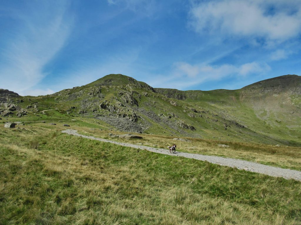
Walna Scar Car Park to Brown Pike (682m)
- Head west from Walna Scar Car Park, along Walna Scar Road. Follow the path as it heads straight with a gentle incline.
- After about 1 mile, the path forks in two – keep straight here.
- Continuing following the path straight for another mile, where it’ll turn sharply to the right with a steep ascent. You’ll want to follow this path all the way uphill.
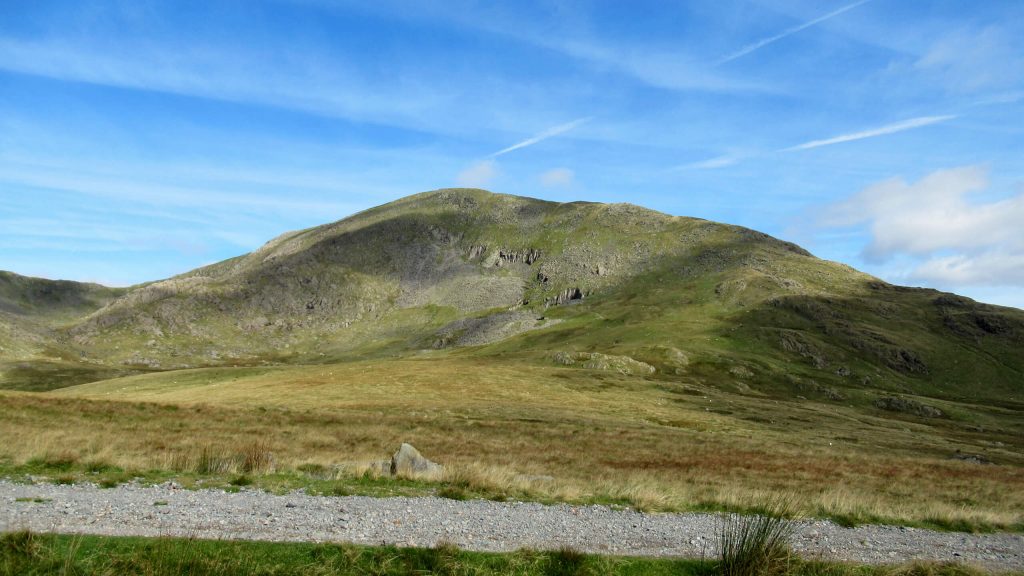
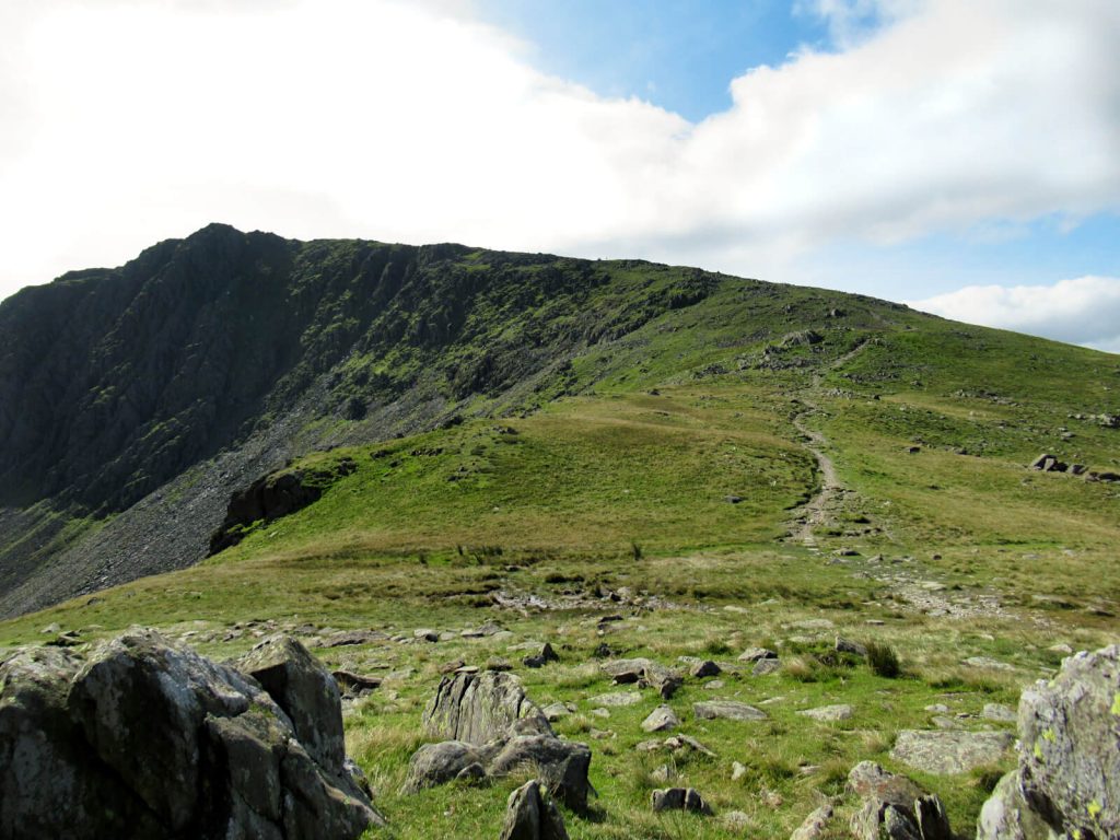
- At the top, you’ll be at Brown Pike. It’s where you’ll be able to look across to Buck Pike and Dow Crag along the ridgeline and Coniston Old Man across the way.
- Conveniently, from here you can just follow the path along the tops with no complex instructions needed.
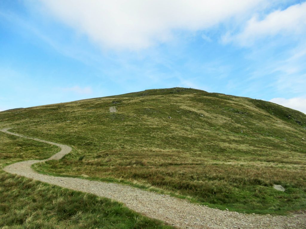
Brown Pike to Buck Pike (744m)
- From Brown Pike, continue along the ridgeline. There’s no let-up between the peaks, as you’ll gain just over 40 metres of elevation in just 0.4 miles.
- The peak of Buck Pike isn’t too obvious, as there isn’t any marking. But, the terrain does level out for a short distance.
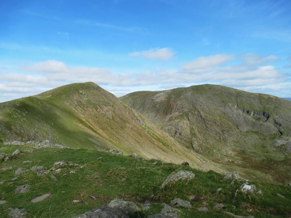
Buck Pike to Dow Crag (778m)
- From Buck Pike, it’s a further 0.3 miles with a steady ascent to Dow Crag, the third peak of this route.
- The striking rock formations mark the peak of Dow Crag. Plus, you’ll know when you’re there as there’s no more hill left to walk up!
- At Dow Crag, you’ll have fantastic views of the western part of the Lake District National Park, including Scafell Pike. And, on a clear day, you’ll be able to see the Cumbrian coastline including the Sellafield Nuclear Site and the Irish Sea…
Dow Crag to the Old Man of Coniston Summit (803m)
- Although the elevations of the final two peaks are similar, it’s not an easy walk between the two.
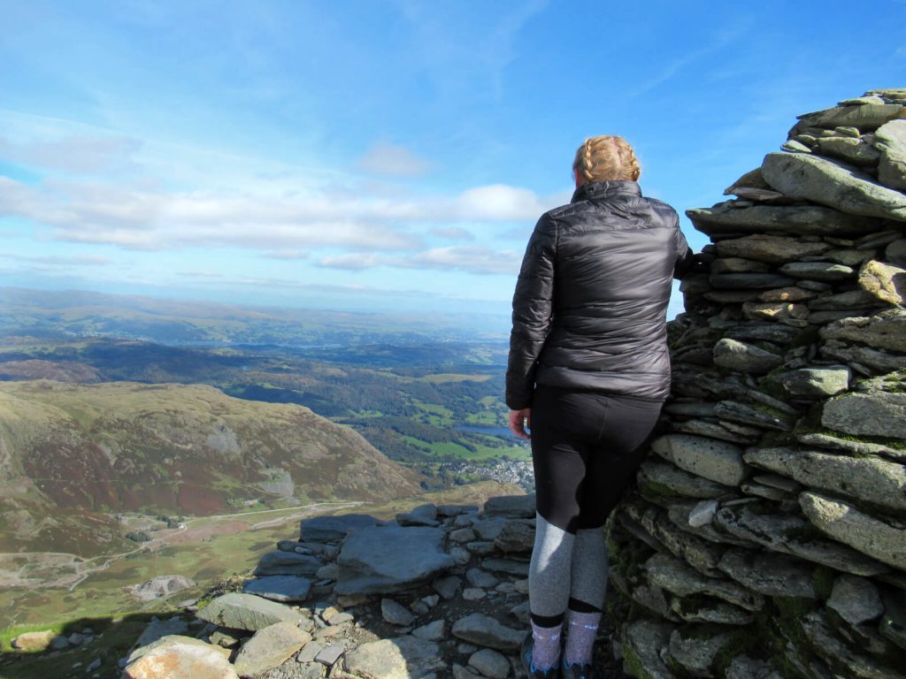
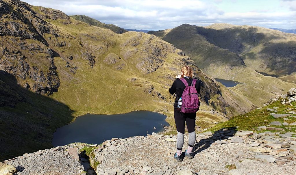
- And from Dow Crag, you’ll walk 0.4 miles downhill, descending around 120 metres in elevation. Then, it’s a short and steep 0.6-mile uphill climb, gaining 130 metres in elevation to reach the trig point of Old Man Coniston.
- At 800 metres above sea level, you’ll have simply spectacular views. To the west are the 3 peaks you’ve already covered. But now in view is Coniston Water, Lake Windermere and even the Yorkshire Dales National Park in the distance.
Old Man of Coniston to Walna Scar Car Park
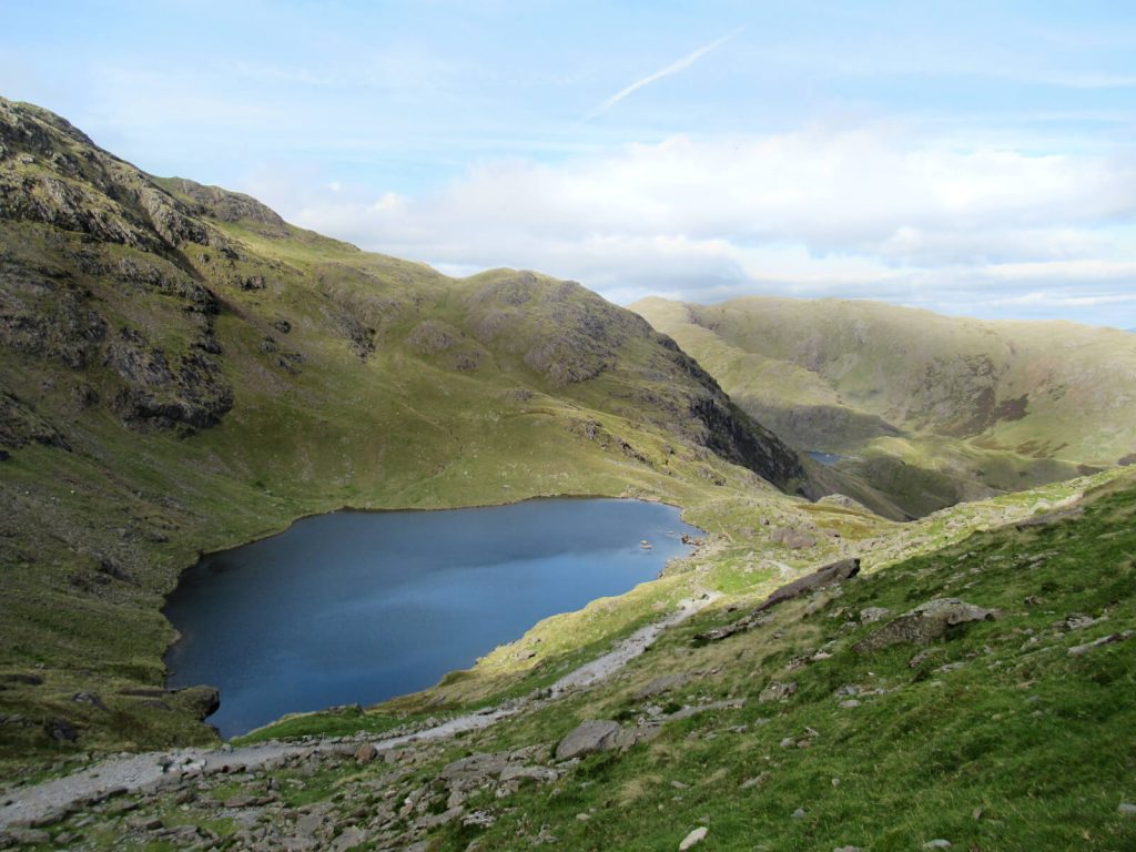
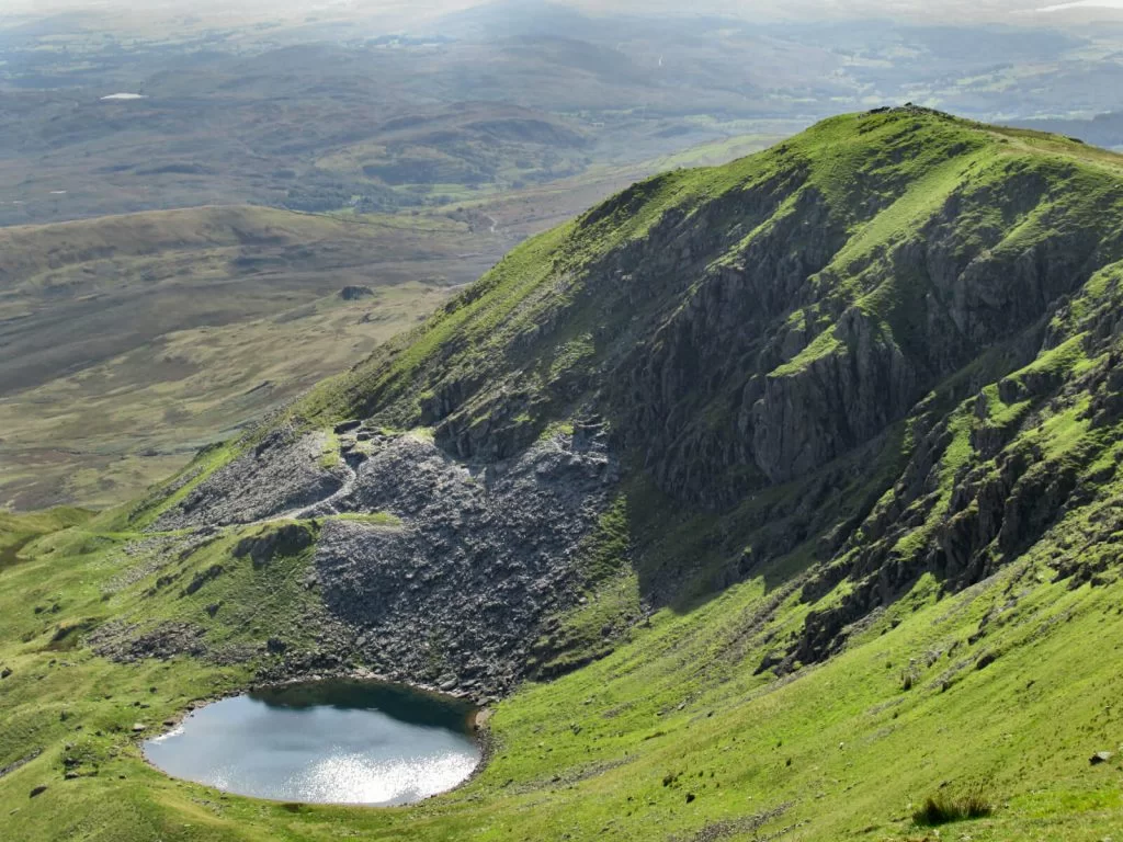
- Once you’ve taken it all in and had a rest, it’s time to descend back to the car park. The path isn’t well-trodden in places, but overall it’s easy to follow. However, there are sections with loose rock underfoot, where you should take particular care.
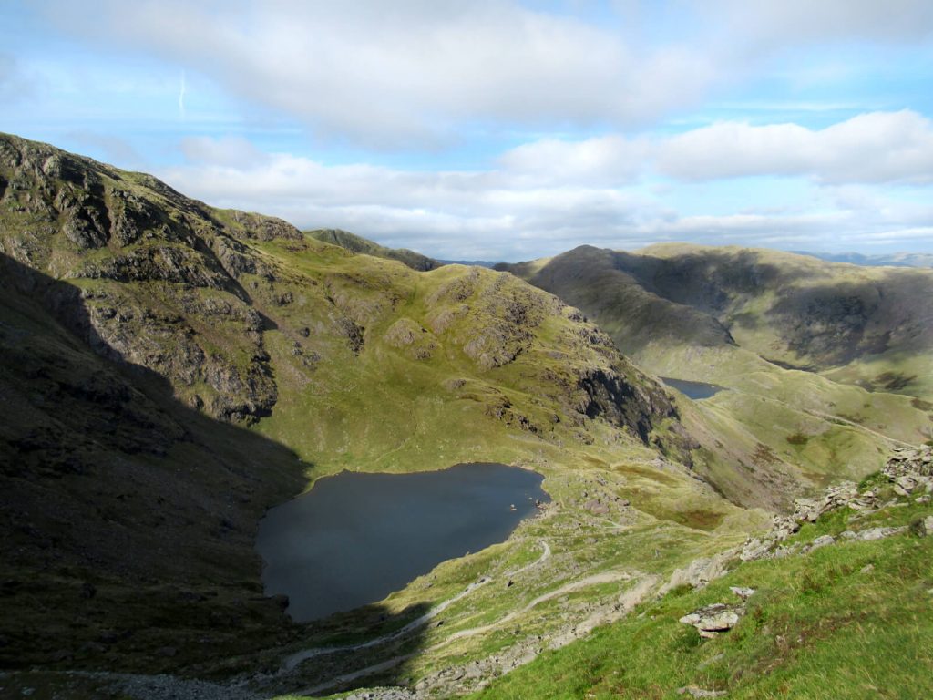
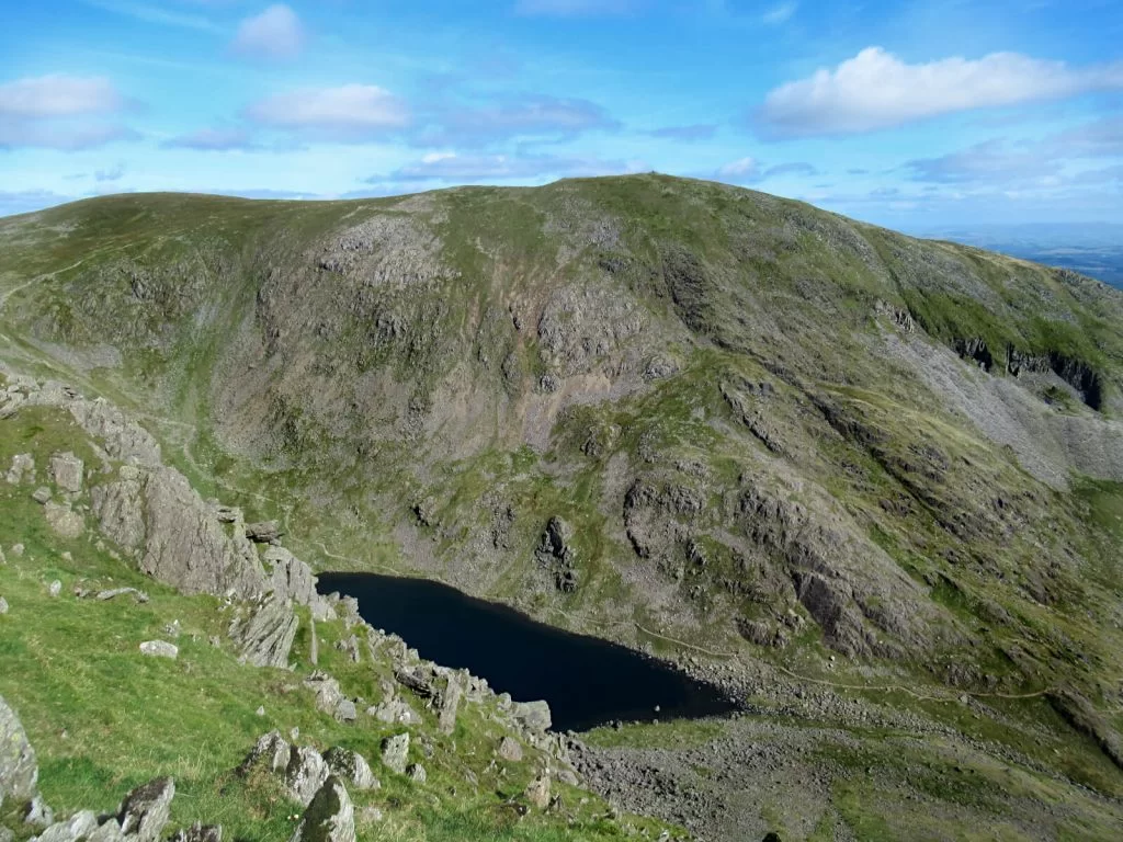
- Follow the path as it zig-zags down to Low Water. A quick look up and you’ll see the summit where you just were high above.
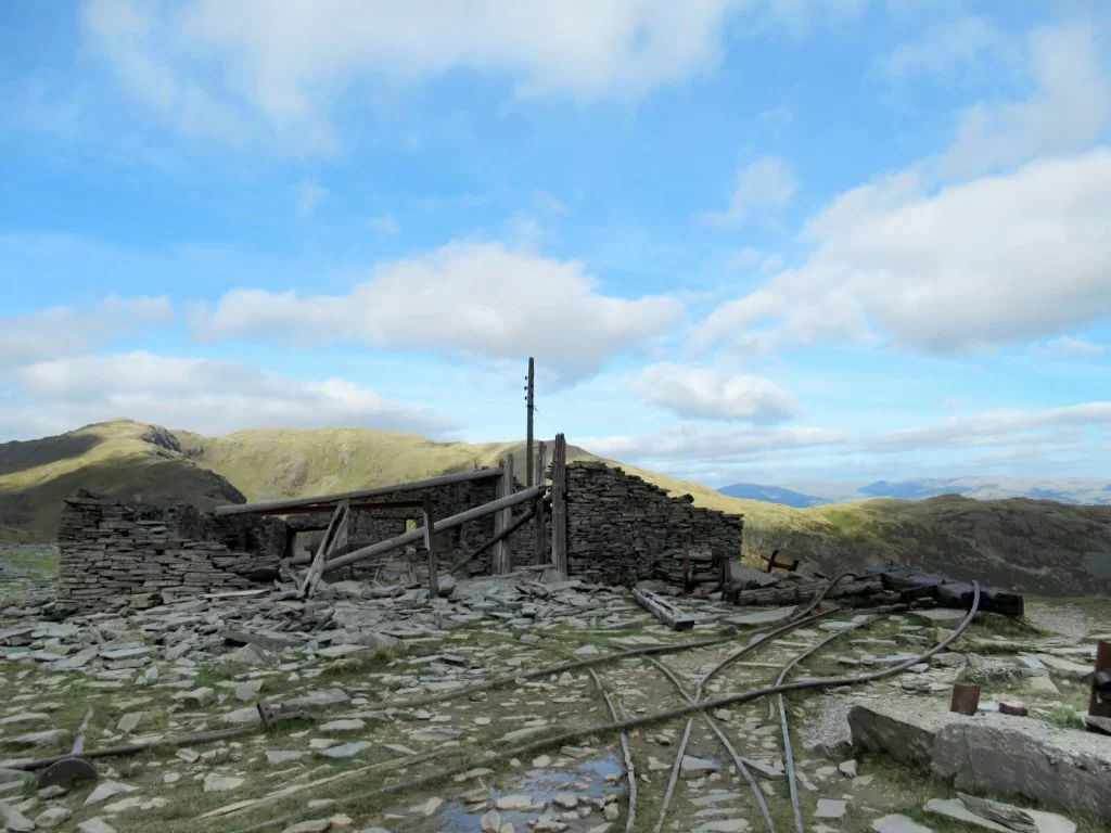
- From the small lake, continue along the path past the old quarry and mines. You’ll pass the remains of the pulley system and mounds of slate, which are literally unmissable.
- Continue along the path until it turns to the right back towards Walna Scar Car Park. From here, the path is flat and easy to follow all the way to the car park. Walk complete!
Old Man Coniston Walk Review
“One of the best walks I’ve ever been on!“
This Old Man of Coniston circular walk route to the summit is honestly one of the best walks I’ve been on! It’s challenging – with a sustained ascent and a long distance to cover.
In particular, no scrambling or climbing with your hands is required and I never felt like I wouldn’t make it. I knew I just had to keep going and telling myself it would be worth it!
It’s easily one of the best walks in the Lake District. In fact, possibly across the whole of northern England for its balance of views, challenge, location and popularity.
For transparency, I did get lucky with the weather as I walked up on a clear day in September. It was also a weekday, so it may well be busier on weekends, but I only saw a handful of other groups.
Having said that, with nearby Scafell Pike being the highest mountain in England, crowds are typically drawn there instead.
FAQs
At a fairly good pace without stopping, then for this circular route, the Old Man of Coniston walk time is about 3 to 3.5 hours. Realistically though, for the average person enjoying this walk, I would allow 5 to 6 hours.
If you just wanted to walk directly to the summit of Old Man of Coniston from Walna Scar Car Park and back again, then the shortest route is 2 miles each way. And, this would take maybe 2 to 2.5 hours non-stop.
No route to the summit is easy. But the shortest is to follow the path north and then west from Walna Scar – the Old Man Coniston Car Park – all the way to the top.
There are plenty of accommodation options in the village of Coniston. Staying here would also mean you don’t need to drive to the Old Man of Coniston start point.
However, Coniston is also just a short 20-minute drive from the towns of Ambleside and Windermere as well as being around 40 minutes from the larger towns of Keswick and Kendal.
Whilst Coniston is a beautiful village located next to Coniston Water, there’s perhaps more to do and see in the other towns mentioned above, making them better for an extended stay. For more ideas of what to do across the Lake District, check out this post from My Travel Scrapbook.
Yes, in the UK any peak over 600 metres of elevation is classed as a mountain. At 802 metres, it clearly meets this definition.
Yes! The Wainwrights are a list of 214 fells in the Lake District that featured in Alfred Wainwright’s Pictorial Guide to the Lakeland Fells published in the 1950s and 1960s.
The 7-part book series groups the different areas of the Lake District and Old Man Coniston is part of the Southern Fells, along with Scafell Pike.
Dow Crag is also a Wainwright, grouped in the Southern Fells too, but the others aren’t.
The reason for this is likely the lack of prominence from Brown Pike and Buck Pike to Dow Crag. Brown Pike and Buck Pike are more staggered steps on the ascent to Dow Crag than standalone fells.
Information, prices and offerings mentioned are correct as of April 2023 but are subject to change in future.
More UK Walks for You to Try…
YORKSHIRE DALES: Buckden Pike Walk (The Perfect Yorkshire Dales Day Out)
WEST YORKSHIRE: Ilkley Moor Walks: 4 Beautiful Circular Routes
YORKSHIRE DALES: A Little Known Malham Walk to Malham Cove, Janet’s Foss & Gordale Scar
SCOTLAND: Glenfinnan Viaduct Viewpoint (Trains, Photos & Walk Guide)
YORKSHIRE DALES: Grimwith Reservoir Walk, Yorkshire Dales (Circular Route)
YORKSHIRE DALES: A Yorkshire Dales Waterfalls Walk (to 5 Keld Waterfalls)
PIN IT FOR LATER!