Hiking is one of the most popular activities in Kyrgyzstan. And the Kol Tor Lake hike is a great place day trip from Bishkek.
On the trail, you’ll climb almost 800 metres in elevation before you finally set your sights on the small but stunning lake. Along the way, the views are also simply spectacular.
The only downside is that it isn’t easy to get here. But it’s not impossible.
And this complete guide to Kol Tor gives you all the information you need to plan your day out.
About Kol Tor Lake Kyrgyzstan
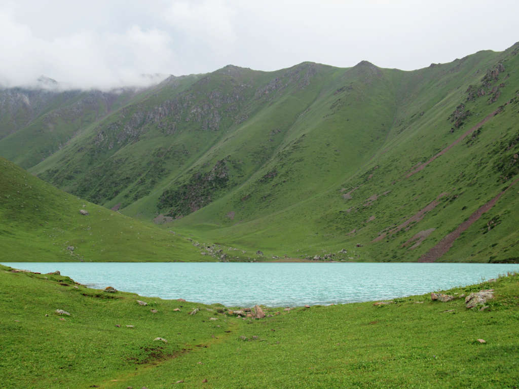
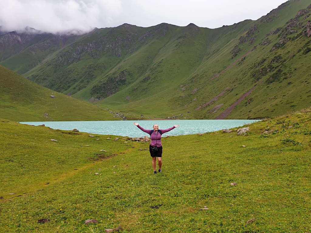
Nestled in the mountains and surrounded by towering peaks, Kol Tor attracts visitors with its stunning blue colour.
However, the lake isn’t easy to access. It’s only accessible by foot or on horseback – with the nearest road ending 5 km away.
Because of this, some people choose to camp overnight at the lake. Although this does mean carrying what you’ll need steeply uphill.
But for most people, a visit to Kol Tor Lake Kyrgyzstan is a day hike from nearby Bishkek. And the trailhead is about a 2-hour drive from the capital.
It’s important to note that weather conditions change quickly at the lake’s altitude. You should make sure you’re prepared for hot, cold, wet and dry weather whether you’re hiking and/or camping.
Additionally, there’s no shelter and no facilities along the route. And with its remote location, there’s no phone signal. So you really do need to be prepared in advance.

Where is Kol Tor Lake?
The lake is southeast of Kyrgyzstan’s capital city, Bishkek. It sits in amongst the mountainous Kegeti Valley, part of the Kungei Ala-Too range.
Because of this, the lake is at an altitude of just over 2700 metres above sea level (8850 feet). Although you’re unlikely to experience altitude sickness at this elevation, especially for just a short stop, it does make the uphill hike harder.
The nearest town is Tokmok. Also nearby is the Burana Tower – and it’s possible to visit both on the same day.

The Kol Tor Lake Hike
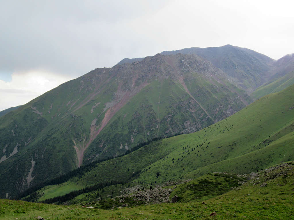
Hiking to the lake isn’t easy but it’s very beautiful. You’ll walk through the valley under the shadows of 3000+ metre peaks and take in views across the serene landscapes.
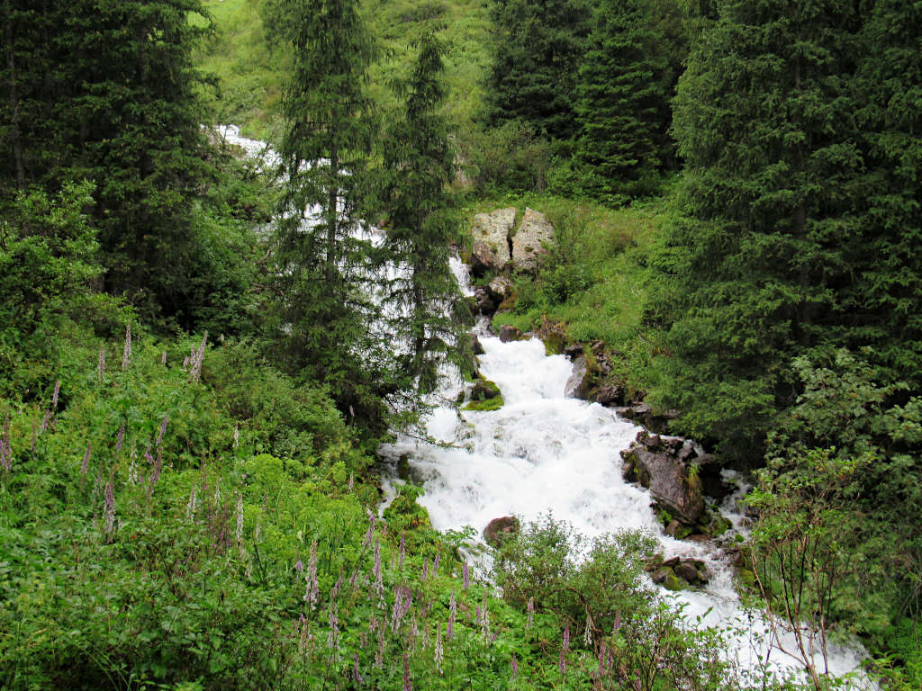
The trail starts off following the river uphill into the valley before climbing steeply to reach the lake. And once you get there, you’ll be rewarded with seeing the vivid blue water with your own eyes.
For more information on the hiking trail, keep reading the sections below…
Hike Overview
Distance: 6.1 miles/9.8 kilometres
Elevation Gain: 790 metres
Start elevation: 1940 metres above sea level
Peak elevation: 2730 metres above sea level
Difficulty: Moderate to Difficult
Walking time: 4 to 6 hours
Start and endpoint: Kol Tor Trailhead
Route and Directions
The route to Kol Tor Lake Bishkek is easy to follow from the trailhead where the yurt camp is located.
It’s just a case of following the trodden path, other than in a couple of places where the path splits. But even then, the paths rejoin and end up in the same place – at the lake.
I’d recommend downloading the Maps.Me app and downloading the map for Kyrgyzstan. This map has the trail on it and you can follow your location with GPS even without having phone signal.
- Just after the trailhead is a very steep but short climb. Don’t worry it flattens out quickly as you walk along the left side of the river.
- After 1.7 km, you’ll need to cross the stream jumping between the rocks. Keep following the path once you’re on the other side and it’ll soon start heading steeply uphill.
- Shortly after the path splits. I’d recommend taking the left-hand route continuing steeply uphill. This loose rock section is difficult and feels never-ending as it turns around corner after corner.
- The next part of the route takes you across more open fields as you continue to gain elevation. It simultaneously feels like you’re almost there and that you’ll never get there!
- The final part of the hike is a steep uphill climb to reach the lake. This rocky section can be difficult when wet, so take care when navigating this part.
- It’s just a few more metres until you reach the water’s edge – take it all in, you’ve earned it!
- Look up at the towering mountain, see the bright colour of the water and give yourself a pat on the back for getting here. When you’re ready to leave, it’s just a case of retracing your steps.
Click the link above to download the file for use in a GPS viewer. This way you’ll be able to track where you are on the route using your phone’s GPS – avoiding accidental detours and providing reassurance for less experienced countryside walkers! Once you’ve downloaded the GPX file above, install a GPX viewer app (Google PlayStore or iPhone App Store) and load the GPX file.

Difficulty
This hike is not easy. And you need to make sure you’re prepared for how different the conditions can be as you gain altitude.
For the most part, this hike is of moderate difficulty. It’s steep in places, almost entirely uphill and at moderate altitude.
But, in places, it can be difficult – especially in or just after poor weather conditions. The paths can become streams, the streams become more difficult to cross and the grass is very slippery.
The loose rock that is a nightmare to climb up (as you slide back down slightly) is even more of a nightmare going down. Only takes one misplaced step to end up sliding uncontrollably downhill.
And I don’t say this to put you off but rather to give you a full picture of what it might be like. Use this information to help you decide if this is the right hike for you.
What to Bring
With its remote mountain location, there are no facilities at all along the trail. You’ll need to bring with you everything you’ll need.
Based on my experience of hiking Kol Tor, I’d recommend:
- Walking shoes – especially if it’s wet, otherwise good and sturdy trainers
- Waterproof coat – at that altitude the weather can change quickly and unexpectedly
- Water and snacks, as well as something for lunch up by the lake
- Battery pack and phone charger – you won’t have signal but you can use GPS to follow your progress on maps apps
- Wear layers – then add or remove as necessary. If it rains and you get wet, you can quickly become very cold

How to get to Kol Tor
Unfortunately, there isn’t any public transport to the Kol Tor trailhead. So, the only way to get there is with your own vehicle, hiring a driver or hitchhiking.
If you’re hiring a vehicle – which I wouldn’t recommend doing just to access this hike, but rather for a longer trip – be warned that in the last part of the drive, the roads are not in great condition. Expect loose rock, dirt paths and potholes.
For those wanting to hitchhike from Bishkek, you’ll first need to get to the town of Tokmok. Once there, you’ll need to score a lift to as close to the trailhead as possible.
Hitchhiking will be much more difficult outside of the peak summer season. As fewer people will be making the journey up into the mountains towards the trailhead. So consider this when making your plans.
Hiring a driver is fairly cheap by international standards. And they’ll wait at the trailhead while you hike up to the lake and back.
I did this hike as part of a day trip organised by Apple Hostel Bishkek. We paid 1000 Som each and there were 7 of us in total on the trip. All in all, we were out for about 12 hours and it was great value for money to have a ‘door-to-door’ service to the trailhead.
If you’re interested in joining a tour you can contact the Trekking Union of Kyrgyzstan to see when they’re running trips to the lake.
Is It worth visiting?
With the weather conditions I experienced (coupled with my unpreparedness), hiking to Kol Tor Lake Bishkek wasn’t worth it for me. At times, I’ve described this as the worst hike I’ve ever done.
For me, it was about 5 hours of walking in the rain to see a lake surrounded by clouds. The colour didn’t seem as vivid with the cloudy skies and there was barely a view of the landscapes around.
But, if the conditions had been dry, I think I would’ve enjoyed it so much more. I wouldn’t have had to hide from a sharp downpour under a tree and I wouldn’t have been soaked to the bone for hours on end.
Overall, I’d say, if you’re an experienced hiker then go for it. If you’re not, then there are better places in Kyrgyzstan to do a hike like this that are easier to get to and easier to complete.

Do you have any questions or want any more information? If so, drop a comment below and I’ll get back to you!
Information is correct as of June 2023 but is subject to change in future.
More Travel Inspiration…
KAZAKHSTAN: Best Time to Visit Kazakhstan (A Fusion of Cultures & Landscapes)
UZBEKISTAN: Best Time to Visit Uzbekistan (Discover Central Asia’s Beauty)
KYRGYZSTAN: Ala-Too Square, Bishkek (Everything You Need to Know)
GEORGIA: What To Do in Kutaisi, Georgia: Ultimate Visitor’s Guide